El Nino comes back, hot summers and storms are stronger
Initial comments of the Meteorological Agency, when El Nino returned to Vietnam around May 5-7, this summer will be hotter than the average for many years and the possibility of strong storms and super typhoons.
Most of the climate agencies in the world have shared that Enso tends to move to El Nino since the second half of 2017. In Vietnam, according to Mr. Le Thanh Hai, Deputy General Director of the Hydrometeorological Center. Nationally, in the summer and autumn of this year, El Nino weakened its ability to return. The weather will manifest as moderate storms and tropical low pressures, most likely to have strong storms and super typhoons.
"The rainy season will be more heavy, the main rainy season is less. The hot sun is stronger than the average for many years. If El Nino continues to fall and winter, the dry season will have drought and saline intrusion , " he said. Hai said.
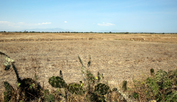
Fields that are uncultivated and cannot be cultivated in Ninh Thuan.(Artwork: CTV).
Central Center for Meteorological and Hydrological Forecasting said that when El Nino returned, the possibility of storms and tropical depressions in the East Sea area was higher than the average of many years (average of many years is about 12-13 storms). /year). But the number directly affects the mainland of Vietnam less (on average 5-6 years). The irregularity of storms will increase in the years affected by El Nino.
Under the impact of El Nino, the rainy season and the flood season in the North come late; Flood peaks in rivers and streams are equivalent to 2016, popular at an alarming rate of 2-3. While the Central Highlands and the South came many years earlier than average; biggest flood in the Mekong Delta at alarming level 2-3.
In recent years, climate change has caused many extreme and unpredictable weather events such as 2015 with a record rain in Quang Binh up to 1,500mm in 10 days, equivalent to 2/3 of the total rainfall. year. Along with that is the flood in the Central region, the drought in the beginning of the year in the Central Highlands, the South, the South Central and saline intrusion.
According to the assessment of most of the major climate centers in the world, the sea surface temperature in the central equatorial center of the Pacific (NINO 3.4) has been increasing rapidly since the first months of 2017. Current standard of temperature is wrong. The NINO 3.4 sea area is higher than the standard average of 0.1 degrees Celsius, which means that Enso is in a neutral state and shows signs of switching from cold to hot.Australian Meteorological Agency (BoM) stated that Enso will reach the starting point of the El Nino phenomenon around July 2017. However, BoM also recommends the low reliability of the forecast models at this time of year.
The US Climate Prediction Center (CPC / NCEP) predicts the probability of El Nino occurring at about 50-60% in the early months of the summer and this probability increases at the end of 2017.
The forecast results of the multi-component combination of the European Medium-Term Forecast Center (ECMWF) shows that the standard of sea level temperature difference in the area of NINO3.4 will reach the El Nino threshold in June 2017.
- El Nino changes may cause many storms to land
- Earth warms weaken El Nino's function to prevent storms
- Nature is angry, El Nino will be more intense
- El Nino is coming back
- El Nino is back
- El Nino re-exported - storms will end soon?
- El Nino 2015 looks strange with the peak of 1997
- Typhoon attacks on Southeast Asia are getting stronger
- Are the storms this year more devastating than previous years?
- The storm will become stronger and stronger
- Europe will have hot summers
- Why do floods flood across Asia?
 Is the magnetic North Pole shift dangerous to humanity?
 Washington legalizes the recycling of human bodies into fertilizer
 Lightning stone - the mysterious guest
 Stunned by the mysterious sunset, strange appearance