How to measure sea level?
According to HowStuffWorks, a giant floating ice sheet has separated from one of the four largest Antarctic ice shelves and was named Larsen C, but scientists did not care too much about its weight (about 1, 1 trillion tons) though this is the largest iceberg ever recorded.
Instead, they turned their attention to the sea level that would immediately rise when the ice mass melted. They also see a bigger problem in the future, which is the whole disintegration. If it melted immediately, scientists estimated that the sea level would rise by half an inch (1.2cm).

Scientists use many tools to measure sea level.
The fall of Larsen C is likely to take place over the next few decades, but such cases are the reason why scientists pay close attention to rising sea levels, especially in recent decades. here. In the last 100 years, Earth's climate has warmed about 1.8 degrees Fahrenheit (1 degree Celsius). As a result, water overflows into ice sheets, glaciers and glaciers have gradually melted, adding more water to the planet's ocean. In addition, high temperatures also cause thermal expansion. All of this makes the world sea level rise by nearly 0.07 inches (2 millimeters) a year.
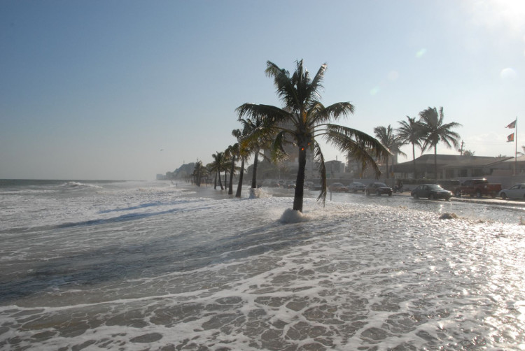
But how to measure the water level on the ocean? You can't just stand on the beach with a measure - the level of fluctuations is partly due to waves, tides, orbiting the planet and the sun. Not to mention there are valleys, mountains and canyons - under the ocean as well as on the mainland. And water in deep basins also changes with climate. More complicated, some coastal areas, such as New Orleans, Louisiana, and Venice, Italy are sinking, while others like Alaska are emerging.
To measure the increase and decrease of water levels in the ocean, scientists use a variety of tools, including tide gauges , placed around the world in harbors, breakwaters and jetties. In the United States, the work belongs to the National Water Monitoring Network (NWLON), which has 210 permanent observation systems across the United States and its territories.
Before the computer era, this measurement process was quite rudimentary. Tide gauges have been placed inside floating houses containing data recording devices. These buoys are in a "fixed well" - a long metal tube to minimize waves - underneath floating houses and gauges that record changes in water levels.

Today the process is much more advanced and uses a glass gauge.
Today the process is much more advanced and uses a glass gauge. Unlike the old tide gauges, simply using buoys and recorders, most of the 210 NWLON stations use sound and electronic equipment inside the "sound tube". The sensor sends an audio signal to the tube and measures the time it takes to signal back. Data is collected every six minutes and time is controlled by the Geostationary Operational Environmental Satellite network (GOES) . The computer system is more accurate and it also calculates both tidal factors, wind speed, wind direction, atmospheric pressure, along with air temperature and water temperature.
NWLON is continuing to improve how to measure sea level. Their latest tools use microwaves to measure the distance from a fixed point on the water surface to its surface. The agency is in the process of updating most monitoring stations with microwave sensors, better than sound sensors. About 40 out of 210 stations use this technology. Scientists also use many satellites orbiting the planet to measure sea level changes, as well as the reasons why they become so.
- How did the ancient Egyptians measure the water level of the Nile?
- Typhoon No. 7 in Quang Ninh, Hanoi in anticipation of wind gusts
- Monkeys measure radiation in Japan
- Influence of storm No. 7, Hanoi evening has heavy rain
- When scientists bring atomic clocks to measure ... the height of the mountain
- Typhoon, flash flood risk
- LogicInk smart tattoos measure the level of UV rays
- Why do all rolls have a round hole?
- Fear can also measure the level!
- Evacuate people to avoid storm No. 6
- 'Measure' server - Costly but worthwhile
- Laser ruler
 'Fine laughs' - Scary and painful torture in ancient times
 The sequence of numbers 142857 of the Egyptian pyramids is known as the strangest number in the world - Why?
 Miracle behind the world's largest stone Buddha statue
 What is alum?