Strong earthquake shook the Philippines
An earthquake occurred early in the north of the Philippines but no tsunami warning was issued.
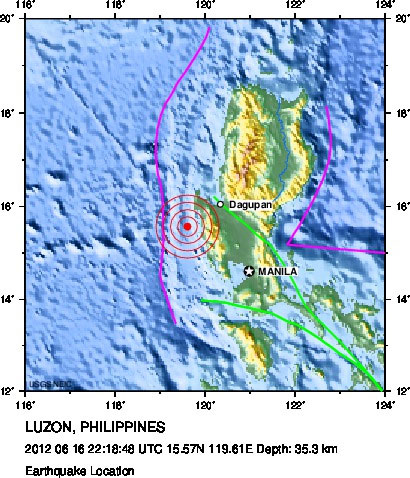
The map shows the location of the earthquake. (Graphic: USGS)
AFP quoted the US Geological Survey (USGS) as saying that the 6.1 magnitude earthquake occurred at a depth of 35km at 6h18 am through local time. The epicenter is about 143km southwest of Baguio city and 182km northwest of Manila.
The Philippine Institute of Seismology and Volcanology has evaluated the magnitude of the magnitude 6 magnitude. There is no information about casualties after the earthquake, although its tremors can be felt in many areas, including the capital Manila.
The Philippines is located on the Pacific Fire Ring. This is the world's largest ocean ring with many active volcanoes and unstable ocean trenches.
In February, a 6.7-magnitude seismic occurred in the central part of the Philippines that led to landslides that killed more than 100 people and went missing.
There is a geological fault line running just below Manila, a metropolis with more than 12 million inhabitants. The Philippine seismologists warned that Manila was not ready to deal with a major earthquake.
- The earthquake shook in Tokyo
- Strong earthquakes in the Philippines and Indonesia
- 6.4 earthquake struck the Philippines
- Earthquake in the Philippines
- Strong earthquake shook Indonesia
- Tokyo shakes because of the earthquake
- Guatemala again shook because of the strong earthquake
- Japan has a strong earthquake again
- Philippines: Earthquake in typhoon Haiyan
- Strong earthquake in Vanuatu, Philippines
- Strong earthquakes rocked Greece, Nicaragua
- Earthquakes in the Philippines and Indonesia
 Is the magnetic North Pole shift dangerous to humanity?
 Washington legalizes the recycling of human bodies into fertilizer
 Lightning stone - the mysterious guest
 Stunned by the mysterious sunset, strange appearance