Hot: China discovered the truth about MH370 in Cambodian forest
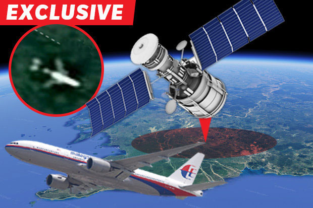
China deployed satellites to search for missing aircraft MH370 in Cambodian jungle after an Englishman said he had discovered the image on Google Maps to the location of MH370.
Chang Guang Satellite Technology Company of China used 10 commercial satellites to capture the rainforest area 60 miles west of Phnom Penh, Cambodia - believed to have its own MH370 wreck Malaysia Airlines aviation disappeared 4 years ago.

Chinese satellites showed no fragments of MH370 in the Cambodian forest area.
However, the images obtained at the end of September 6 showed no fragments of MH370 in this area.
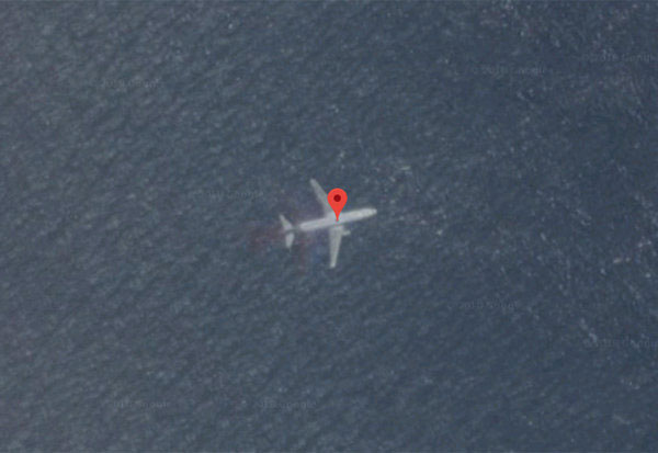
The Chinese company's search took place after recent media coverage of British tech expert Ian Wilson 'spent hours learning on Google Maps' and found traces of MH370 aircraft deep in one. tropical forest in highland Cambodia. Wilson's location found that a plane was 70 meters long, slightly longer than the actual MH370's length of 63.7 meters.
According to Wei Shu, Chang Guang company office director based in Jilin Province, China, the latest satellite images do not detect any aircraft in the rainforest area as expert hypotheses. Wilson. According to Mr. Wei, Chang Guang company's satellite images and videos are covered by cloud 76% so it is difficult to see exactly what happens on the ground. The company said it would continue to capture satellite images to verify the final conclusion.

The suspicious image of MH370 was captured by Google Maps.
Meanwhile, according to Angkor Time, the aircraft expert Wilson discovered on Google Maps is not MH370, but could have been a plane that crashed more than 20 years ago.
However, Mr. Wilson insists that the location of Google Maps needs to be checked and is planning a field search using a helicopter.
And private investigator Andre Milne, founder of military technology company Unicorn Aerospace, has called on Google Maps technology giant to enlarge the image on the spot by using its own satellite to capture more clearly. .
The Mh370 took off from Malaysia's Kuala Lumpur capital to Beijing and disappeared on March 8, 2014, carrying 239 passengers on board. So far, the cause of missing is still a mystery and it is not possible to determine exactly.
- MH370 was found in a place not in the Cambodian forest
- At the end of MH370, jump out of the sky and head straight into the sea!
- Hot: Detect a mysterious group of passengers that can attack MH370
- MH370 was intercepted by a fighter just before disappearing?
- In addition, the theory of the plane MH370 lies in the jungle of Cambodia
- Australian scientist claims to know where MH370 falls
- Newly discovered fragments of missing aircraft MH370
- Decipher the mysterious plane missing MH370?
- Hot: Detect exact location of aircraft MH370
- The cockpit of MH370 may have been ripped apart
- Two fragments are confirmed 'almost certainly' by MH370
- 10 newly discovered animals
 'Fine laughs' - Scary and painful torture in ancient times
 The sequence of numbers 142857 of the Egyptian pyramids is known as the strangest number in the world - Why?
 History of the iron
 What is alum?