China completes the deployment of the global positioning system
On June 23, China completed the deployment of the North China Sea Navigation System (BDS) after its last satellite was launched into orbit the same morning.

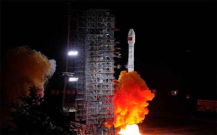
Truong Chinh 3B rocket carries the last satellite of the Bac Dau Navigation System (BDS) leaving the launch pad from the Xichang Satellite Launching Center, Sichuan Province, China on June 23, 2020. (Photo: THX / TTXVN)
According to Xinhua News Agency, the last satellite in BDS was launched from the Xichang Satellite Launch Center at 9:43 am on June 23 (local time). This is the 55th satellite in the Bac Dau "family" successfully put into orbit thanks to Truong Chinh 3B boosters (Long March -3B).
China's completion of the BDS marks its major step in the race to gain market share in this potential field, alongside its US rival.
China started building its own global positioning system in the early 90s of the last century, with the aim of supporting the control of cars, fishing boats and military vehicles using map data. from your own satellite navigation system. Today, millions of mobile phone subscribers are using the system to search for places to go, give directions to taxis, or flight paths of rockets and drones.
BDS, a combination of 30 satellites, has been used to provide map data services since 2012, but only in the Asia-Pacific region. Since 2018, BDS has started to provide global reach services. About 120 countries, including Pakistan and Thailand, use BDS services to monitor water transport and direct rescue operations during natural disasters and other services.
- China launched the 10th positioning satellite
- Russia's Glonass system has global coverage
- America will upgrade the global positioning system
- China will build a global positioning satellite system
- How the GPS system works
- Vietnam successfully used Galileo positioning signal
- Russia's global positioning system
- China provides global positioning services
- China is about to have a more accurate GPS navigation system than the United States
- How does navigation device work?
- China expanded its location services throughout Asia
- Galileo global positioning satellite system has trouble
 Van Allen's belt and evidence that the Apollo 11 mission to the Moon was myth
 The levels of civilization in the universe (Kardashev scale)
 Today Mars, the sun and the Earth are aligned
 The Amazon owner announced a secret plan to build a space base for thousands of people