Everest altitude measurement technique
Mountain altitude measurement is based on geometric formulas and surveying techniques that have not changed for centuries.
According to Live Science, basically measuring the height of a mountain depends only on high school math. To calculate the height of a mountain, simply measure the distance between the two points on the ground and then measure the angle between the top of the mountain and each point.
"If you know the two corners, you will be able to deduce a third angle, because the three angles in the triangle are 180 degrees," said Peter Molnar, a geologist at the University of Colorado.
To perform these measurements, the surveyor must define a horizontal plane using a level ruler (a type of ruler has a gas bubble inside the water, if the horizontal plane of the balloon will be in the middle of the ruler, Slightly to the side, the ball will run to that side).
Then they will determine the angle with a high-precision angle protractor called the theodolite . Knowing two angles and an edge of a triangle, using trigonometry will calculate the remaining edges and the height of the triangle, or the height of the mountain itself.

Mount Everest, second on the left.(Photo: Pavel Novak).
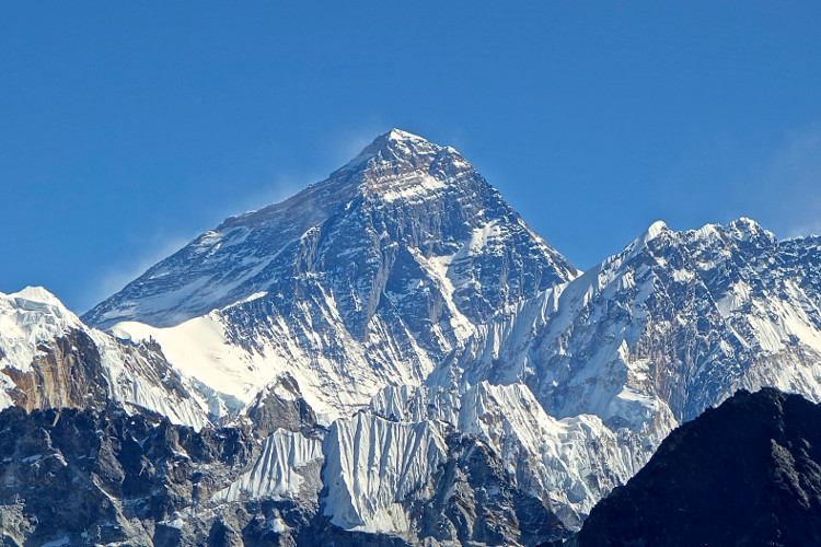
This is the method that Welsh geographer and geographer Sir George Everest used to measure the height of the highest mountain in the Himalayas in the 1840s.
To limit confusion, the group of geographers measured mountain sizes many times from different places at the foot of the mountain and obtained average results. Accordingly, the most accurate height of Mount Everest is 8,839 meters, Molnar said.
However, "they don't think that someone will believe this result and added 0.6 meters to look more reliable , " Mohnar said.
The official height of 8,848 meters of Mount Everest comes after the 1955 survey.
Small adjustments
Today, basic trigonometry has been greatly supported by satellites. When a satellite sends a signal to a receiver tower located on the ground, it can calculate the position of that point in a given coordinate system with incredible accuracy.
This calculation is based on the speed of the radio signal (which is also the speed of light) and the position of the satellite located at a location relative to the center of the Earth, at a known time. With the receiver tower located near Mount Everest, they can measure the altitude more accurately.
In addition, because the Earth is spherical, the position of two 2 points on Earth is far from accurate to measure the distance between each other. The error will be proportional to the quotient between the distance between the two points and the Earth's radius.
The Earth is also slightly bulging at the equator. The poles are closer to the center than a point on the equator about 26km, so the surveyors must add another adjustment, including the sea level error.
Errors due to sea level
Another cause of sea level error is where landmark is taken to calculate altitude.
Another cause of sea level error is where landmark is taken to calculate altitude. The distance from the center of the Earth to different shores is not uniform throughout the world, not only because of the wind and the weather, but also the result of an orbital bulge.
These make water and everything else spread out in orbit, according to Mohnar. In addition, the Earth is uneven, large terrain like hills and mountains also changes gravity in the surrounding area.
"If you take the sea level mark in Kolkata, Nepal or Mumbai, you will have different results," Molnar said.
Today, geographers use a mathematical expression to estimate sea level. They imagine what would happen if there were no winds or tides, and all the water from the ocean went into the continent through narrow canals.
This will create an abnormally idealized sphere that represents the average sea level from which to measure height, according to the US National Oceanic and Atmospheric Administration (NOAA). However, according to Mohnar, "all height has errors".
- 'Death Threshold' on Everest: The untold story of the 5 greatest climbing legend in history
- The factors that make Everest the dead end of the climbers
- Human health becomes meaningless at the top of Everest's roof
- Why does the plane have to fly higher than Mount Everest?
- Atoms are 7 times smaller than we have ever known
- Can't conquer Everest due to ... out of snow?
- Learn interesting things about Mount Everest
- Russian explorer for the second time conquered Everest
- The UFO suddenly appeared at Mount Everest, making science a headache
- The reason the plane is flying higher than the Everest peak
- Video: The collision created the Everest
- Nepal calls for help measuring Everest height
 History of the iron
 The sequence of numbers 142857 of the Egyptian pyramids is known as the strangest number in the world - Why?
 'Fine laughs' - Scary and painful torture in ancient times
 Himba tribe has topless women in Africa