How do we measure the deepest places on Earth?
How does science determine this is the deepest point on the Earth, as well as measuring the depth there?
Kathy Sullivan , the first American female astronaut to create a new record on June 7, when she became the first woman to reach Challenger Deep, the lowest point of the ocean.
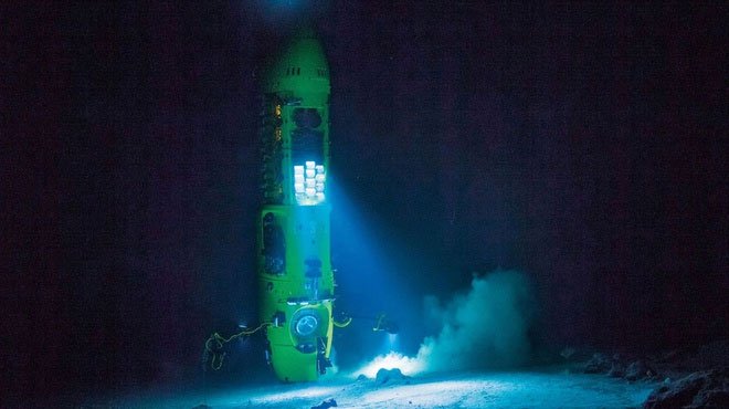
Renowned director James Cameron made a dive to Challenger Deep in 2012. (Image: National Geographic).
Challenger Deep is known as the lowest point in the Mariana Trench , a stretch of tectonic plates stretching over 2,400km along the western Pacific Ocean. It is said to be the region with the deepest abyss of all oceans in the world. At depths of more than 10,000m, the pressure can reach over 1,020 atm. For ease of comparison, the daily pressure with humans fluctuates at 1 atm.
How do we know that Challenger Deep is the deepest point on Earth. Is there any point in the world deeper than Challenger Deep?
The truth is we can't know for sure. The Challenger Deep was first measured by the HMS Challenger expedition team in 1875. The expedition's scientific research trip with a total length of nearly 112,000 km across the Earth's surface laid the foundation for ocean science. present.
To explore the depths of the ocean, the crew uses only long ropes. The first depth recorded is more than 8,000 m above sea level.
In 1951, the figure was recorded to be more than 10,000 meters when another ship, also named the HMS Challenger, measured the depth using the sound waveform: an audio wave signal was transmitted into the abyss. deep and then the scientists wait for it to reverberate, measure the time the wave travels underwater and from there calculate the depth. After several technology updates with a more accurate measurement, the scientists recorded Challenger Deep's depth of 10.99 km.
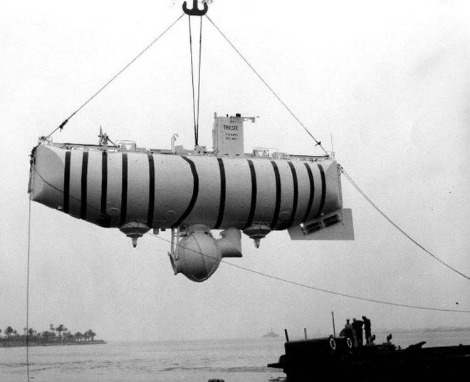
The Trieste, the first ship to take people down to Challenger Deep. (Image: Wikimedia Commons).
The tolerance on this measurement is approximately 30 m. Therefore, it is possible that the future depth of Challenger Deep will change but not much with more accurate measurements.
Perhaps it will be harder to find any deeper place on Earth. Underwater terrain science has long used ultrasonic devices to create digital maps of underwater terrain. The beams that are illuminated to the ocean floor are updated many times a second and verified by global positioning satellites. By 1997, researchers discovered a place called Sirena Deep, with a depth of about 10.7 km, a little less than Challenger Deep.
These maps clearly indicate that the Mariana Trench is the deepest place to be measured. With the researchers using the most advanced technologies to explore the ocean, the likelihood of deeper trenches is very small.
- Inside the explorer ship, the deepest part of the Earth
- The deepest hole in the Earth: digging for 24 consecutive years 12km, and more than 6300km to reach the center of the Earth
- The deepest part of the earth is exposed
- 10 exotic places on Google Earth map
- Video: The greatest depth in the human world ever conquered
- The most severe places of natural disasters on Earth (Part 2)
- 3-hour diary under the deepest Mariana region of film director Titanic
- Visit the 8 mysterious 'hidden places' on Earth
- 4 famous 'alien' locations on Earth
- Detecting scrap yard in the deepest place in the world
- How does the 'hell well' deepest on the ground appear?
- The most severe places of natural disasters on Earth (Part 1)
 History of the iron
 The sequence of numbers 142857 of the Egyptian pyramids is known as the strangest number in the world - Why?
 'Fine laughs' - Scary and painful torture in ancient times
 Himba tribe has topless women in Africa