NASA launches a satellite measuring soil moisture
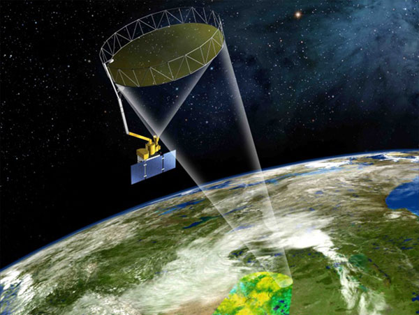
According to a recent report, the US Aeronautics Agency (NASA) is preparing to launch the Soil Moisture Active Passive (SMAP) satellite on orbit to measure soil moisture on a global scale. When officially put into operation, soil moisture data from SMAP can be used to provide useful information to farmers during the season. According to NASA, SMAP is capable of providing accurate and fast information on current and future humidity thanks to the support of the most advanced technology.
As planned, the SMAP satellite will be launched into orbit and put into operation in the coming October by Delta boosters. 2. NASA said the technology to determine the moisture content of the ground that SMAP uses is a jump. never seen so far compared to the technologies used so far. Specifically, older satellite generations could not determine the moisture content of the ground with high resolution and accuracy like SMAP.

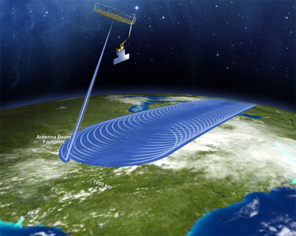
Previously, the old generation of satellites determined the moisture content of the ground by measuring at a local point. The downside of this approach is that the data is not reliable and it is difficult to make a forecast on a large area. However, SMAP is capable of performing tasks not only in a certain region but on a global scale and results in 2-3 maps of the Earth's humidity each day.
SMAP will operate at an altitude of 365km in the polar orbit in sync with the orbit of the Sun, using the L-band radar system and L-band radiation to continuously scan every 5cm of earth on Earth. At the same time, SMAP is also capable of collecting moisture data with a resolution of about 50km, although it is not possible to provide a moisture content difference between this land and another land, but still allow data provision. The most comprehensive and detailed moisture content ever.

Narendra Das, the SMAP group's water and carbon cycle scientist at NASA, said: "If farmers know the moisture content of the crop, they can proactively plan crops to maximize productivity. SMAP can assist in making predictions about how drought will happen to help farmers plan to recover crops after dry days. "
At the same time, soil moisture data collected from SMAP satellites can also support agencies and organizations to understand more about the link between water, energy and carbon cycles in order to more accurately predict weather and climate changes.
- NASA has successfully launched the SMAP satellite
- NASA is ready to launch satellites to measure CO2 on Earth's atmosphere
- NASA launches the most modern weather satellite to date
- Russia spoiled the satellite again
- NASA launches a new generation satellite
- US launches satellite to measure emissions
- NASA launched a satellite to monitor greenhouse gas emissions
- NASA launches satellites to explore the mysterious region of the atmosphere
- US launches satellite tracking climate change
- Bolivia launches satellites in China
- Rescue agents for NASA
- Prepare to launch a global rainfall measuring satellite GPM
 Van Allen's belt and evidence that the Apollo 11 mission to the Moon was myth
 The levels of civilization in the universe (Kardashev scale)
 Today Mars, the sun and the Earth are aligned
 The Amazon owner announced a secret plan to build a space base for thousands of people