Track polar bears from space
Track populations of polar bears in very heavy and dangerous frost conditions. This work has become softer when monitoring them from space.
>>>5 interesting features of polar white bears
Scientists have used satellite imagery to monitor organisms off the Canadian coast, and the technology also considers polar ice melting to affect the number of bears. The images are said to be very detailed because each image requires 2.5GB of storage, more than 1,300 times the amount of an average image recorded by the iPhone.
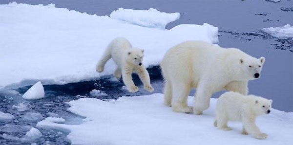
Polar Bear - (Photo: Polarbearsinternational.com)
Researchers began recording bears in the summer of 2012 and based on that to calculate the number of bears.
Creatures can be distinguished from different bright colors by comparing satellite images with other images on the same island.
A previous field study showed that about 100 bears on a polar island, and satellite images confirmed this.
Daily Mail said developing effective techniques to monitor wildlife is a priority in the Arctic, far away and difficult for logistics to reach.
Satellite imagery is a promising tool to monitor not only polar bears but also other wildlife that live in this environment.
- Detecting starving polar bears
- The polar bear again collides with the brown bear
- 5 interesting features of the polar bear
- Interesting facts about little-known bears
- Decreasing the number of polar bears and walruses
- Polar bears and global warming
- Polar bear's super swimming ability
- Melting ice threatens polar bears
- Polar bears have to swim continuously for 687km to feed
- Polar bears are older than previously announced
- Polar bears eat dolphin meat due to climate change
- Hazardous waste can cause bisexual syndrome in polar bears
 Animal 'suffering' after hibernation
 Why do goats climb well?
 Scientists were surprised to see chimpanzees eating turtles
 Giant catfish died deadly due to drought in Thailand