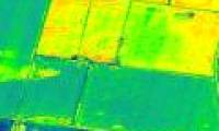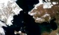
Scientists around the world are now using images from high-resolution satellites to identify places where grave robbers are looting.

Pakistan's Tribune website on September 1 reported that Pakistan became the first country in the world to use satellite imagery to map crops.

Google Earth images taken from satellites, airplanes, and balloons reveal strange places on Earth that can only be seen from space.

A photo taken of Egypt's Nile River, as red as blood, has caused a stir among public opinion.

For the first time in the history of the International Space Station, there is a separate YouTube channel that transmits images to Earth 24/7.

Iran on June 18 launched a new Iran-Sat satellite surveillance system at the Alborz Space Center.

Track populations of polar bears in very heavy and dangerous frost conditions. This work has become softer when monitoring them from space.

NASA and ESA satellites have recently sent photos to Earth in January 2018. The series continues to be a warning about global climate change.

Satellite images show that the pink haze of China has affected Japan, South Korea, Korea, Taiwan and northern Vietnam.

These blue streaks can have serious consequences for the Antarctic region in particular and the Earth in general.
 Scientists around the world are now using images from high-resolution satellites to identify places where grave robbers are looting.
 Pakistan's Tribune website on September 1 reported that Pakistan became the first country in the world to use satellite imagery to map crops.
 Google Earth images taken from satellites, airplanes, and balloons reveal strange places on Earth that can only be seen from space.
 A photo taken of Egypt's Nile River, as red as blood, has caused a stir among public opinion.
 For the first time in the history of the International Space Station, there is a separate YouTube channel that transmits images to Earth 24/7.
 Iran on June 18 launched a new Iran-Sat satellite surveillance system at the Alborz Space Center.
 Track populations of polar bears in very heavy and dangerous frost conditions. This work has become softer when monitoring them from space.
 NASA and ESA satellites have recently sent photos to Earth in January 2018. The series continues to be a warning about global climate change.
 Satellite images show that the pink haze of China has affected Japan, South Korea, Korea, Taiwan and northern Vietnam.
 These blue streaks can have serious consequences for the Antarctic region in particular and the Earth in general.


 Do signals from extraterrestrial civilizations detected by Sky Eye really exist?
 'City without air conditioning' in China: People don't know what heat is!
 The element of the sun god is giving scientists a headache
 Unique Village: Roofs Become Roads for Residents!
 Top 7 strange psychological effects of the brain that we all have without knowing
 Which is the most terrifying bedroom elixir in Chinese history?
 Earth's core may start rotating in reverse
 A day in Japan can be up to 30 hours long, does this country live in a different 'timeline'?