The world's first crop map from satellite imagery
Pakistan's Tribune website on September 1 reported that Pakistan became the first country in the world to use satellite imagery to map crops.
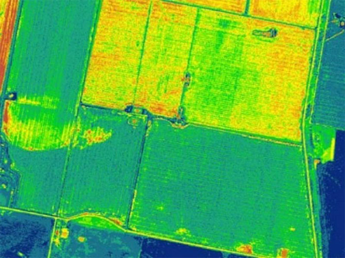
Speaking on a local television channel, the Vice President of the University of Information Technology (ITU) and Chairman of the Punjab State Information Technology Board, Umar Saif, said the satellites used were remote sensing satellites. He is called Sentinel-2A , 10m resolution, to determine the type of plant, the condition of the plant and the soil moisture to predict the growth process.
This data also helps the government develop a proper agricultural policy.
According to Dr. Siaf, Google has previously provided black and white images of 3m resolution through data and GPS location collected from Android phone users.
With the introduction of Sentinel-2 A satellite, Pakistan will be completely proactive, regardless of any third party.
The Sentinel-2A satellite will fly over Pakistan once a week and provide 13-color images to help identify crop data, including seed quality, growth, disease, cultivated area, yield and operations. moving to the economy and determining the export potential of surplus production.
Dr. Saif added that the work is a product after 2 years of research and development and users can access it for free. This data also helps the government to develop agricultural policies. Insurance companies and agriculture can also benefit.
- Predict epidemics by satellite
- The transformations of the Earth through satellite images
- Satellite simultaneously captures total eclipse and tornado
- NASA announces picturesque satellite imagery
- New method to increase crop yields
- Satellite images reveal the disaster of Chinese air pollution
- Take pictures from space capture the situation on the ground
- Africa increases crop yields through termites and ants
- Greenhouse effect reduces crop productivity
- Sports shoes find people lost
- Alien ship suspect hidden in the Antarctic cave
- The truths always amaze you about the biological world
 History of the iron
 The sequence of numbers 142857 of the Egyptian pyramids is known as the strangest number in the world - Why?
 'Fine laughs' - Scary and painful torture in ancient times
 Himba tribe has topless women in Africa