Europe launched 5 global observation satellites
The European Space Agency (ESA) is expected to launch 5 Sentinel satellites to track all changes in land, ocean, weather and climate across the Earth. The plan follows the Global Environmental and Security Monitoring Program (GMES), a joint initiative of ESA and the European Union.
To implement this program, ESA Director General, Jean-Jacques Dordain, and President of Thales Alenia Space, Mr. Pascale Sourisse signed a $ 305 million contract to design and develop the satellite First Earth: Sentinel 1. The signing ceremony took place at the Paris Air Show, on June 18, 2007.
Mr. Volker Liebig, Director of ESA's Earth Monitoring Programs, said: 'This is the first concrete step in creating the spatial infrastructure for GMES'.
Sentinel 1: Versatile satellite

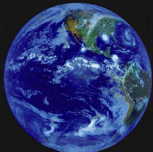
Sentinel 1 is the first of five satellites that ESA will use to observe the globe.(Photo: ESA)
Sentinel 1 is equipped with a synthetic aperture radar system (SAR), capable of producing very detailed radar images. With this system, satellites can take pictures anytime, day and night, regardless of the Sun's illumination Sun brightness.
SAR also has the ability to see through clouds and dust, while devices using infrared rays cannot do that.
Sentinel 1 can take pictures of the Earth in ranges of up to 250 km in diameter, with aerial shots reaching a surface smoothness of 5 meters. This satellite is also responsible for monitoring environmental conditions both on land and offshore. It is also a means of observing changes in land surfaces, such as landslides.
Sentinel 1's fast mapping ability is very important in natural disasters, because emergency services need to quickly know which routes exist and what areas is affected.
The satellite also undertakes monitoring of the marine environment, making maps of slicks and fluctuations in ice sheets on the ocean.
About this satellite, Mr. Liebig said: 'Sentinel 1 will be the only means of observing what is happening at the two poles of the Earth, places that have a very important influence on sea level and climate'.
GMES: Global monitoring and forecast
GMES is an essential tool to learn about climate change, disaster monitoring, such as storms, earthquakes, volcanic eruptions . worldwide.(Photo: math.montana.edu)
This program is designed to provide politicians with independent environmental data for them to use in planning relevant policies.
GMES is an essential tool to learn about climate change, as well as to monitor natural disasters, such as storms, earthquakes, volcanic eruptions, etc. Speaking to the press at the aforementioned Paris exhibition, Mr. Liebig said: 'The recent G8 summit shows that Europe has actually led the way in political discussions on global climate change'.
'GMES will provide the necessary means and information for politicians to make the right decisions about solving this complex issue.' He said the Intergovernmental Panel's Fourth Assessment Report on Climate Change predicts that by the end of the century the temperature increase will be 1.8 to 4 degrees Celsius (3.2 - 7.2 degrees Fahrenheit). .
The report, published earlier this year, also said sea levels could rise by 28 to 43 cm and the Arctic ice in the summer would halve in the second half of the century.
These climate changes can increase the frequency of heat waves and the intensity of tropical storms. Mr. Liebig said: 'Global climate change is no longer a matter of waiting for the resolution of the next generation, but we must deal with it, because it is happening every day before our eyes.'
Regarding the role of GMES, President Pascale Sourisse said: 'This program is very important for European citizens and industries. It helps us get short, medium and long-term forecasts for many different areas. '
Quang Thinh
- New era for global meteorological observation system
- Prepare to launch a global rainfall measuring satellite GPM
- NASA decided to launch a new Earth observation satellite
- Nigeria successfully launched two observation satellites
- China successfully launched the satellite for Turkey
- China successfully launched a satellite observing the Earth
- Europe has successfully launched two telecommunications satellites
- Europe successfully launched the satellite under Galileo navigation system
- China launched the 10th positioning satellite
- Vietnam launched Micro Dragon satellite at the end of 2018
- Myanmar thanks Japan to launch a global observation satellite
- The world's first 3D printed satellite was launched from ISS
 Van Allen's belt and evidence that the Apollo 11 mission to the Moon was myth
 The levels of civilization in the universe (Kardashev scale)
 Today Mars, the sun and the Earth are aligned
 The Amazon owner announced a secret plan to build a space base for thousands of people