Super high resolution of the new map of the icy continent
The height of an ice mountain would only be counted in meters instead of the previous kilometers.
This is the most perfect surface of the Antarctic surface , imagine if you could lay your hand on it, you would feel the point of rising from the glacial ice slopes of the Northern Antarctic Peninsula. this continent.

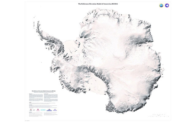
REMA - Antarctic reference elevation model.(Photo: US National Geographic Intelligence Agency).
The researchers drew topographic maps through high-resolution images, collected between 400-700km from a group of satellites around Earth's orbit over the past 6 years. To create an overall map, hundreds of thousands of stereoscopic digital elevation models (DEM) and millions of 5-year processed images by Blue Waters - one of the world's most powerful supercomputers with processing speed of 1 million billion calculations per second, according to the University of Minnesota announcement. The map is called 'Antarctic reference altitude model' (REMA) . The US National Geographic Intelligence Agency and the National Science Foundation fund the project.
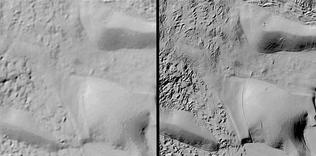
The previous map of the frozen continent only had a resolution of more than 3,000 feet (1,000 meters), but the new map provided us with an incredible resolution: about 26 feet (8m). With an area of 5.4 million square miles (about 14 million square kilometers) - 98% of Antarctica - it becomes the most detailed map of the frigid continent drawn.
"In the past, the Mars surface map was of higher quality than the Antarctic map," said Ian Howat, one of the project's researchers, director of Ohio State University's Center for Climate Research. "Now we have the best topographic map of a continent on Earth," Howat said.

The resolution of the previous Antarctic map when compared to REMA has just been completed.(Photo: Fox9).
The determination of the height of Antarctic ice and ice reefs is now within the reach of scientists, and its deviation is within a range of less than 1m, according to the announcement.
"With this resolution, you can see almost everything," Howat said. "We will observe the change of the snow cover or the transitions of the ice, we can monitor the flow of rivers, floods and volcanoes and the fragility of the ice on the river surface. ".
With quite a lot of data - the map file size is 150 terabytes (153600 GB) - scientists can now better visualize the impact of global warming through the Antarctic landscape, Paul Morin, The co-chair of the project wrote in the notice. " Currently, we have the better chance than ever to observe changes in melting and freezing , " he said. " This will help us understand the impact of climate change and sea level rise. It will be right before our eyes."
Although the map is complete, the capture and processing of satellite imagery will continue and changes (if any) are updated twice a year. REMA is published online from September 4 on the site of the Minnesota Center for Polar Space (PGC).
- NEC introduces 'ultra-resolution'
- Find the 'lost' ancient continent ... located below Europe
- China launched the first high-resolution satellite
- House number: Attractive but price ... exorbitant
- Korea: New MRI device with high resolution team
- Google provides Mars with high resolution images
- Nepal earthquake creates momentum to create new supercontinent
- Explore the 5 million km2 continent submerged under the Pacific Ocean
- Discovering traces of the ancient Antarctic continent
- American astronauts walk outside the space to install high-resolution cameras
- Take pictures from space capture the situation on the ground
- New drugs treat HIV and malaria
 'Fine laughs' - Scary and painful torture in ancient times
 The sequence of numbers 142857 of the Egyptian pyramids is known as the strangest number in the world - Why?
 History of the iron
 What is alum?