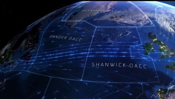
Video: Map road maps over the North Atlantic Ocean
The waters between Europe and North America are relatively calm despite any day, but above 9km altitude, more than 2,500 planes follow each other like invisible highways, moving between the two Mainland and land in gateway cities like London and New York or fly further.

Of course, not all aircrafts carry commercial passengers, but among them there are flights of transporting goods, military weapons, soldiers and private flights that also make considerable traffic. No matter the purpose and location, it is spectacular when we can see these flights visually.
NATS, the UK National Air Transport Service, created a video to help us envision more than 1400 flights this agency handles every day. This video has been posted on Vimeo and attracted a lot of user interest.
- North Atlantic ocean currents heat the Arctic
- The sea is hot to the extinct North Atlantic whale
- Discover new creatures under the Atlantic Ocean
- The Atlantic will be
- The most spectacular routes on the planet
- New discovery about the role of the ocean with climate
- The highest wave in the world, more than 6-storey house in the Atlantic Ocean
- Water in the Indian Ocean flows into the Atlantic Ocean
- The invisible highway network for aircraft in the Atlantic Ocean
- Sahara desert sandstorm sustains life in the Atlantic Ocean
- New breeding ground for head whales?
- The lucky one survived 60 hours on the Atlantic bottom before being rescued by a diver
 Why does steam cause burns worse than boiling water?
 Lightning-fast octopus is amazing
 Video: The secret to quickly fold clothes in just 2 seconds for busy people
 The eel waving off his head still bites the can of water