15th-century hand-drawn map reveals the end-of-world scenario
A hand-drawn map of a 15th-century German author depicting the apocalypse when Islam rose, the gates of hell opened and the Earth image later.

Dozens of 15th-century prints depict the end of the world coming close to mourning, but a hand-drawn map depicting the end of the world in a very different way. "The atlas illustrates what will happen at each stage," said Chet Van Duzer, a geographer historian who once wrote a book on the atlas.

According to National Geographic, geographic imagery is sketched in a modern way, but the map emphasizes one point clearly: if a person causes a crime, they will have nowhere to hide.

This manuscript is a collection of the first thematic maps, including maps depicting content unrelated to environmental characteristics (such as rivers, roads or cities).Today, the thematic map is very popular, ranging from chromatic climate maps to blue and red election results maps.But most historians argue that they originated in the 17th century. The draft of the apocalypse is owned by the Huntington library in San Marino, California, which dates back to the 15th century.

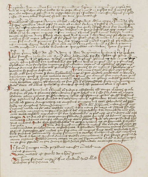
The manuscript was created in Lübeck, Germany, between 1486 and 1488 and knew in Latin not for the majority. But the content of the manuscript is not as scholarly as many contemporary documents, and the style is relatively poor. "The work is aimed at intellectuals, but not for the most elite of intellectuals , " Van Duzer said.The man who wrote the manuscript has not been clarified yet, but Van Duzer thinks it may belong to a doctor who traveled a lot from Baptista.
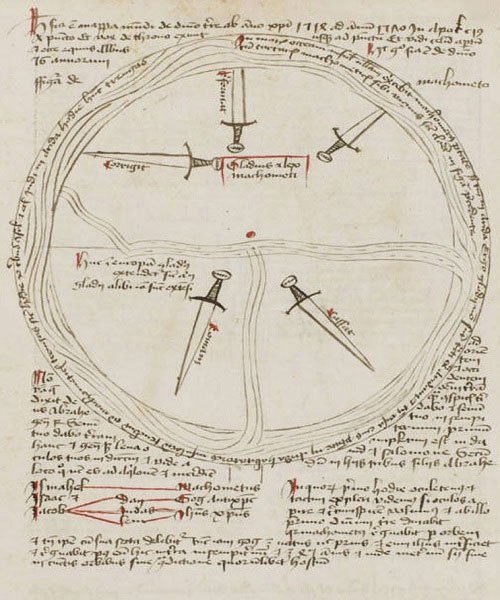
The description of the apocalypse begins with a map showing the state of the world between 639-1514. The Earth is circular, and Asia, Africa and Europe are illustrated as pieces of the shape Cake surrounded by water.The text describes the rise of Islam, and the author considers it a growing threat to Christianity.According to Van Duzer, it was a common prejudice in Europe at the time.
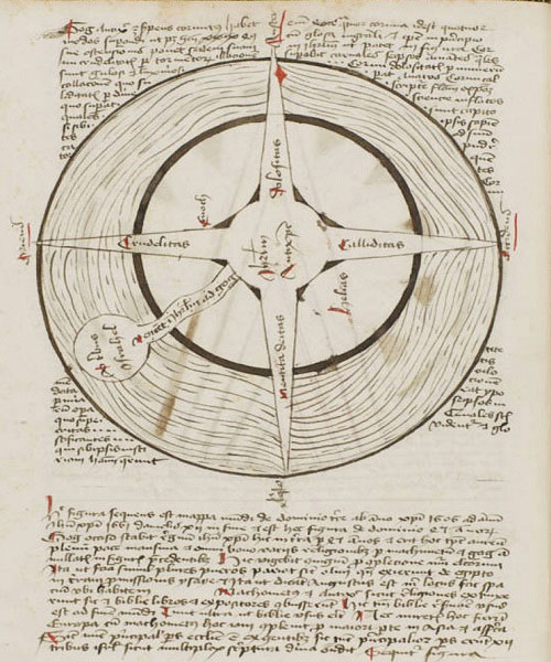
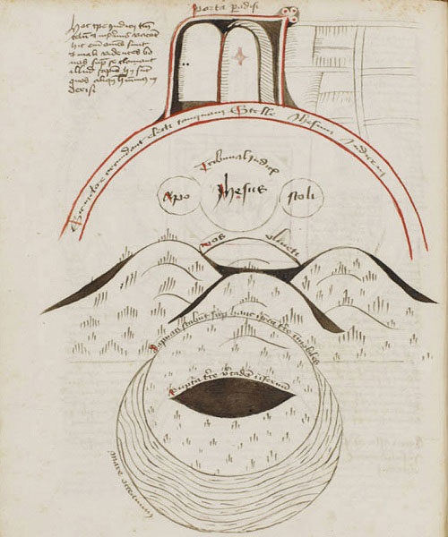
Subsequent maps depict the "Muslim blade" sweeping Europe after the rise of Islam by a large triangle that extends to two poles.Another map depicting the gate of hell opened on the Day of Judgment, was predicted by the author to take place in 1651. The next page has a small, flat globe, which symbolizes the world afterwards.All maps in the manuscript are symbolic.
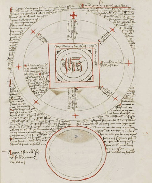
Writing in the manuscript is bold in personal colors.The author calculates the distance to the 777-mile German paradise from Lübeck to Jerusalem, and needs to take another 1,000 miles to reach the easternmost of the Earth (German miles are an obsolete measuring unit with many variations and hard to deduce. equivalent units in modern times).This person also calculated the circumference of Earth and Hell respectively 8,000 and 6,100 miles Germany.
In addition to the part about the apocalypse, the manuscript also includes a section on medicine and a geographical interpretation beyond the age.For example, the author writes about the need to adjust the font size so that the map is not distorted and becomes more readable, a problem that still makes it difficult for mappers today.
The last part of the geography is a short discussion of the purpose and function of the world map. According to Van Duzer, the author demonstrates how to understand thematic maps as a means of illustrating the characteristics of people or political organizations in different regions. "For me, this is one of the most interesting passages when a 15th-century person shares his views on what maps can describe," Van Duzer said.
- The prison for witchcraft in Scotland in the 15th century
- Peru discovered 6 mummies of dogs from the 15th century
- The old couple dug the treasure from the 14th century in the garden
- Decode the ancient Martellus Atlas map of Columbus
- Reveal a part of the world's most mysterious book
- Bad scenario in 2060
- Fun fact Brain damage reveals the truth about intelligence
- The three most popular hand symbols in the world
- Discover the wonders of India's giant Mehrangarh fortress
- Displaying the oldest western map is drawn on papyrus
- American earthquake response exercises
- The predictions of the genius of Leonardo da Vinci
 10 famous Isaac Newton inventions
 7 perspective of the destruction of the Earth
 'Doomsday 2021' and Mayan conspiracy theories
 Find the apocalyptic message of genius Leornado Da Vinci?