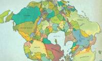
Scientists predict that in 250 million years, Earth will have a new supercontinent. But what will it look like?
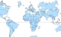
This projection, while keeping the right direction, but distorts the true size of some objects, especially those that are far away from the equator.

In any current world map, Africa, China and Alaska are distorted, despite the availability of accurate satellite data.
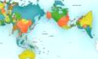
Japanese architect Hajime Narukawa claims to have solved a problem for centuries - how to draw a sphere flattened to Earth on a flat surface.

The world population is unevenly distributed across territories, in fact it is difficult to believe that it is true.

The borders of countries have never been straight and neat, and often countries do not have a specific country shape.

Even if the world population reaches 11 billion by the end of the century, it cannot be said that we do not have enough room for everyone.

The first grandiose chart of 4,000 years of world history was created by the author - amateur historian John B. Sparks and first published in 1931.

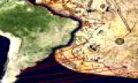
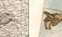
Piri Reis is a world map compiled in 1513 from military intelligence of the Ottoman navy and Piri Reis cartographer.

David Rumsey Center of Stanford University paid for buying the Monte-era map set in September 2017.
 Scientists predict that in 250 million years, Earth will have a new supercontinent. But what will it look like?
 This projection, while keeping the right direction, but distorts the true size of some objects, especially those that are far away from the equator.
 In any current world map, Africa, China and Alaska are distorted, despite the availability of accurate satellite data.
 Japanese architect Hajime Narukawa claims to have solved a problem for centuries - how to draw a sphere flattened to Earth on a flat surface.
 The world population is unevenly distributed across territories, in fact it is difficult to believe that it is true.
 The borders of countries have never been straight and neat, and often countries do not have a specific country shape.
 Even if the world population reaches 11 billion by the end of the century, it cannot be said that we do not have enough room for everyone.
 The first grandiose chart of 4,000 years of world history was created by the author - amateur historian John B. Sparks and first published in 1931.
 Piri Reis is a world map compiled in 1513 from military intelligence of the Ottoman navy and Piri Reis cartographer.
 David Rumsey Center of Stanford University paid for buying the Monte-era map set in September 2017.


 Do signals from extraterrestrial civilizations detected by Sky Eye really exist?
 'City without air conditioning' in China: People don't know what heat is!
 The element of the sun god is giving scientists a headache
 Unique Village: Roofs Become Roads for Residents!
 Top 7 strange psychological effects of the brain that we all have without knowing
 Which is the most terrifying bedroom elixir in Chinese history?
 Earth's core may start rotating in reverse
 A day in Japan can be up to 30 hours long, does this country live in a different 'timeline'?