For the first time, experts have mapped the Martian subsoil
Experts map the Martian subsoil by listening to the sound of wind bouncing off layers of soil and rock near the equator.
They used instruments on InSight, NASA's lander that landed on the Elysium Planitia plain in 2018 to study mild earthquakes on Mars. InSight data also gave scientists a rough idea of the size and composition of the Martian core, as well as the nature of the mantle and thickness of the crust.
The team, led by Swiss geophysicists, used a new technique developed on Earth to peer through the arid Martian surface and explore areas less than 200 meters deep in the crust.
"This technique is based on the vibrations of the surrounding environment. On Earth, the oceans and winds cause the ground to vibrate all the time. The vibrations measured at a given point also have the imprint of the subsurface layer," he said. face," explains Cedric Schmelzbach, a geophysicist at the Swiss Federal Institute of Technology (ETH Zurich), a member of the research team.
Basically, surface tremors cause the earth to shake. These microscopic vibrations travel deep below the surface and can be detected by sensitive instruments.
Mars is much quieter than Earth, has no oceans, and the atmosphere is also much thinner, leading to weaker winds, says Schmelzbach. Not to mention, while geologists on Earth can use an infinite number of stations, on Mars they only have one - the InSight lander.
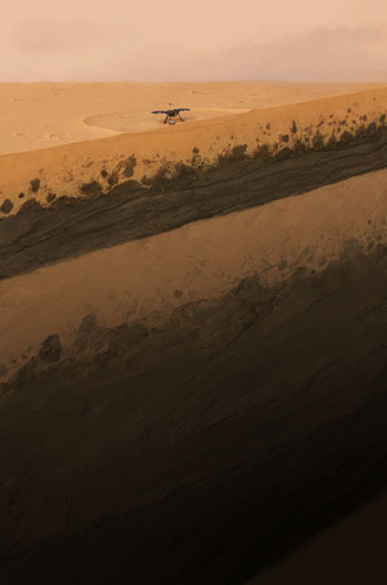
Simulation of the Martian ground beneath the InSight lander. (Photo: ETH Zurich/Geraldine Zenhausern).
However, listening to the interaction between the winds and the earth still reveals the structures beneath the red planet's surface with amazing detail. The map provides interesting information about the evolution of Mars over billions of years. It revealed an unexpectedly deep layer of sediment and a thick layer of solidified lava, all covered by a 3-meter thick layer of sandy soil.
The origin of the newly discovered sediment remains a mystery. It is located 30 - 70m below the surface of Mars, sandwiched between two layers of frozen ancient lava. The team compared the two layers of lava with previous studies of the geology of nearby depressions. This helped them determine that they formed at two important periods in the geological history of Mars, about 1.7 billion years ago and 3.6 billion years ago.
At the top of the younger lava layer, just below the topsoil, is a strip of rock about 15m thick. These rocks may have been ejected from the Martian surface by a meteorite impact, and then fell back down.
The new study was published in the journal Nature Communications on November 23. In the future, the scientists want to see if it is possible to develop their technique and look deeper, down to the first few kilometers of the Martian crust.
- Artificial intelligence only takes 5 seconds to detect a new crater on Mars
- 'Martian Gardens - Martian Gardens' helps scientists find a way to grow vegetables on Mars
- NASA develops dust storm forecasting technology on Mars
- For the first time, map the Japanese genome
- Earthquakes up to 6.8 on the Richter scale off Vietnam
- Brick from soil simulating Martian soil: stronger than concrete
- Earthworms can grow well in Martian soil
- Found freshwater lakes that once existed on Mars
- Tomorrow time is pulled back by a second
- Redefine the Martian meteorite age
- The Perseverance landing site is an ancient Martian lake bottom, now it's time to find fossils of life
- The Milky Way is twisted, not flat
 Announced 3 houses on the Moon and Mars
 Science proves: Mars also knows 'deflated'
 Elon Musk announced the price for a Mars trip was 11.6 billion VND, free of charge
 NASA discovered strange 'gate' on Mars, is the hiding place found?