Li explained the white snow phenomenon in the Sahara desert
Although one of the hottest places on the planet with an average temperature of about 100 degrees Celsius in the summer, the Sahara has experienced an unprecedented snow in the past 40 years.
According to CNN, Ain Sefra, a town located in the Algerian desert, which is considered the "gateway to the Sahara" has just witnessed a record snowfall. This is a rare record of falling snow between the Sahara desert over the past 40 years. Many sources said that snow in some places was 38.1cm thick. Even, snow clung to the soil and only started to melt near the end of the day.
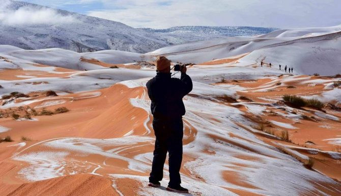
A photographer is taking pictures of snow falling in the desert.
The temperature difference in the Sahara desert is very high. The daytime temperature in this desert sometimes reaches 100 degrees C. But at night, the temperature can drop very deep, maybe even down to a negative level. But in order to happen the phenomenon of snow falling in the desert requires a lot of resonant elements.
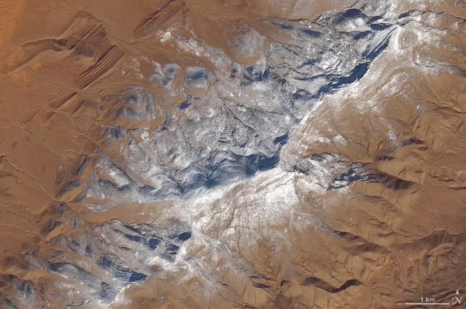
Satellite images recorded a large area of land covered with white snow.
Photographer Karim Bouchetata shared with Shutterstock: "We were really surprised when we woke up and saw the snow. It cleared the Sahara desert on Sunday and just started to melt around 5pm."
Although the phenomenon is rare, it does not happen. Last year also recorded the state of snowfall. But about 37 years ago, people in Ain Sefra witnessed the snowfall in the desert.
Why is there a phenomenon?
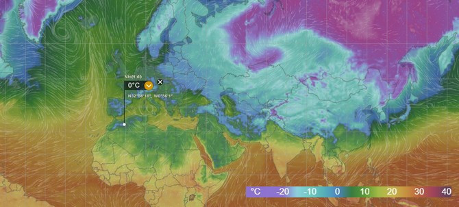
According to The Verge's explanation, snowfall in the Sahara desert is only part of a common atmospheric model in the Northern Hemisphere , leading to a "snow bomb" sweeping the United States during the past week.
The time is from November to March every year when the Northern Hemisphere gradually gets farther away from the Sun (caused by the 23.4-degree tilting axis of the Earth), high-pressure high-pressure air flows from the North Pole down to the pressure low at the equator.
Although it is rare that cold air may overflow into the equator, there are no exceptions. When the air is warm in the south and the cold air in the north accumulates more and more and disputes with each other. This will lead to an imbalance in the climate model and create unprecedented extreme phenomena.
High pressure air flows continuously and now crosses the boundary of the low pressure zone (the lower the cold zone).
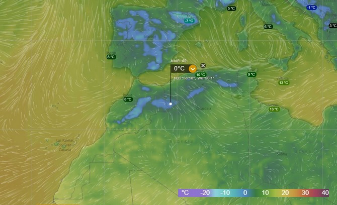
This is the location where the snowfall in the Sahara has been recorded.
This situation leads to even places that are hot all year round like the Sahara Desert can still be covered with ice like polar regions. Of course, high pressure blocks with the characteristics of dry and cold when falling down can hardly create snow.
According to geologist Stefan Kröpelin of the University. Cologne, Germany shared that the cold air incidentally combined with the moisture from the Mediterranean Sea and the Atlantic Ocean to create a white snowfall in the Sahara.
As expected, the high pressure gas will continuously blow down to the South in the future. Thus the possibility that many other areas of the Sahara desert may catch very high snowfall.
It was only early in 2018, but the world witnessed extreme weather events such as the terrible cold spell in the US and now the snowfall in the Sahara desert. Perhaps, the expression of climate change is gradually becoming more pronounced than ever if people remain indifferent to the environment.
- Snow fell for the first time in 37 years in the Sahara
- Snow falls in the Sahara desert from the universe
- Snow is dyed red like blood covering the Sahara desert
- The Sahara is submerged under a meter of snow
- Snow falls over the Sahara
- Little known facts about the Sahara desert
- The wild world on the Sahara desert
- Found the true age of the Sahara desert?
- Many deserts ... water
- What is going on with the Sahara?
- The arid Sahara desert used to be the place where the largest marine creatures lived
- Could it be that humans have turned the Sahara into a desert?
 Is the magnetic North Pole shift dangerous to humanity?
 Washington legalizes the recycling of human bodies into fertilizer
 Lightning stone - the mysterious guest
 Stunned by the mysterious sunset, strange appearance