Map the global coral
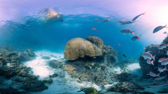
Scientists have published a series of unique photos about the coral world in the 'Caltin Seaview Survey' project (Caltin Sea Vision Survey) with the aim of mapping the world-wide map and studying the great life positive.
The team embarked on the work of mapping Australia's giant Barrier coral reef in September 2012, using a deep-sea diving robot along with high-tech cameras, called SeaView SVII.

Some images of the giant coral reef Barrier are captured by high-tech cameras
Scientists say the high-tech SeaView SVII camera has revolutionized the ocean, automating images with high sharpness that no camera has ever done before.
Under-ocean images taken with 360-degree angles every three seconds, the camera will accurately record the position and orientation of the photo with a GPS device, allowing scientists to accurately assess the health status of Coral reef.
More than 50,000 photos in the expedition 20 coral reefs will be "stitched" together by a special software. From there the image of the coral map will appear on Google Earth.
Hoegh - Guldberg, one of the marine biologists, said: 'We are now halfway through the journey. Meanwhile you will take 100 years to do this with ordinary divers along with normal cameras ".
Observing and studying a number of remote coral reefs in the world will allow scientists to correctly answer the question: when, where and why it is so important. gender is declining.
- The area of global coral is shrinking too fast
- New hope for corals to die from global warming
- Vietnam faces unprecedented storms and floods if the coral reef is lost
- Living Coral - 'Orange coral ngoe nguoi' is the official color of 2019
- Acid in the sea is destroying coral reefs
- Display of 6,000-year rose-shaped fossil corals in Ly Son
- What will happen if the entire coral reef on this Earth disappears?
- Spawning coral: Great product of nature!
- Discover coral reefs that are as bright as a rainbow
- Japanese coral transgender in the seabed
- Coral sperm bank
- The hot climate gradually destroys coral reefs
 Surprised: Fish that live in the dark ocean still see colors
 Japan suddenly caught the creature that caused the earthquake in the legend
 A series of gray whale carcasses washed ashore on California's coast
 Compare the size of shark species in the world