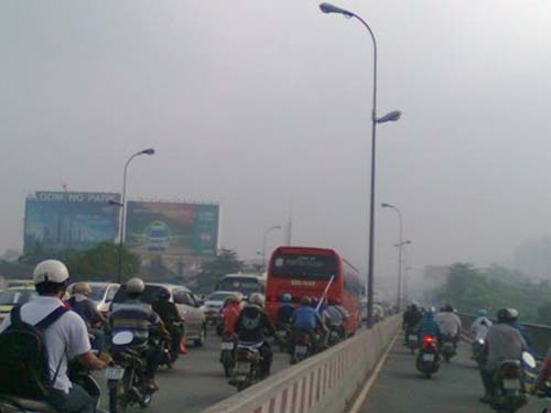
The south continued to be cold and full of fog
Due to the influence of increased cold air, the common temperature in the South decreased to about 17-19 degrees Celsius. The ability of the weather will continue to be chilly until Tet.
According to Mr. Dang Van Dung, Head of the Department of Hydro-meteorological Forecasting in the Southern region, due to the increase of cold air, the lowest temperature in the Southern region has decreased in recent days.

From now until Tet, there is still fog. Traffic participants must be careful, also
Farmers pay attention to prevent diseases for plants
Early today (January 18), the temperature in the East has increased a little, ranging from 19-21 degrees Celsius. From tomorrow, the temperature will continue to rise but not significantly (east about 19 -21o C, West region 20-22oC, Ho Chi Minh City is about 20.5-21.5oC and continues to increase. It is forecasted that from now until Lunar New Year, Southern will be affected by at least 3 waves of cold air .
Mr. Dung also said that the occurrence of fog in the early morning in the Southern provinces is also affected by cold air. ' The cold air from the Chinese mainland deflected to the east and then went north into the East Sea and continued to flood south of the South China Sea and affect the mainland of the Southern region. After passing through the sea, cold air is enhanced with a large amount of moisture which increases the humidity in the air. When affecting the land in the early morning when the temperature drops, the steam condenses and creates fog ', Dung explained.
Particularly in HCMC, this situation also alarms the environment of highly polluted air . Dust from traffic activities, factories, construction sites . rising, meeting a relatively low temperature, high humidity and calm weather, condensing into fog.
It is forecasted that in the second half of January 2011, fog will appear relatively much in the early morning. Therefore, traffic participants must be careful and prevent accidents due to limited visibility. As for farmers, attention should be paid to preventing rice blast.
Ho Chi Minh City protects high tide
According to the forecast of the Southern Meteorological and Hydrological Station, the water level of rivers and streams in Ho Chi Minh City is now increasing with the tide. The highest water level forecast at Phu An station (Saigon river) peaks in the early morning of 22-23 January with the highest water level of 1.48m (lower than the alarm level of 2 cm).
However, during high tide, it is also capable of being influenced by cold air. If there is a disadvantageous combination: the combination of high tide and strong Northeast monsoon, the peak tide level will be higher.
In 2009, the tidal peak in January was considered the highest in many years, reaching 1.54m above the alarm III.
In the face of the tide, the flood and storm control committee and the city search and rescue team warned localities to prevent and respond. Particularly important areas such as district 12 (An Phu Dong ward, Thanh Loc ward, Thanh Xuan ward); Thu Duc district (Hiep Binh Phuoc ward, Hiep Binh Chanh ward, Tam Phu ward, Linh Dong ward); Binh Thanh district (Ward 28); Go Vap district (Ward 15); Cu Chi district (Binh My commune, Trung An commune); Hoc Mon district (Nhi Binh commune).
- Cold air intensified, the North continued to be cold from March 1
- The North continued to drizzle, the South was warm
- Cold air moves quickly, many places have rain
- Cold air intensified, the North continued to be cold
- Cold air causes rain and cold in Central Central
- South America suffered the worst cold spell in the past decade
- Cold air intensifies down to the northern provinces
- The cold air affects the North, causing severe cold on February 8
- The north received cold air to strengthen and recur cold weather
- The North continued to be cold in a week
- Cold air continued to intensify to the North
- Cold air intensifies, the North is cold
 Is the magnetic North Pole shift dangerous to humanity?
 Washington legalizes the recycling of human bodies into fertilizer
 Lightning stone - the mysterious guest
 Stunned by the mysterious sunset, strange appearance