The space war of GPS satellites
While on the ground, you don't know that you can be tracked by countless orbiting devices, including a global positioning system - GPS.
The name GPS is the name of the navigation system designed and managed by the US. Opposite the GPS system is Russia's GLONASS, Europe's Galileo, and China Compass.
GPS navigation system can accurately determine the user's location when they use a GPS receiver.
To do this, the GPS receiver must lock the signal of at least 3 satellites to calculate the 2-way position (latitude and longitude) and to track the motion. If 4 or more satellites are locked in the receiver area, it is possible to calculate the 3-dimensional position (longitude, latitude and height).
Once you do this, you can also determine the movement speed, movement direction, travel distance, and more.
Although lately, navigation systems have been used in part for civilian purposes, they previously served only military purposes.
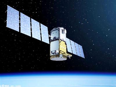
Galileo satellite
Therefore, as soon as Russia implemented the GLONASS system (in 1976), the US also urgently operated the GPS system (1978). Meanwhile, Japan also expressed concern when China announced it would put into use the Compass system (Chinese 'Beidu' - North Dau) with the aim of locating the whole of Asia in 2010.
Japan thinks that GLONASS will seriously affect the country's national security, and it is inevitable that in Asia there will be a race for global positioning.
In Europe and America, people are too aware of the rivalry between US GPS and Russian GLONASS. Both systems are intended to be originally designed for military use, primarily to guide ballistic missiles towards the target. Only later were they given a share to the civilian population, with the US in 1980, and to Russia in 2001.
The US GPS system is a network of 24 satellites (21 active satellites and 3 spare satellites) placed on orbit by the US Department of Defense 12 thousand miles from the ground.
GPS satellites fly at 7,000 miles per hour around the Earth twice a day in a very precise trajectory and signal information to Earth.
GPS can work in all weather conditions, everywhere on Earth and continuously 24 hours a day. The satellites are powered by solar energy, and there is also a backup battery to maintain the operation in areas without sunlight.
GPS has 5 control stations scattered on the ground, including 4 automatic control stations and a central control station.
In addition to this GPS system, the US also intends to set up a new foreign intelligence satellite system in orbit.
The system, called BASIC, consists of two satellites dedicated to intelligence work, specifically to spy on, monitor military operations of some countries, localize and detect suspected places. nuclear production facility.
BASIC can provide sharper and larger images than conventional satellites. BASIC photographed a continuous location on the ground, creating a continuous and up-to-date series of information while conventional satellites could only track one location on the ground twice a day.
As planned, this system will be deployed in 2010 with an estimated budget of 2-4 billion USD.
Meanwhile, Russia's GLONASS is a network of 24 satellites, of which 21 are responsible for signal transmission, and 3 are on orbit. GLONASS is 19,100 km from the ground and has quite high accuracy.
The ground-based receiver of this system can see at least 5 satellites at any time and anywhere (the higher the number of visible satellites, the greater the accuracy).
GLONASS also has 5 control stations like GPS, with 1 central station located in Moscow and 4 other stations located in Saint Petersburg, Ternopol, Eniseisk and Komsomolsk-na-Amure.
It is also important to know that both GPS and GLONASS are prioritized for military purposes. So even though they have a share of the civilian population, no system can guarantee continuity, sustainability and accuracy, especially in the case of military operations by the host countries. that system. Only the Galileo satellite system of Europe was originally designed for navigation and civilian purposes.
Galileo is currently being built by the EU and the European Space Agency (ESA) with an estimated budget of 3.4 billion euros to counterbalance GPS and GLONASS. However, the construction of this system has many obstacles mainly because the members have not reached agreement.
By the end of 2007, the transport minister of 27 European countries had reached an agreement on the construction of this system (expected to be operational by 2013).
Galileo consists of 30 satellites, with 2 control centers on the ground - one near Munich, Germany; and one located at Fucino, 130km from Rome, Italy to the East.
Meanwhile, China 's navigation system Compass consists of 35 satellites, including 5 geostationary satellites and 30 medium - range satellite satellites.
China hopes to cover the entire territory of this country and part of its neighbors this year before continuing to develop into a global positioning system. Japan is also developing its satellite system Quazi Zenith, with three satellites in e-orbit with extremes far from Japan and Asia.
- Learn more about space satellite systems
- Vietnam satellite will enter space in 2018
- The satellite crashed each other to threaten the universe
- Vietnamese satellites leave the space station tomorrow night
- FPT satellite is about to fly to space
- Vietnamese people write names on the universe
- Russia's killer satellite suddenly reactivated after 2 years
- Thousands of satellites on Earth orbit can crash into each other
- China will soon surpass Russia in the number of satellites operating in orbit
- France launched telecommunications satellites for India and Qatar
- Russian rocket launcher Soyuz carries 6 satellites
- Russia successfully launched 11 satellites from Vostochny space airport
 The most famous scientific failures in history
 Mysterious genius mechanic and the machine froze time
 The son carries the 'bad gene' of genius Albert Einstein
 Marie Curie and her family won 5 Nobel Prizes