'Transport planning' on the Galaxy strip
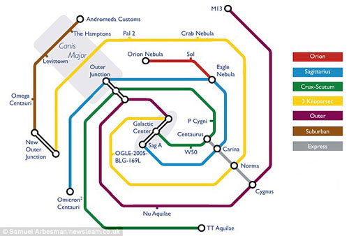
A Harvard University scientist has published the traffic map of the Galaxy series described based on the London subway map.
Harvard University scientist said: The purpose of this map is to make the distance between the planets in the Galaxy range become closer.
If you think that working cars spend a lot of our time every day, think about the work that astronauts will work on in the 'Galaxy Transportation Department' in the future.

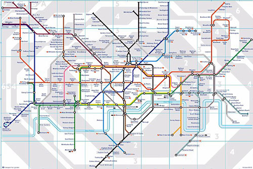
Subway map in London
Completely based on the subway map, a scientist has published a traffic map of the galaxy. This map shows the vast and complex relationship of our Milky Way series in a transport route.
But future passengers do not want to use the 'stops', places thousands of light-years apart in a galaxy traffic project like stops on a map.
Dr. Arbesman of Harvard University in Boston said: He tried to draw a map that was relatively accurate in his ability. This map is an attempt to get closer to the Galaxy band and make people think of the possibilities for long-term outer space.
The purpose of this map is to make an extremely complex concept like planets in the universe become closer to everyone. Each stop on the map is about a thousand light-years apart and each route corresponds to a branch of the Galaxy, and 'stop' is stars, nebulae, or other astronomical objects.

Dr. Arbesman's Galaxy Map is based on London's pipeline map.
Dr. Arbesman also said: Although this traffic map is still many shortcomings, but it has a certain value in simplifying the 'interstellar traffic congestion'.
The inspiration came in the form of a map to the doctor after he reread Carl Sagan's 'The contact' novel, which mentions a 'central station' of the universe. This idea led him to analyze, research the first metro map and pipeline map designed by Harry Beck in London.
Arbesman added: 'I hope this traffic map can help find the fastest of our current position and make the distance far closer'. At the same time he used the image of a Sol note to describe the distance from our position to the constellation of Heavenly Lang, and likened it to the way to the suburbs.
- What's special about our Milky Way?
- Private take the spacecraft to the international space station
- Discovered 'evil galaxy' transparent like illusion
- Discover the farthest galaxy ever
- Discover the most 'cramped' galaxy
- A brick in the galaxy
- Hubble discovered the galaxy with brilliant lenses
- The discovery of new super galaxies is 160,000 times brighter than the sun
- The most thrilling transportation in the world
- NASA wants to revive supersonic air transport
- The galaxy is 13.28 billion light-years from Earth
- Find the farthest galaxy
 Van Allen's belt and evidence that the Apollo 11 mission to the Moon was myth
 The levels of civilization in the universe (Kardashev scale)
 Today Mars, the sun and the Earth are aligned
 The Amazon owner announced a secret plan to build a space base for thousands of people