Cold air intensified, the North was cold
Early this morning (March 22), cold air affected some parts of the northern border provinces.
Due to the influence of cold air, Bac Bo has rain, showers and scattered thunderstorms. In the storm, there are whirlwinds and strong winds; wind diverted northeast in mainland level 3-4; Grade 5 coastal zone, level 6 jerk. Bac Bo Bay has strong Northeast winds at level 6-7, level 8-9.
The waters off the central coast of the North-east wind are strong at level 6, shock level 7-8. The North and the South China Sea (including the Paracel Islands) have strong northeast winds of level 7, sometimes level 8, level 9-10. Strong sea.
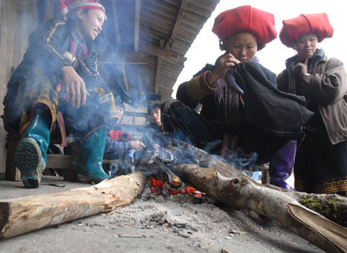
Illustration
The northern provinces are influenced by the cold air division from the north, compressing and pushing the low pressure grooves, which are about 24-26 degrees north latitude, gradually shifting to the south and gradually become cloudy, rainy and rainy. light fences are scattered and there are places with thunderstorms. Northeast wind at level 2 and level 3. Night and morning are cold. During the thunderstorm, people needing precautions to have whirlwinds and strong winds.
The central and southern central provinces affected by the Northeast wind zone are active gradually in the days of cold air intensification, cloudy sky, scattered rain and showers, with moderate and heavy rain. North wind to northwest, level 2, level 3. North sky is cold.
The Central Highlands and Southern provinces are located on the southern edge of the continental cold high pressure blade combined with the western edge of the subtropical high pressure blade, the clouds change, the evening has rain, scattered showers and where there are thunderstorms . East wind level 2 and level 3.
According to the Central Hydrometeorological Center, cloudy North West, rainy days, scattered showers and places where there are rain, there are some rain in the night. Gentle. The night was cold. During the thunderstorm, people needing precautions to have whirlwinds and strong winds. The lowest temperature is from 14-17 degrees Celsius, the highest temperature is from 24-27 degrees Celsius, and the northwestern region is 27-30 degrees Celsius.
The eastern part of the North is cloudy, rainy days, scattered showers and there are places where there are rain in the night. Northeast wind level 3-4, coastal zone level 5, shock level 6. Cold weather, mountainous areas where cold. During the thunderstorm, people needing precautions to have whirlwinds and strong winds. The lowest temperature is 14-17 degrees Celsius, the highest temperature is 20-23 degrees C.
Hanoi is cloudy, rainy days, light showers; Night rain some places. Northeast wind level 3-4. Cold weather. The lowest temperature is 14-17 degrees Celsius, the highest temperature is 20-23 degrees C.
The provinces of Thanh Hoa-Thua Thien Hue are cloudy with rain and moderate rainfall. North wind to northwest level 3-4, coastal zone level 5. North dark and cold night. The lowest temperature is from 15-18 degrees Celsius, the highest temperature is from 22-25 degrees Celsius, the south is 25-28 degrees Celsius.
Da Nang to Binh Thuan changes in clouds, there are showers in some places; Cloudy nights, rain, scattered showers and places with thunderstorms. Northeast wind level 3. The lowest temperature is 20-23 degrees C, the south is 24-26 degrees C, the highest temperature is 30-33 degrees C.
The Central Highlands changes, the sunny day, the evening has scattered showers and there are some places where there are thunderstorms and nights in some places. East wind to Northeast level 2-3. Lowest temperature from 19-22 degrees C, the highest temperature from 30-33 degrees C.
Southern clouds change, sunny day, evening and night showers and some places. Southeast wind to East level 2-3. Lowest temperature from 23-26 degrees C, the highest temperature from 32-35 degrees C.
- Cold air intensified, the North continued to be cold from March 1
- Cold air intensifies, the North welcomes from the night
- Adding cold air intensified, the North remained cold
- The North is cold, the mountain temperature is 3 degrees Celsius
- Strong cold air rushed back, the North decreased 5 degrees
- The north received cold air to strengthen and recur cold weather
- The North suffered two more waves of cold air
- Why is Hanoi and the Northern provinces coldest in the winter this year?
- Cold air intensified, the North continued to be cold
- Early in the week, cold air intensified in the North
- Cold air intensified to the North
- Cold air intensifies causing cold weather in the North
 Is the magnetic North Pole shift dangerous to humanity?
 Washington legalizes the recycling of human bodies into fertilizer
 Lightning stone - the mysterious guest
 Stunned by the mysterious sunset, strange appearance