Detecting and forecasting dangerous weather by radar
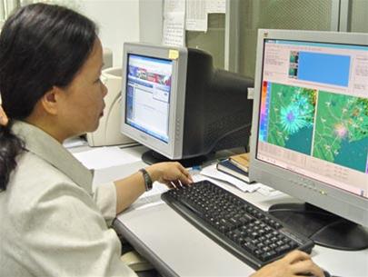
The Southern Regional Hydro-meteorological Station said that the agency has put into use the weather radar (photo), which is located in Nha Be (Ho Chi Minh City), with a long-range scanning area of about 480km. This radar system helps to detect, monitor and forecast dangerous weather phenomena such as storms, thunderstorms, cyclones, heavy rains . and even the phenomenon of heavy rain generating floods on the Dong Nai river system.
Mr. Nguyen Minh Giam, head of the hydro-meteorological forecasting department, the Southern Regional Meteorological Station, said that when the storm No. 9 (2006) entered the scanning area of the radar, the agency could follow the link. continuation of the storm through images and data collected from radar. Through data analysis of radar, professionals can forecast in a specific, clear . position, area of influence and trend of the storm continuously.
Analytical information from radar can be transferred continuously and directly to each locality potentially affected by dangerous weather phenomena.
(Photo: Quoc Thanh)
QUOC THANH
- Australia buys radar for weather research at sea
- Why is the weather forecast all day wrong?
- This type of radar is capable of detecting volcanic ash
- Honeywell unleashes new technology limiting risk to aircraft
- Close-up of the god of artisan Artisan
- Startled 'security' to control the weather, causing natural disasters in China?
- CliMate weather forecasting device
- New weather technologies help keep the aircraft safe during thunderstorms
- Radar is unique in the world of Russia
- Radar Detectors help detect suicide bombers
- Radar in the backpack
- Russian radar can detect metal balls from 2,000km
 Is the magnetic North Pole shift dangerous to humanity?
 Washington legalizes the recycling of human bodies into fertilizer
 Lightning stone - the mysterious guest
 Stunned by the mysterious sunset, strange appearance