Glaciers in the Himalayas are melting
The Himalayas, the roof of the world, home to seven of Asia's largest rivers, are now suffering from the effects of global warming like many other mountain ranges. To assess the melting of 33,000 km of glaciers in the Himalayas, scientists are now using a process that they have pioneered in the last few years.
Satellite images of the topography of the glacier surface taken at different times in several years have been adjusted and compared. Calculations show that 915 km2 of glaciers at the survey site are located in Spiti / Lahaul district in Himachal Pradesh city, India has been thinned with an average rate of 0.85 meters a year between 1994 and 2004. This technique is still in an experimental phase but it has been proven effective with the Alps (Alps) experiments and proved extremely effective to monitor all the Himalayan glaciers. However, the process to achieve a reliable estimate must overcome a type of error sources and approximation derives satellite-based observations.
Researchers began collecting data from satellites in two periods in 2000 and 2004. A digital terrain model was created for each data, a topographic description of an underlying ground reference point. numeric form and therefore it will be used in computerized computing. The terrain of the earliest studied area provided by NASA has investigated 80% of the earth's surface area in the collection of radar terrain data on the shuttle Endeavor (SRTM). February 2000. Then, in November 2004, two 2.5-meter photos of the same area were taken at two different angles taken specifically by the French Spot5 satellite within the framework of ISIS project (CNES).

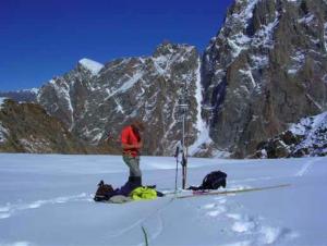
Using Differential Global Positioning System (DGPS) to mark the location of the pile to recognize the erosion of glaciers at the protruding ribbon of the Chhota Shigri glacier at an altitude of 4,400 meters (Photo: IRD / Yves Arnaud)
Comparing these two images helped build a terrain model called digital elevation model (DEM) based on stereoscopic photometry. The DEM model shows that NASA's radar data has underestimated the values of high altitudes and overestimated the values of smaller elevations. And Spot satellite created a margin of error plus and minus 25 meters in horizontal positioning images.
Moreover, because the governments of some Himalayan countries (India, Pakistan, and China) did not allow public access to detailed terrain maps or aerial photographs of the This border is sensitive so there is no reference to evaluate and correct the errors in satellite photometry.
Therefore, there is only a way to compare the topographic image of SRTM and SPOT5 by using fixed areas without glaciers around glaciers that researchers can adjust the deviation and place two tissues. This digital terrain pattern overlaps. These comparisons are the basis for a map of the variability of glaciers (synonymous with thickness) in altitude above sea level with a height difference of 100 meters over a period of time. from 2000 to 2004.
The comparative results show a clear contraction of the large ice species that have protruding strips of land at the lowest elevation (about 4000m) with thinning of about 8 to 10 below 4,400 meters . And at an altitude of 4,400 to 5,000 meters, the glaciers shrink from 4 to 7 meters and over 5,000 meters, shrinking 2 meters. The assessment of satellite images shows an average balance of 0.7 to 0.85 meters on a lake equivalent to an area of 915 km of 2 glaciers surveyed, total weight lost. is about 3.9 km 3 of the lake for 5 years.
To verify these results and approve this process, the results from satellite data were compared with the equilibrium masses of the 15 km 2 Chhota Shigri glacier determined by measurement. The site survey and topographic survey was carried out from 2002 to 2004 by the Great Ice Research Unit and its Indian partners. The equilibrium mass is determined by field topographical data and calculations from the data of the hygiene have coincided. In both calculation methods, the Chhota Shigri glacier seems to have lost about 1 meter of ice in a year.
These results completely coincide with the results of the global ice survey conducted in the period from 2001 to 2004. Therefore, this method is being expanded to apply to other areas in the range. Himalay aims to gather more information about the changes we have little known are happening in areas with glaciers in these regions that supply water to tens of millions of people.
The Kiet
- 2100: The Himalayas may lose 45% of the ice
- Himalayas glaciers have been flawed for the past 40 years
- The world's fastest melting glaciers through satellite images 30 years apart
- The Andes glaciers narrowed the record
- The existence of glaciers in the Himalayas
- When the glaciers in Iceland melt into small streams
- Antarctic glaciers are melting at a rapid rate
- The discovery of glaciers is melting under the layer of dust on the surface of Mars
- 20% of Canadian glaciers disappeared in this century
- Himalayan glaciers threaten millions of people
- Find the main culprit causing the glaciers to melt
- Glaciers in Asia are unusually bloated
 Is the magnetic North Pole shift dangerous to humanity?
 Washington legalizes the recycling of human bodies into fertilizer
 Lightning stone - the mysterious guest
 Stunned by the mysterious sunset, strange appearance