How does Google Maps work?
Google Maps has become an essential part of the internet in the past decade, but very few people know how it works. As for the rest, it is almost like a miracle.
For example, how can Google create such an accurate map for each region? How can it collect so much data? Who works to keep Google Maps maintained and updated? Add to that the questions about the real-time traffic conditions, temporary speed limits, and opening hours of nearby businesses?
In a way that these complex functions work so well, that's why so many of us depend on it for daily travel. So it's time you need to know how this tool works. The following article will uncover this miracle.
Why did Google launch Maps?
Google's mass mission is to 'organize information about the world and make it universally accessible and useful'. Many, but not all, of today's Google projects focus on this task, a task that depends on collecting, organizing and understanding millions of gigabytes of data.

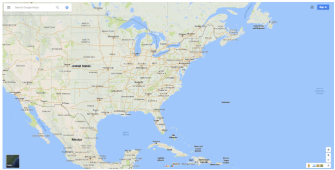
Google Maps collects a huge amount of offline information and then publishes them online.
But the information that Google is trying to organize is not only online. Many of them are offline. In a conversation with The Atlantic, Manik Gupta, Google Maps product manager, explains: 'As our lives improve, we are trying to bridge the gap between what we do. see in real life and [what we see online], and Maps really plays this role ".
At the most basic level, Google Maps collects a huge amount of offline information and then publishes them online. We are talking about things like highway networks, traffic signs, street names and business names. And in the future, Google Maps can do much more.
Collect data for Google Maps
When it comes to collecting data to help maintain and improve Google Maps, it seems never enough - and even more impressive when no information is older than 3 years. This is a really big project.
Map Partner
To help with this effort, Google collaborates with: 'the most comprehensive and accurate data sources' through the Base Map Partner Program . A large number of agencies submit detailed vector data to Google, some of which may include: US Forest Protection Department, US National Park Service, US Geological Survey, next to there are many other units.
These data are used to identify altered boundaries and rivers, display new roads and more, and this keeps the 'basic map' up to date as best as possible.
Street View
Google Street View is a never-ending journey. With an enormous amount of movement around the world, their goal is to repeat the movement of all the paths they find and take 360-degree photos wherever they go.

Google displays their Street View images on a basic map.
Based on the built-in GPS technology on those vehicles, Google displays their Street View images on a basic map.
Street View does more than just a panorama of stitched streets and locations. Using improved optical character recognition (OCR) technology, Google can 'read' things like road signs, traffic signs, and business names.
Readable OCR things will be processed and converted into navigational data that Google Maps can incorporate into its database. If the name of a road has been changed since the last time it was taken, a newer Street View photo will be detected. This is also (in part) the way Google builds a detailed database of huge local businesses.
The satellites
Another class of Google Maps and satellite view. This is a close collaboration with Google Earth, combining photos taken from high-resolution satellites together.
These images are cross-checked with other layers of data, such as Street View and Map Partners. This helps Maps collect geographic changes, new or remodeled buildings, etc.
Location services
There is not much information available about exactly how Google uses mobile location services to keep Maps up to date, but it clearly plays an important role.
Yes, if Google has access to the location data collected by your smartphone, you are part of Google's improved and expanded Maps system.

Maps may assume that there is a deviation, and will follow that to adjust the direction.
Your location data can be used for things like real-time traffic updates, estimating current traffic speeds, and determining deviations. If a route is often crowded but is now extremely deserted, Maps may assume that there is a deviation, and will follow it to adjust the direction.
Google also uses this data to estimate the hours that different industries are busy. It does this by tracking pedestrian traffic in separate buildings. It seems a bit scary, but it is another attempt to bring offline information online.
Google Maps users
Google Map Maker is another Google medium for implementing crowd data collection for Maps, and this is a program that has been available since 2008.
Works with many similarities with OpenStreetMap . Google Map Maker allows anyone to contribute their local insights to Google Maps. The good news is that most of this functionality has been integrated into Maps by itself, and Maps Maker will be closed this year when the conversion is complete.

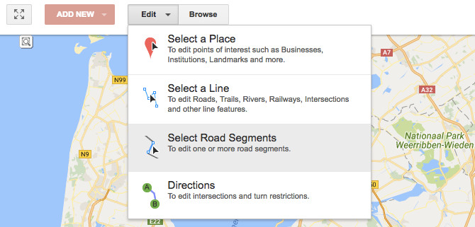
Users can edit Google maps with their own contributions.
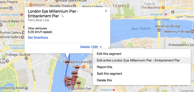
In short, users can edit Google maps with their own contributions. You can add and edit places, new roads and more. And if you think you can escape after deliberately sabotaging, think again: user edits can be reviewed by other users.
This means there is an enormous force of editors keeping Google Maps up to date 24/7. This is particularly useful for putting hard-to-reach places on the map and to gather insights that are otherwise out of reach or noticed by Google.
Local guidelines
Like the editorial force, Google also has millions of Local Guides. Local Guides is a feature that reminds Foursquare and is Google's effort to collect a more subjective data layer to put on its basic map layer.
When you are in Google Maps, go to My Contributions section and you can search for different locations in your area. By leaving a comment, answering a few questions, and posting a photo, you can contribute to this extra layer.
These local insights make Maps aware of things like a café, a hotel with a parking lot, or a vegetarian restaurant. In return for these contributions, users can receive rewards such as increased capacity of Google Drive.
Making data becomes meaningful
As you can see, the amount of data collected by Google is enormous and we have yet to touch other service combinations.
These data layers, when processed, are what will give us access to all the information found on Google Maps. But what will make all this data meaningful?
It is similar to the types of algorithms that have made Google the king today. These algorithms, seem extremely complex and classified, work to clean data, find contradictions, and combine them all together to make them more useful.

Google has teams around the world to keep everything up to date in the countries where it is.
For example, when Street View scans road signs and business names, algorithms can try to create road networks by translating road signs. At the same time, location data will be included to find the shortest route from A to B.
Although algorithms are always improving, they can only make it there, so all these data are also handled by many people. If there is something that Google's algorithms cannot find the meaning behind, a team member will review and resolve it.
Normally, junction logic is entered manually and new roads are brought to the right place by the people themselves. This is because sometimes the best way to understand what is seen on the road is to assign this task to a person.
No need to argue, this is a really big task. That's why Google has teams around the world to keep everything up to date in the countries where it is.
When there is a mistake on Google Maps
Every day, a large number of changes are applied to Google Maps. Some of these may be additions to new places and paths while other changes may cause errors.
Many of these errors are randomly corrected by community members: Edit location descriptions, add routes, and more. But above all, Google has a large-scale team of people working with thousands of reports submitted to Google every day.

Every day, a large number of changes are applied to Google Maps.
The good side of these reports is that it is reviewed and executed manually. This is done with Atlas , Google's own map editing program. New routes are hand-drawn, connected roads, new buildings are put on maps, etc.
This is a huge project that never ends. With thousands of new roads built every day and cities changing traffic laws when necessary, Google Maps will always be in a state of battle to keep everything accurate.
Google Maps: A great responsibility
While Google is often considered 'just another map' , we have looked down on its giant data layers. All of these things come together and create a service that many of us are becoming dependent on - a leading service, far removed from our competitors.
From moving millions of miles, using extremely complex algorithms, demanding huge human input, Google Maps is something admirable.

Google Maps has been planned to play an important role in its self-driving production.
Of course, Google hasn't stopped here yet. Google Maps has been planned to play an important role in its self-driving production. And the more subjective information, the images and videos are linked to Maps, this application can become a guide of the world, not just the current world map.
- How to see the Moon, Mars with Google Maps
- How to use Google Maps where there is no Internet
- Google Maps announces photos of
- Google Maps complements the Moon map and many other planets
- Google Maps detects 8 strange bases of aliens?
- Vietnamese users have been able to check traffic jam status on Google Maps
- Mysterious places on Google Maps
- Mysterious area for 8 years was forgotten by Google Maps
- Google helps you ... get married
- Google Earth takes a black circular object like a flying saucer
- Microsoft provides 3D online maps
- 'Ghost city'
 'Fine laughs' - Scary and painful torture in ancient times
 The sequence of numbers 142857 of the Egyptian pyramids is known as the strangest number in the world - Why?
 History of the iron
 What is alum?