Humans have grasped the wind map in their hands
The European Space Agency (ESA) has launched a satellite to orbit a global level of wind on the earth's surface.
With this information, we will get better weather forecasts and better predictions for global warming. This is part of the Copernicus project, a joint initiative of the European Union and ESA to monitor environmental damage and support disaster relief activities.
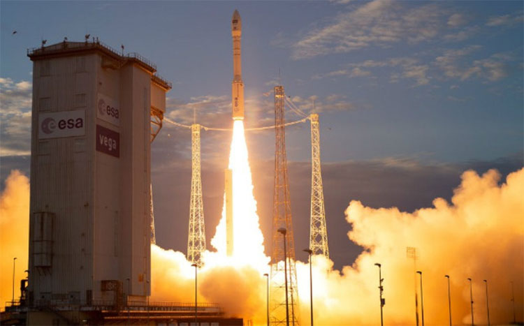
Released by Arianespace at 9:20 pm on August 22, 2018 from the Kourou space station in Guyana, France, after a day of delay due to weather, the satellite is named Aeolus , named after the wind god. Ancient Greek mythology, currently located in orbit 200 miles above the ground, or 320 km. On satellites carrying only one device called Aladin , is an advanced laser system designed to accurately measure global wind patterns from space.

Overview of the launch of Aeolus satellite.(Photo: ESA)
With the task of monitoring the atmosphere in a range of 0 - 30km, Aladin has the ability to transmit short and strong laser light pulses towards the earth in the ultraviolet spectrum. Molecules in the air: moisture, gas, dust, which will partially reflect the energy of light transmitted back to the transceiver, which is collected and recorded.
The delay between the transmitted pulse and the reflected signal will show the direction of the wind, the speed and the transmission distance and then the data from the orbit is downloaded to a ground station in Svalbard, Norway.
Aladin is capable of providing 100 sets of wind profiles per hour, including remote areas of the southern and ocean hemispheres, especially in the data blind spot of the tropics, where almost never before directly observed. This means a huge progress on knowledge about the wind, which so far is only informed by daily radio stations from certain weather stations.
The data provided by Aeolus will fill the important gap of Earth's atmosphere, the wind-generating agent. Because wind plays an important role in the exchange of heat and moisture between the earth's surface and the atmosphere, if there is enough data about the wind, it will improve the weather forecast, including the storms in temperate regions and weather in the southern hemisphere.
If the measured data is as accurate, the prediction will be more accurate. Not only that, these wind configurations will also help predict the situation of dust and other airborne concentrations, contaminate the lower atmosphere and pose a health hazard.
- The stamina of humans before wind is stronger than 700km / h
- Researchers create flexible robotic hands like human hands
- Experiments show that you are washing your hands extremely 'dirty'
- 10 things not everyone knows about the wind
- Hands freezing cold because of cold weather, what is the way to warm hands fast and safest?
- Fish species have 'hands'
- What happens if the wind stops blowing on Earth?
- Decoding evolution in human hands
- Human genome mystery
- Lam Dong develops wind power
- Motorcycles powered by wind power
- Learn about the wind and how to handle when being hit by the wind
 Van Allen's belt and evidence that the Apollo 11 mission to the Moon was myth
 The levels of civilization in the universe (Kardashev scale)
 Today Mars, the sun and the Earth are aligned
 The Amazon owner announced a secret plan to build a space base for thousands of people