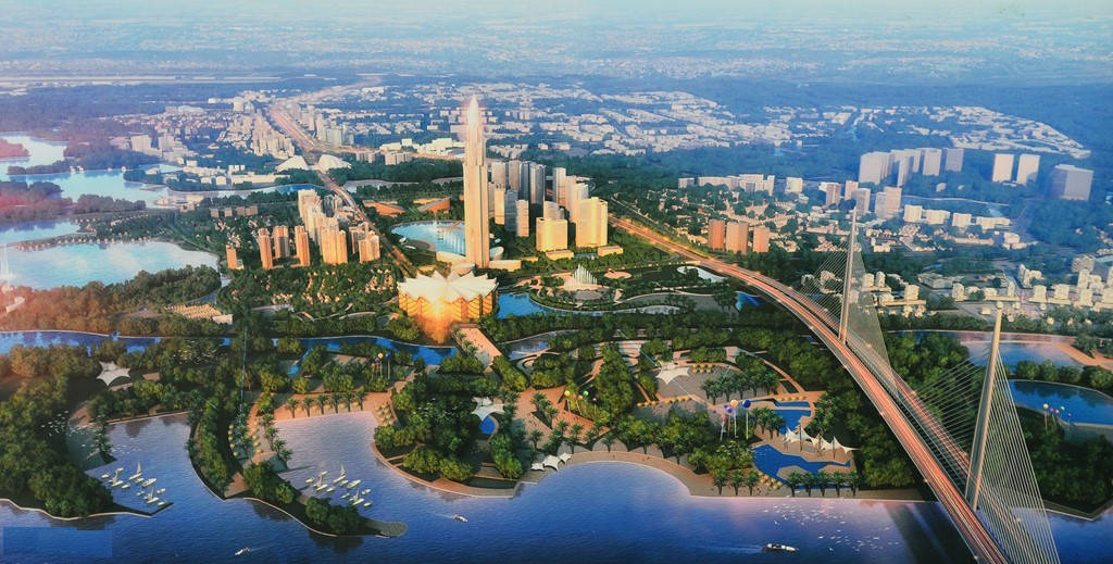
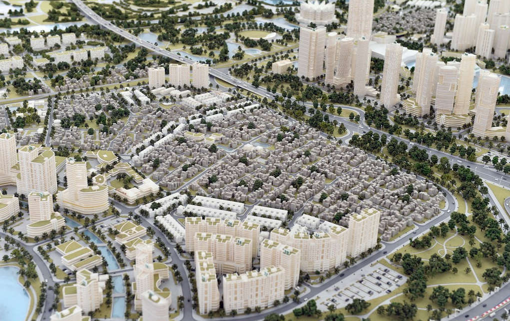
Modern image at Hanoi gateway in the future
The North Red River area will become an administrative center for international trade, trade, high-tech industry, modern urban development associated with preserving heritage values.
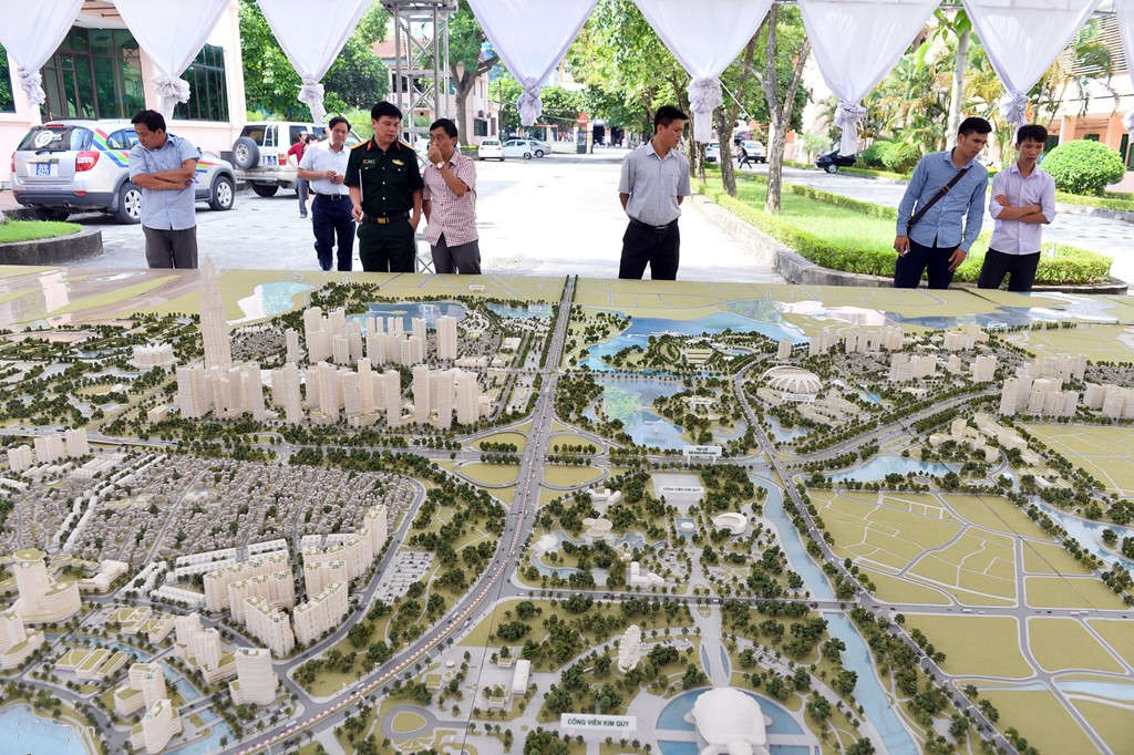
On the afternoon of June 23, Hanoi City People's Committee held a ceremony to announce the Project of detailed planning on both sides of Nhat Tan - Noi Bai road at the office of Dong Anh District People's Committee.This is an important step in concretizing the general plan approved by the Prime Minister, which is a premise for synchronous urban development in the Northern Red River area.
The event aimed at identifying projects, calling for investors to join, contributing to creating a new urban area in the North of the Red River, the image of the modern capital in the future.
In the general planning of construction of Hanoi Capital to 2030, vision of 2050, the Government has oriented the development of the Northern Red River area to become an international trade and administrative center for high-tech and high-tech industries. , modern urban development associated with preserving heritage values of Co Loa citadel and the value of natural landscapes of Van Tri lagoon - river Thiep.
Present at the ceremony, Chairman of Hanoi City People's Committee Nguyen Duc Chung said that the North of Red River and Dong Anh district had advantages in location, economic potential, and land resources.This will be the new, important and modern urban area of the capital.
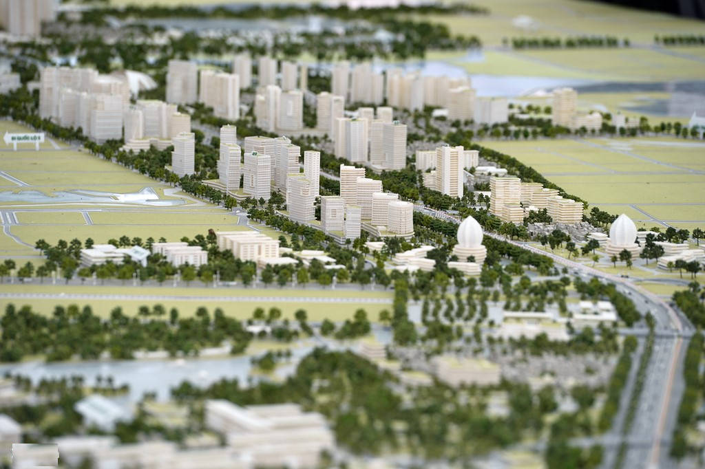
The total area of detailed planning is 2,080 ha including 4 main sections with a total length of about 11.7 km.
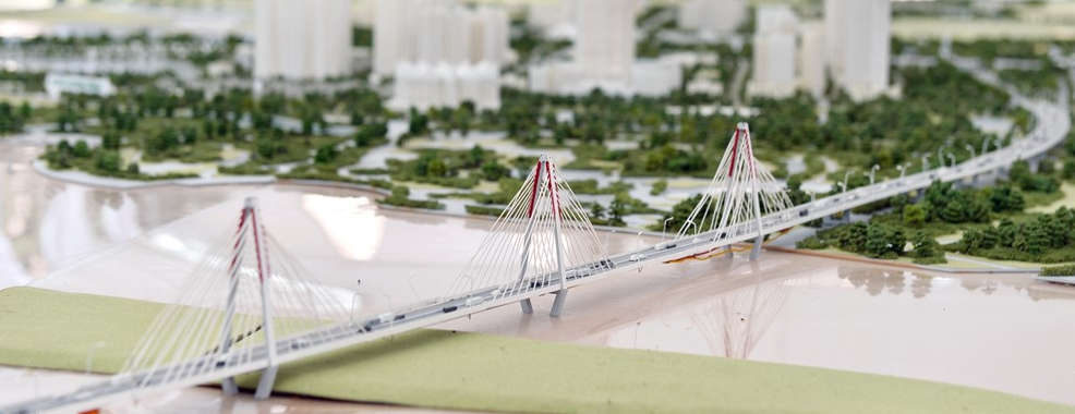
The conference announced the detailed planning of 3 sections dividing Nhat Tan - Noi Bai route into 3 stretches from Noi Bai airport to Hong left dike with Nhat Tan bridge, total length of 11.1 km.
Part of the administrative boundaries of nine communes and towns in Dong Anh district in this region include Vinh Ngoc, Tam Xa, Hai Boi, Xuan Canh, Van Noi, Tien Duong, Bac Hong, Nguyen Khe and Dong Anh town.
In addition, the project also takes 3 communes of Soc Son district including Phu Minh, Mai Dinh and Phu Lo.
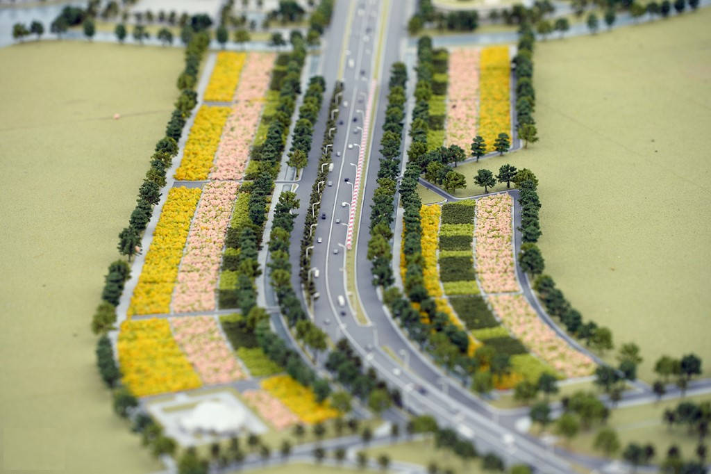
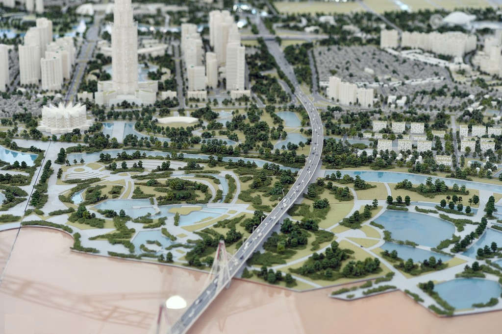
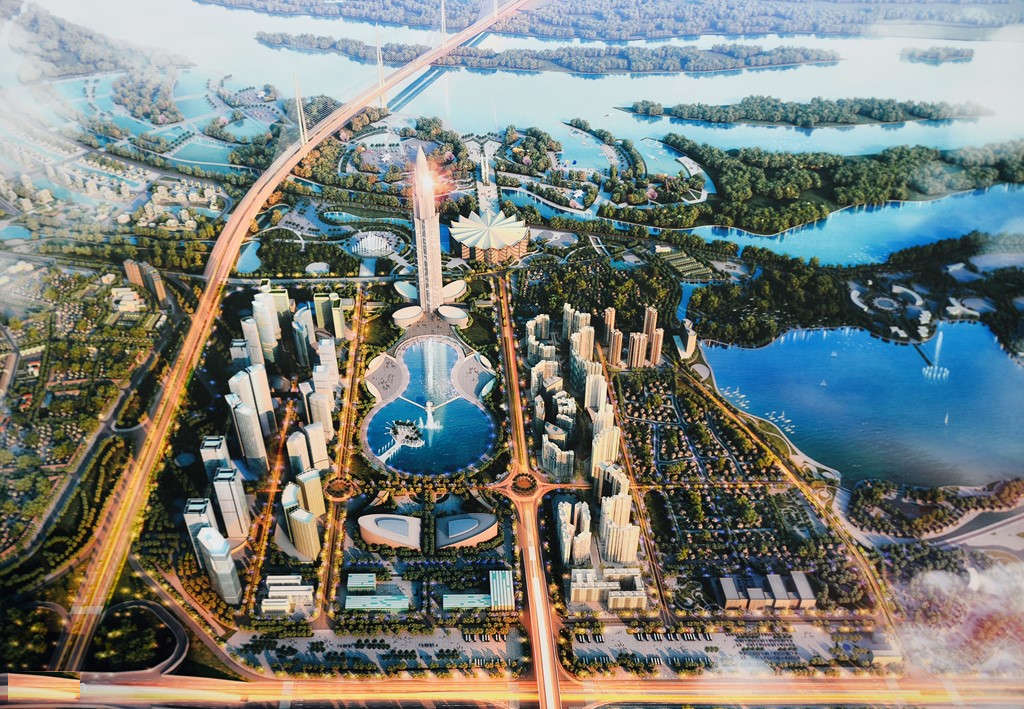
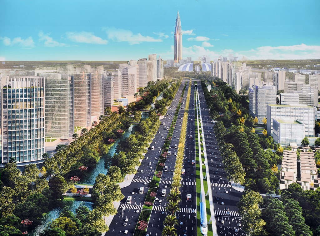
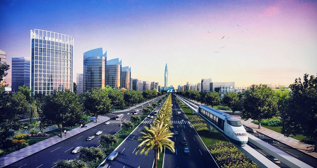
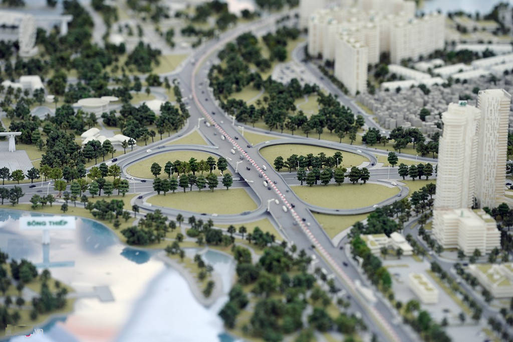
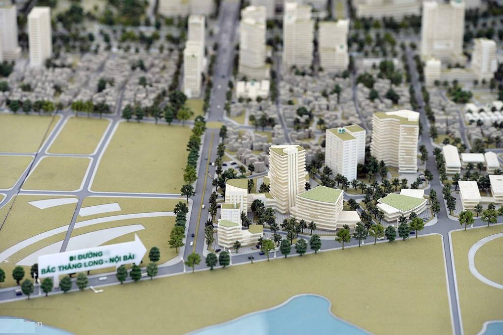
This is the gateway to Vietnam and the world, creating a picture of a road with a sustainable green environment with a dividing strip stretching on both sides and intermingling green space with natural water surface.
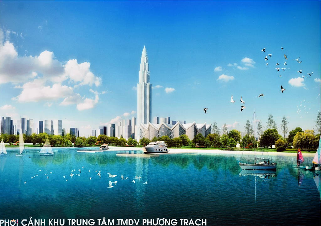
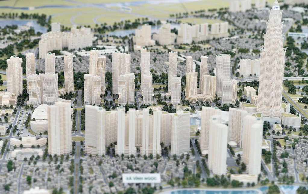
The focus of the area is the 108-storey Phuong Trach Trade Finance Tower.
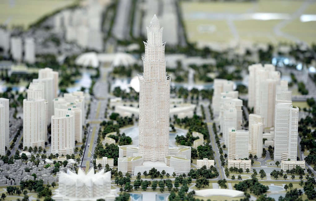
The tower is designed to simulate the lotus image, a typical Vietnamese culture.
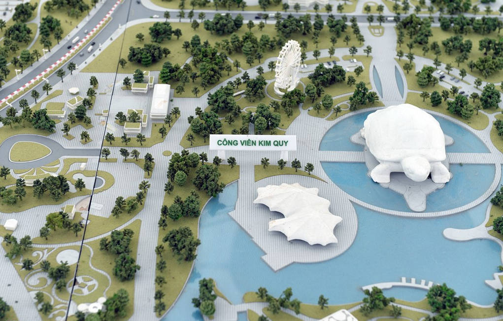
Along the route, there are many highlights of green landscape such as regulating lake park in Tien Duong commune, Hai Bo lake regulating park, Kim Quy park in Dam Van Tri area built to world standards. .
Public works, trade exhibition services combined with green space of Son Du lagoon .
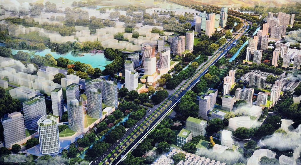
. complex area of high-rise buildings adjacent to the intersection between Nhat Tan - Noi Bai and National Highway 5 extends.
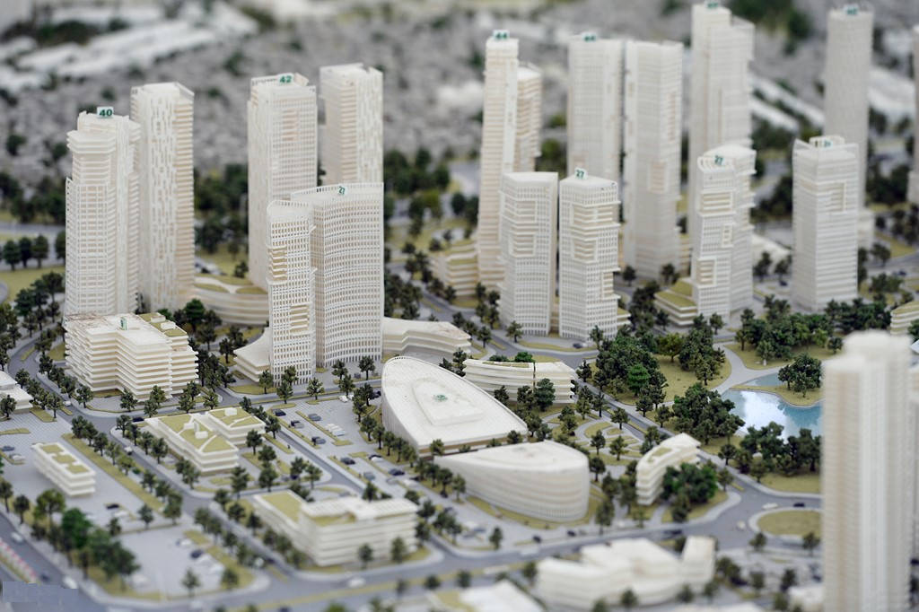
New and modern urban areas associated with financial, exhibition, cultural and commercial centers . with a synchronous infrastructure system attached to the axis;become a driving force for economic, social, cultural, cultural, commercial and tourist development . of the Northern Red River region.
At the same time, creating a gateway city connecting Hanoi and Vietnam to the world, with national identity, sustainability and a time of not only in architecture and planning but also in technology application towards class. and international integration.
One side of the North Thang Long - Noi Bai axis will be more crowded instead of the vast vast fields nowadays.
In the project, it is also determined that Nhat Tan - Noi Bai is the main driving force in the formation and development of the Northern Red River urban area, playing a role in connecting the traffic of the capital of the capital with the gateway to the city with the Port. Noi Bai international airline.
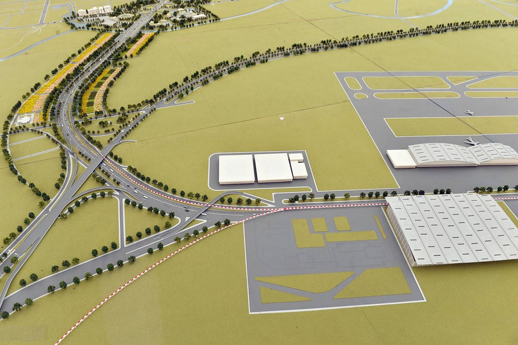
Images of Noi Bai airport expansion model, located in the plan on both sides of Nhat Tan - Noi Bai route.
- View the most modern highways in Vietnam before the opening day
- The shocking solution of the gateway to the 'negative realm'
- 'Battery recovery storm' touches Gateway
- Ancient streets of Hanoi in the 90s in pictures of Japanese Ambassador
- Beautiful photo set about 'Hanoi - The street vendors'
- 'Space hotel' will be operational by 2025
- Gateway recalled 14,000 batteries with a risk of fire
- Little-known photo series about Hanoi in 1950 (Part 1)
- Video: A rare film about Hanoi street 50 years ago
- Modern technology can be worn on the human body
- Scan shows how future brain sketches
- Hanoi started the modern software park
 The 11 most unique public toilets in the world
 Explore the ghost town in Namibia
 Rare historical moments are 'colored', giving us a clearer view of the past
 The world famous ghost ship