Preventing and fighting against Day river dike erosion
According to the forecasts of scientists, in about 20 years, Day river bank in Ninh Binh province will be eroded from 9.0 - 26.8m. So the riverbank will approach the dyke foot. This suggests that there should be solutions to actively prevent and control the Day river dike erosion.
Day River is a big tributary of the Red River, the length of the river is about 230km, flowing through the provinces of Ha Tay, Ha Nam, Nam Dinh and Ninh Binh and flowing into the East Sea at the mouth of Day.
Causes of erosion
On the section of the river passing dyke Huu Day, from Dac Bo to Xuan Dai, 35km long, the erosion ability has been happening in five key sections: Ke Doc Bo, Dau Dau, Ngoi Quyen, Do Muoi, Kim Dai and Xuan Dai.
The first cause , the river form in the confluence. The key point of Independence on Huu Day dyke is in Yen Khanh district, Ninh Binh province. This is the confluence of Dao and Day rivers.
In the flood season, the flow of Dao river is about 700-800 m3 / s, while the flow of Day river is only about 150-200 m3 / s. In the dry season, the flow of Dao river is about 200-300 m3 / s while the river discharge of Day river is only about 50-70 m3 / s. Thus, the flow of Dao river at the confluence is four times higher than the Day river.
The large difference in traffic leads to the dominant flow of the Dao River, which presses the flow of the two rivers at the confluence to the right bank. This is the main cause of river morphology causing erosion of the Day River right bank in Doc Bo area.
The second cause , the river is curved. The remaining four key sections are all located at the concave edge of the river in the mainstream of the river, which is close to the shore. At the results of hydrological survey, there is a key point of landslide on Day river, showing that at the time of tide withdrawal, the flow velocity at the basin is from 1.2 to 1.8 m. In particular, the flow close to the bottom has a horizontal direction to the shore causing erosion.
In order to overcome the erosion phenomenon of the Department of Flood and Storm Control in Ninh Binh province, it is necessary to provide bank protection against landslides at the above points. These embankments have been promoting the main effect, so the river does not open horizontally but causes deep erosion.
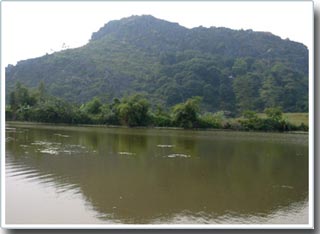
Day river section in Ha Nam province
(Photo: HaNam.gov.vn)
At the three-phase topographic survey results, the river bed was eroded further from 0.5 to 1.5 m after one year.
The third cause , the slope (m) of the river bank. Although the geology in the study area is classified as an average geology, the slope here is very steep. Many sections due to bank embankment, so that the river bed is deeply eroded, the slope of the river bank is very steep. If it does not create suitable roofs, river bank erosion will continue and threaten safety of the dyke. In the study area, the slope of the bank is too steep to cause erosion of river banks and river banks.
The fourth reason, due to the waves and waves. The study area is near the sea mouth, so the river bed is quite wide, when the tide is high, the width is 250-400m. Therefore, when meeting the combination of high tide, surges and storms, the influence of waves on the shore is very large.
The landslide was significant when the northeast monsoon and high tides, Day river was also a waterway route with many large boats traveling. Waves due to high speed trains encountered during high tide are also a cause of bank erosion.
The fifth cause , human activity on the riverbank and the exploitation on the river bed. Surveying in this area, we find that there are many brick kilns appearing on the riverbank, taking soil along the river bank to make bricks, on the river, sand-pumping activities take place every day.
Illegal encroachment and human activities on river banks and river beds have caused great changes to hydrological and hydraulic regime in the above-mentioned river section and Day river in general, especially in the season. flood when water overflows.
This change made the riverbed and riverbank change unconventionally and the situation was complicated. The forecast results show that after 20 years the river bank will be eroded from 9.0 to 26.8m and so the river bank will approach to the foot of the dyke. This will be a major danger if no shore protection measures are provided to protect dykes to ensure people's lives and production as well as the infrastructure of this region in particular and Ninh Binh province. in general.
Solutions to prevent and combat the erosion of Day river dike
First , propose a route to correct the river section. Because the monitoring data is still limited, the research history document of this river section is limited or unavailable. However, based on the current situation on this paragraph, with the actual research experience, we would like to introduce the corrective route at these points as follows: At the key year landslides are narrow river sections and widths. river banks to narrow dike feet with many sections without yards.
On the other hand, there have been stable embankments in the downstream area such as the embankment of Doc Bo, Dau Dau, Ngoi Quyen, Do Muoi, Kim Dai and Xuan Dai. All of these embankments have been working well. Therefore, it is not recommended to do any type of coastal construction which will affect the river morphology here.
The corrective route remains the same as the current riverbank, without causing river distortion to continue to occur. Extending the embankments along the river bank has been stabilized by existing embankments. At these erosion points, in order to ensure dyke safety, the construction measures need to be supplemented: strengthening existing embankments by releasing dragons to keep the embankment through the deep creek. Extending the embankments to the upstream and downstream of the specific landslide: elevating the dyke to avoid overflow to meet disadvantageous complexes of big floods meeting high tide and high winds. For Kim Dai and Xuan Dai embankments, special attention should be paid to the combination of tide surges and large waves causing overtopping.
Secondly , construction of shore protection works: Focus of Standalone. This is a key river section that needs protection. Due to the characteristics of this river section is the confluence of Day river with the river Dao flow of Dao river dominates the flow of Day river after the confluence goes close to the saved bank, so the riverbank here is narrow, the average river width is 250m , the river bank is only 5 - 20m away. The rate of landslide is not as strong as in some other places on the Red River system.
Through the assessment of the current situation and the study of the river section, it is most reasonable to use the revetment to protect the shore here.
On the other hand, the project connecting this river section in the downstream has also used revetment to protect the bank (revetment of Doc Bo). For the revetment of this section, it should be extended upstream, the embankment of Doc Bo has about 200m to protect the river section of Day River so that it will not be narrowed to form a coastal embankment, ensuring stability for the entire river. this.
Embankment of this section should use a foot protection dragon. The embankment body can use materials such as khan stone as the embankment section here. The advantage of this material is that it is cheap, adaptable to local subsidence, easy to repair when damaged.
The first part of the Buffalo, the concave section of the curved river section. At this section, the mainstream flow goes close to the shore, only about 15 to 30m from the edge of the coast. This section is quite deep in the deep creek of the riverbed elevation from 7 to 10m. This section has protection embankments that have been promoting the protection of the dyke, but because the funding is not satisfactory enough, the foot embankment has not reached the deep creek.
We recommend: Drop tangled stone to create a reasonable embankment. The stone dragon drop holds the foot over the deep creek. Toning the dike surface to 5.5m elevation. Extending the embankment to the downstream of the old embankment to keep the river bank 300m further. Foot embankment should be supplemented by bamboo dragon.
When using this method, it is possible to take advantage of local materials, materials heavy enough to resist the drift of the river, not sinking under sand, easily deforming, suitable for the new shape of River. The embankments of Ngoi Quyen, Do Muoi, Kim Dai and Xuan Dai have the same causes of landslide as Đâu Trâu, we propose a solution like the construction of Đầu Trâu in terms of the height of the top two parameters. , 0m.
Thirdly , construction methods: The illegal encroachment and operation of people on river banks and riverbeds every day, every hour causes riverbed fluctuations and impacts on river bank erosion.
In this river section, it is mainly the construction of brick kilns on the beach and the exploitation of river-bed sand. Therefore, in the river section, we propose the competent authorities to break down all brick kilns to return airy to the river bank, prohibit sand extraction and sand bottom exploitation.
The problem of river erosion is still very complicated and needs further attention and research. Regularly monitoring the happenings of erosion and landslides, filling up the base map of forecasted landslides. Since then, it is possible to actively control and offer appropriate solutions to protect the river bank and keep the dyke safe.
NGUYEN NGOC QUNHNH
Deputy Director of Ninh Binh Department of Science and Technology
- Self-insulating concrete for soft ground
- Why can eating cheese prevent tooth decay?
- Found the cause of the Amazon River instead of flow
- Water of Lam river is high, many houses are flooded
- Prevent erosion by self-inserting concrete mats
- Turn coconut shell into mesh against erosion
- Venice does not allow water to erase the floating dike system
- 70% of the Red River mouth area is in danger
- Confluent rivers are not suitable for color matching
- Italy: 4 people were killed in the flood in the town of Refrontolo
- Effective against saline water by manual methods
- See how the US 'patched' the highest dam in California
 Is the magnetic North Pole shift dangerous to humanity?
 Washington legalizes the recycling of human bodies into fertilizer
 Lightning stone - the mysterious guest
 Stunned by the mysterious sunset, strange appearance