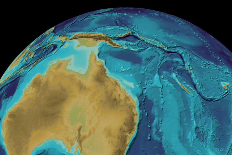
The continental Australia coordinates deviate by more than 1.5m from the 1994 figures
The Sydney reporter led the newly published study to show that the continent of Australia is moving, probably more than 1.5m from the previously published coordinates, and scientists at the Australian Institute of Geological Sciences will must recalculate the longitude and latitude of the country.
The current coordinates used, named Geocentric Datum of Australia , were last updated in 1994.
Because Australia lies on the fastest-moving continental plate in the world , the previously measured coordinates continue to change over time.

Large earthquakes often change the shape of a continental plate.
According to calculations by scientists, this continental array moves about 7cm north each year and may collide with the Pacific Plate, which is now moving about 11cm west each year.
The stress accumulation between these two continental plates when released may cause earthquakes.
The calculation of data must also rely on many other factors, such as large earthquakes that often change the shape of a continental array.
For example, an earthquake of 8.1 magnitude in the north of Australia's Macquarie Island on December 23, 2004 caused a distance of a few millimeters between Sydney and New South Wales, and Hobart, Tasmania state. .
Scientist Dan Jaksa of the Australian Institute of Geosciences is participating in the program of modernizing scientific data about Australia, saying that adjusting the data on coordinates is necessary because of the difference between the current position With the coordinates that the Global Satellite Positioning System (GPS) uses is growing.
Expected, new measurement data will be announced early next year.
- No GPS, no Google Map - how do astronauts locate in the universe?
- The Australian continent tilts, moving in seasons
- Discover the world's longest continental volcanic chain
- Discovered the underground continent of nearly 5 million km2 hidden under the Pacific Ocean
- Mysterious aboriginal figure in Australia
- APEC coordinates response to pandemic avian influenza
- Surprise with the true appearance of famous historical figures
- The watch was so accurate that it did not deviate from time for 40 million years
- The 10 most influential figures in the 20th century
- Fossil egg shells of ostriches confirm the theory of continental drift
- 25 weird images only in Australia you need to know if you want to go there
- Detecting the precious weapon of Qin Shihuang
 Is the magnetic North Pole shift dangerous to humanity?
 Washington legalizes the recycling of human bodies into fertilizer
 Lightning stone - the mysterious guest
 Stunned by the mysterious sunset, strange appearance
 The United States has just increased its area by 1 million square kilometers.
  Discover a small continent hidden under lava in the islands of Reunion and Mauritius