The northeast monsoon is about to overflow
The Central Center for Hydrometeorological Forecasting said that it is expected that by the end of September, another northeast monsoon wind will come and cause widespread rain.
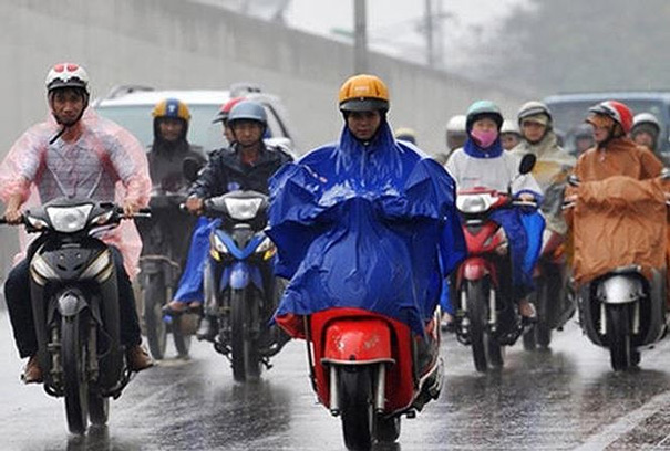
It is likely that northeast monsoon winds affect the North from September 27 and last until September 29. This cold air phase is not strong but it is likely to cause widespread rain for the Northern region. During the two days of 27 and 28, the rain was mainly in the North, after that, the cold air continued to be supplemented, so the rainy area expanded to the North Central provinces and a part of the Middle Central.
The cold air was added and flooded to the south, facilitating the dry weather in Hanoi and the North East region. The 1-2 day weather pattern at the end of September and early October in Hanoi capital will be cold at night with temperatures between 21-24 degrees Celsius and sunny and dry days with the highest temperature of about 29- 32 degrees C.
According to the National Center for Hydro-Meteorological Forecasting, in the early days of next week, the weather in the provinces from North Vietnam to Thua Thien Hue will not rain, the sun is interrupted with the highest temperature of about 31-34 degree C. The Central Highlands and the South will have a lot of rain in the afternoon and evening, the highest temperature in the day is about 32-33 degrees C. The capital of Hanoi in the first 3 days of the week is almost no rain, either. intermittent sunshine with the highest temperature of the day is about 32-34 degrees C.
According to the National Center for Hydrometeorological Forecasting, the Pacific Northwest region is currently experiencing a storm of Trami (the name of the storm proposed by Vietnam), this is the 24th storm in the Thai Binh Northwest region. Duong in 2018. In the next 3-5 days, Typhoon Trami moves mainly in the West but is unlikely to enter the South China Sea.
- Next week, the North received a cold spell
- Hanoi is about to catch the Northeast monsoon, the night and the early morning are cold
- The North continued to be cold in a week
- Why does our country have a humid tropical climate with monsoon?
- The northeast monsoon winds are strong across the stormy winds
- The first storm appeared in the South China Sea
- Cold air enhances rain in many areas of the country
- Monsoon climate
- Asian monsoon: the cause of dispersing pollutants
- Record flooding in Phu Quoc and Central Highlands due to the monsoon in Australia
- Aere storm is unpredictable, can cause heavy rain in the mainland
- The North received more intense cold waves
 Is the magnetic North Pole shift dangerous to humanity?
 Washington legalizes the recycling of human bodies into fertilizer
 Lightning stone - the mysterious guest
 Stunned by the mysterious sunset, strange appearance