Unusual weather now originates from the strange phenomenon in the North Pole
The Earth Pole is slowly approaching the cold winter, the night is slowly covering a large area, a 24-hour night. Normally, this cold night must cause the ice to spread out at a very fast speed.
But instead, the temperature is rising, and the sea ice is decreasing markedly. This should not be allowed to happen.

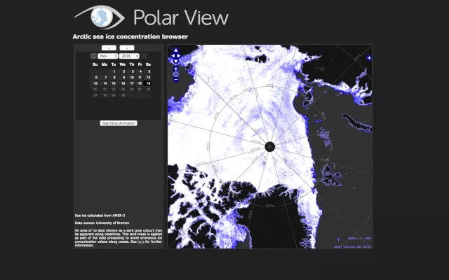
The North Pole in the middle, around the changes of the sea ice from November 12 until November 19 this year.The white area is the ice cover, the dark blue area is the area that reduces the coverage of the tape and the gray area is the area without ice.
In some places, the sea ice has signs of spreading but from November 16 last, the overall trend of the whole Arctic sea ice has shown a downward trend.
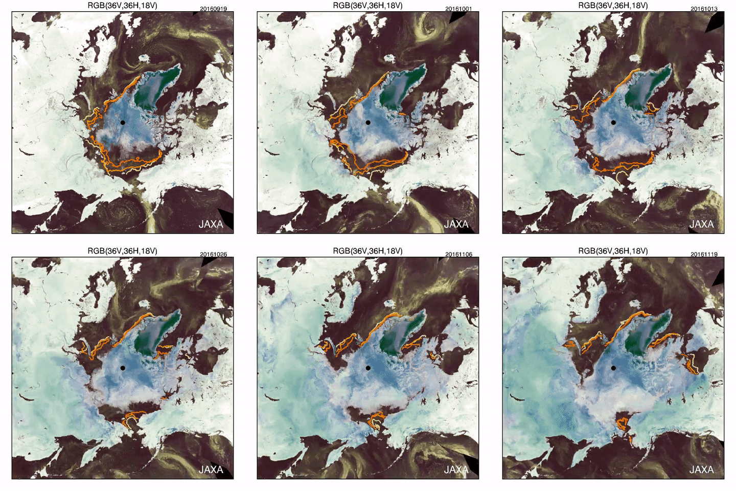
This happened because the sea ice had been withdrawn so much in the Arctic area that was close to the Svalbard and Franz Josef Islands. In both images you see, the withdrawal of the sea ice is clearly shown. These are also completely accurate information, because the data is taken from the AMSR2 measuring tool on the Japanese GCOM-W satellite.

The sea ice during the period from September 19 to November 19 this year.The outer ring represents the ice sea in 1980, 1990 and 2000.
People make the North Pole temperature warm up to twice the speed of any area in the world. Now, these extremely cold areas also have difficulty lowering the temperature to freezing.
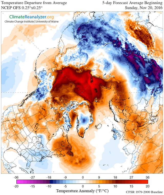
The current temperature in the North Pole is warmer than allowed.

In the chart above, the red zone is the place where the temperature is higher than the normal level of 1.6 degrees Celsius. The areas of the Barent Sea near the islands of Svalbard and Franz Josef have a higher temperature than the freezing in the waters. surface .
Arctic researcher with a long career, Ted Scambos said that last August, two big storms in the Arctic broke the ice sea, and besides they could also stir up warm water. from the deep sea floor, it caused the sea surface temperature to change and the sea ice was not as intact as before.
Broken sea ice means that the sea surface is exposed to sunlight longer than usual. Cold ice reflects solar energy very effectively, but the dark seawater absorbs very strong light. Therefore, warm sea water when mixed with water on the bottom layer is even warmer due to the sun's impact. Perhaps that is why the sea ice here is not the same as every year.

This year's spread of ice sea has reached a record low.
Currently, the amount of warm water that is bringing the energy they get from that sunlight into the atmosphere, could also be the reason why we are going through a rather unusual temperature in winter. this year.
At the same time, the circulation of atmospheric temperature is also pumping more into the Arctic region with warm winds of the South, which also makes the sea's freezing speed slower.
That's because strange weather events have created a strange situation in this Arctic.
People still have errors in this with the effects of global warming caused by emissions . But this time, we can also blame nature for the unusual weather that we are currently passing.
- Unusual weather phenomena in the world
- Why is Hanoi and North and Central hot and hot?
- The pole from the North of the Earth is ... shifting
- The north pole from the Earth is moving
- The pole from the North is moving to Russia
- How does the compass tell us where the North pole is at the South Pole?
- Strange things in the sun did not set for 2 months
- The culprit caused an unusually hot and cold weather phenomenon
- Video: Earth has 3 north poles
- The winter is prolonged due to the North Pole spiral moving
- Unusual weather phenomenon: Snowfall in mid-summer in New Zealand
- Australia applies a hot early warning system
 Is the magnetic North Pole shift dangerous to humanity?
 Washington legalizes the recycling of human bodies into fertilizer
 Lightning stone - the mysterious guest
 Stunned by the mysterious sunset, strange appearance