The territory of Vietnam through each period is the transformation of the living space of Vietnamese people, expressed by recognized orthodox dynasties. It is complex, losing territory to other states, conquering and conquering new territory. The collection of Vietnamese map images from the 10th century to the 19th century below hopes to help you understand more about the development history of our country.

Vietnam map through historical periods from 1653 - 1853

45 Vietnamese maps from the 10th century period (part 3) images 1
In 1653

45 Vietnamese maps from the 10th century period (part 3) images 2
In 1658

45 Vietnamese maps from the 10th century period (part 3) images 3
In 1679

45 Vietnamese maps from the 10th century period (part 3) images 4
In 1693

45 Vietnamese maps from the 10th century period (part 3) images 5
In 1708

45 Vietnamese maps from the 10th century period (part 3) images 6
In 1732

45 Vietnamese maps from the 10th century period (part 3) images 7
1739

45 Vietnamese maps from the 10th century period (part 3) images 8
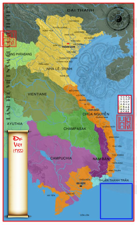
1755

45 Vietnamese maps from the 10th century period (part 3) images 9
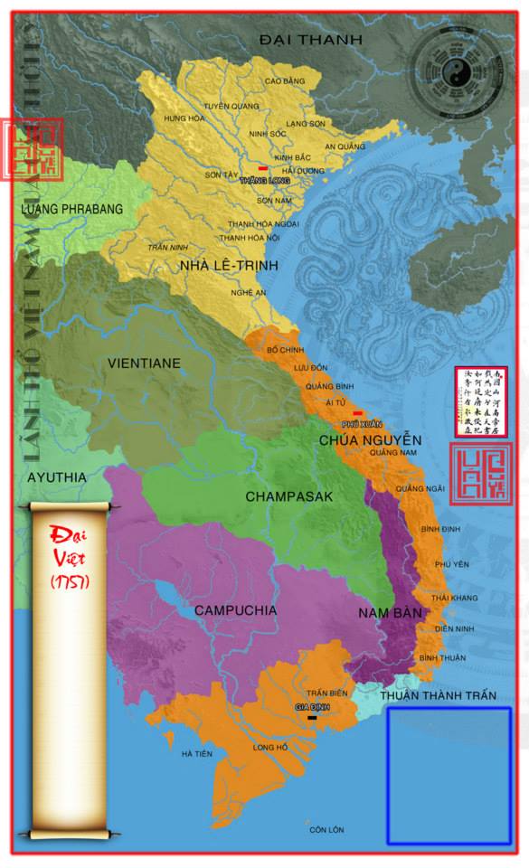
In 1757

45 Vietnamese maps from the 10th century period (part 3) images 10
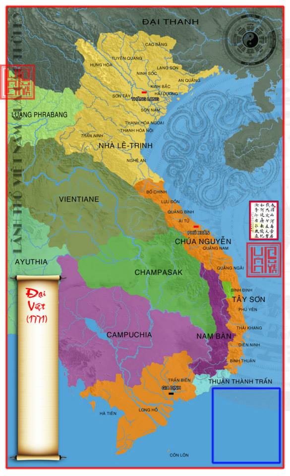
In 1771

45 Vietnamese maps from the 10th century period (part 3) images 11
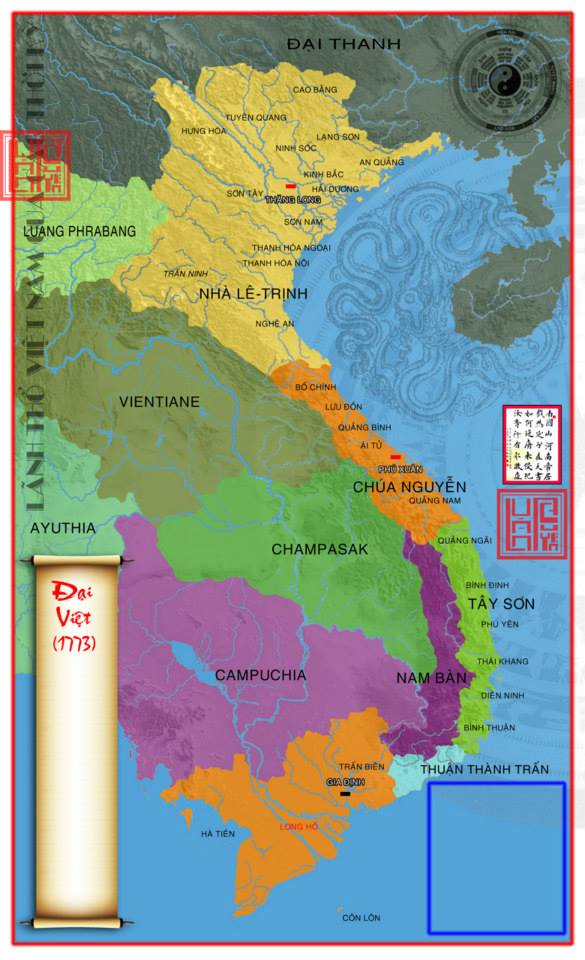
1773

45 Vietnamese maps from the 10th century period (part 3) images 12
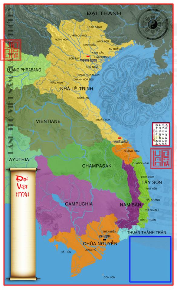
In 1774

45 Vietnamese maps from the 10th century period (part 3) images 13

In 1788

45 Vietnamese maps from the 10th century period (part 3) images 14
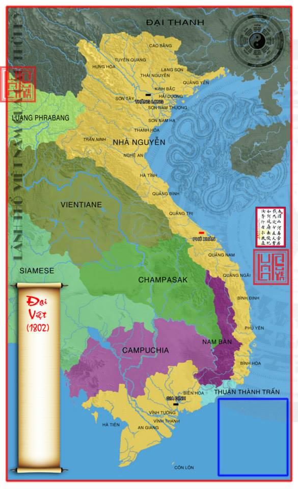
In 1802

45 Vietnamese maps from the 10th century period (part 3) images 15
In 1832

45 Vietnamese maps from the 10th century period (part 3) images 16
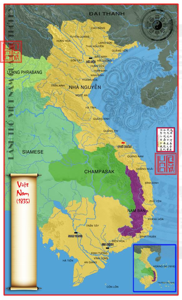
1835