Close up of 'shocking' storms
Mike Hollingshead, a "hunter" storm has turned his hobby into a career when he regularly drives tens of thousands of kilometers every year to capture the 'fierce' moments of the weather. storms, tornadoes with the road are up to more than 32,000 km.
Mike began "hunting" the storm in 1999. He quit his job at a grain mill in 2004 and devoted his time to a new job.
Currently, Mike makes a living by selling photos and videos of storms. Mike lives in Blair, near Omaha, in the eastern state of Nebraska, USA, where he describes it as a "path of tornadoes".
Below is a bunch of impressive Mike "storm hunting" photos:

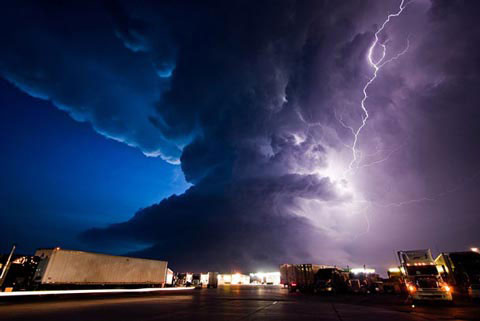
The photo was taken at the end of June 17, 2009 when Mike observed three tornadoes created from the 'mother storm'. The storm is moving toward York County's truck park, Nebraska, USA.

On May 10, 2005, Mike followed the storm in Grand Island, County Hall, Nebraska. Mike said: 'I observed that the storm moved slowly to the east and captured this scene after sunset. It was quite dark at the time, the long exposure helped the image look brighter. '

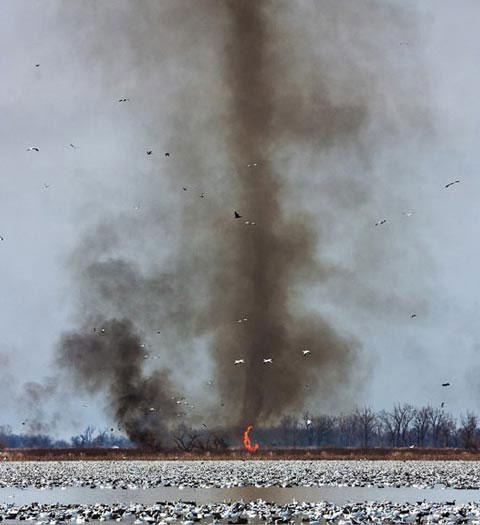
The photo above was taken in February 2009, in the Wild River Squaw Zoo, northwestern Missouri.'This is one of the most' crazy 'storms I have seen. It was about 304 meters tall with a large tornado, creating fire below and throwing fragments everywhere ", Mike recalls.

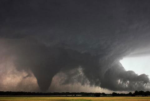
On June 9, 2005 from Hill City to Stockton Kansas, Mike said: 'This is one of my favorite storms. The cloudy part on the right is the cloudy form, it marks the area between cold air, rain and hot, humid air in front of the storm. As my father said, these clouds form the shape of a crocodile's head. '

On August 17, 2005, the sun appeared just under a small intensity storm in southwestern Nebraska state.

On July 13, 2005, Mike said: 'This is one of the top storms I pursue. I followed it for a long time, starting near Rapid City, South Dakota at 16:00 until peaking at 22:00 the following day. '

June 18, 2008, at Badlands, South Dakota at 4:00. Mike said: 'A combination of weak storms runs southeast, there is another weak storm coming from the North. They seem to have collided. I couldn't believe my eyes when I saw the whole mass of storms moving towards me. '

On May 28, 2004, on Highway 12, Nebraska State.'This is a surprising storm, I have been chasing it since it first formed and took this picture right after that. The cyclone core is shaped like a donut with tails trailing behind, ' Mike said.

June 10, 2006: "This 'hunt' is not a big storm, just a strong combination with high winds," Mike commented.

June 7, 2005: 'This is a spacecraft-like storm, taking place in South Dakota,' Mike said.
Source: Telegraph
- Typhoon Nari approached the waters of the central provinces
- Storm Nari threatened, many Central people evacuated
- The most dangerous storms in Vietnam
- Co To Island and Bach Long Vi Island are affected by the storm No. 3
- The anger of Earth's mother
- What is a storm? How storms form and why do storms occur?
- The US government is close to revealing secrets about aliens
- Typhoon attacks on Southeast Asia are getting stronger
- Shipwrecks reveal information about historic storms
- This afternoon storms into the waters of Binh Dinh - Phu Yen provinces
- How was the storm in the East Sea formed?
- Tropical storms are moving slowly and that is bad news for all of us
 The 11 most unique public toilets in the world
 Explore the ghost town in Namibia
 Rare historical moments are 'colored', giving us a clearer view of the past
 The world famous ghost ship