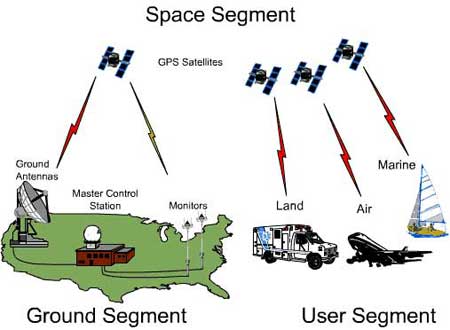
Get to know tsunami by GPS system
Until now, people still rely on classic seismic devices to identify when tsunami (tsunami) is about to happen. During a conference in San Francisco, Jeff Freymueller scientist at the University of Alaska and just presented a method that can identify tsunamis faster and more accurately thanks to the global positioning system GPS ( Global Positioning System ).
There has been a disadvantage so far that seismic machines can only redraw the earthquake. In order to know the intensity of these tremors, it usually takes a relatively long time. Meanwhile, from Freymueller's point of view, with the GPS system, one can identify very quickly and quite accurately the distance between moving layers.

The important factor to identify tsunamis is faster and more accurate thanks to the global positioning system GPS ( Global Positioning System ).
If many GPS systems are set up in an earthquake-prone area, people can immediately identify them within a few minutes at the warning center, if offshore seismic events occur.
Freymueller said that it has invented a machine capable of combining the functions of the GPS system with the classic seismic recorders. These machines can be set up several hundred miles apart, offshore and each machine costs less than $ 10,000.
According to Freymueller, the victims of the tsunami in late 2004 should not have been so much if they had two hours to evacuate.
But the analysis to identify the intensity of offshore seismic activity lasted for several hours, and the terrible tsunami came too suddenly to keep up.
- Japanese tsunami system focused on evacuating people
- Japan's new
- India installed a tsunami warning system in the South China Sea
- China developed a new tsunami warning system
- Indonesia has a new tsunami warning system
- Extend the tsunami warning system function
- Japan: put into use the new tsunami warning system
- GPS can alert tsunamis faster than today
- Develop tsunami warning method by GPS
- NASA developed a new tsunami forecast system
- Installation of the first tsunami warning system in the Indian Ocean
- 'Thousands of people' tsunami hit Europe anytime
 'Barefoot engineer' invents a pipeless pump
 Process of handling dead pigs due to disease
 Radiometer
 Warp Engine: Technology brings us closer to the speed of light