Installation of the first tsunami warning system in the Indian Ocean
In an effort to prevent tsunami damage, on December 1, Thailand began deploying the first high-tech tsunami detection and warning system in the Indian Ocean.
A Thai ship equipped with tsunami detection and warning devices originated from Phuket Island on December 1 to reach the location near Nicobar Island, about 1,100 km from Thailand's west coast.

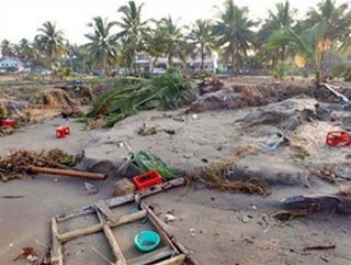
A beach in Pandangaran was destroyed in the tsunami July 17, 2006 (Photo: TTO)
The system, known as the Deep Sea Tsunami Assessment and Assessment System (DART), is a US-built measurement and communication system.
This is a key part of the plan to implement an early warning system to help coastal residents receive warnings at least an hour before the tsunami. After completing the installation (expected on December 3), this will be the first system of this type to be installed in the Indian Ocean.
The DART station, which is located at a critical location along the fault line of the continent on the seabed and connected to a 4,500 m deep pressure gauge at the bottom of the sea, will record all fluctuations in the pressure of Ocean waves immediately after an earthquake, then will transmit information via satellite to observation stations in more than 20 Indian Ocean countries within 5 to 7 minutes.
According to Curt Barrett, director of the International Tsunami Project Group of the US National and Atmospheric Administration, authorities can determine which quakes are possible immediately. The ability to cause tsunamis as well as its impact level. In the short term, the temporary Indian Ocean tsunami warning system will be run by the Pacific Tsunami Warning Center in Hawaii (USA) and the Japan Weather Center.
The DART system began to be deployed in the Pacific from the mid-1990s. Currently there are 20 stations in the area and it proved effective in the 8.1 magnitude earthquake on the island of Curin, in the north. Pacific, November 15.
The massive 9.3-magnitude earthquake on Indonesia's Sumatra island on December 26, 2004 caused a tsunami that killed nearly 300,000 in 12 countries in the Indian Ocean region. Within 10 minutes of the earthquake, the Hawaiian scientists knew the magnitude and location of the earthquake, but could not effectively announce it due to the lack of a warning network.
Facing this situation, the United Nations Multinational Oceanographic Commission has developed a plan to deploy an early warning system in the Indian Ocean. The US pledged to contribute US $ 16.6 million in cash and two years of professional support for this System.
- Test of Indian Ocean tsunami warning
- Extend the tsunami warning system function
- Constructing tsunami warning system
- Indonesia built a tsunami warning system
- India installed a tsunami warning system in the South China Sea
- Develop tsunami warning method by GPS
- Japan's new
- Da Nang tried to warn the tsunami
- Indonesia has a new tsunami warning system
- Why is the Indonesian tsunami warning not activated?
- Earthquake and tsunami warning on the Indian Ocean
- China developed a new tsunami warning system
 Is the magnetic North Pole shift dangerous to humanity?
 Washington legalizes the recycling of human bodies into fertilizer
 Lightning stone - the mysterious guest
 Stunned by the mysterious sunset, strange appearance