Scary phenomena can occur in super typhoons
Tsunamis, tornadoes, dragon taps, cumulonimbus . are terrifying weather patterns that can appear before and during super typhoons.
Haiyan super typhoon is receiving great attention from the world public opinion. After devastating the Philippines, the most terrible class 17 super typhoon in history is heading towards Vietnam.
What many people worry about is not only that the storm will bring heavy rain, strong winds cause great damage to people and people, but also the bad weather patterns that can occur in super storms, creating a difficult disaster. unforeseen…
Find out some fearsome weather patterns that may appear before and during super typhoons.
1. Fire hose
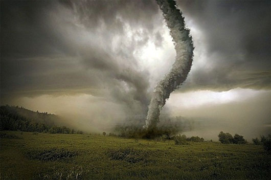
At 11 am on November 9, due to the effects of super typhoon Haiyan, a water cannon formed on the coast of Phu Hai and Thua Thien Hue communes before the storm hit Central Vietnam.

For those who do not know, water cannon is one of the most rare weather patterns. It usually grows from a very strong thunderstorm, when cold air moves from the top down and presses on the hot air from the bottom up through the impact of the side winds. The result is cyclone formation with circular airflows with a diameter of 50m and the strongest wind speed can reach 333 - 420km / h.
Dragon hoses have a tremendous power, can fly everything on its way: from houses, vehicles to people and animals . In the world, America is a country with many taps. most dragons, averaging about 800 appearances per year.

Reversing the past, on March 18, 1925, at the same time, 7 spacecraft appeared in the states of Illinois, Missouri and Indiana (USA), killing 740, destroying many major infrastructure. Nearly 50 years later, in April 1974, a 148-member small group of taps killed 315 people from Northern Alabama to Ohio, causing tremendous damage to the country.
2. The cumulonimbus cloud
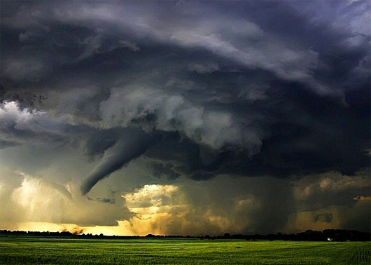
The cumulonimbus cloud is also called by the folk with the name of thunder cloud, which is a form of weather often appearing before storms in general and super typhoon in particular. The scientific name of this type of cloud is the Cumulonimbus cloud.

The cumulonimbus clouds are usually black, dense, develop vertically, take the form of a mountain or anvil of a blacksmith. This type of cloud can be as high as 10km depending on the season and latitude.
The strength and weakness as well as the size of the cloud depend on the elements that make up it - the lower part is the water particles evaporating from the ground, the upper part is the available ice crystals. In the right conditions, a cloud of cumulonimbus can grow, become a storm, even a super typhoon.

However, in fact, compared to the destructive power of super typhoon, cumulonimbus clouds do not cause too many terrible consequences. Normally, this cloud carries thunder, high winds and especially hail.
Typically, at the end of March 2013, in Lang Son province, the hail caused by cumulonimbus clouds destroyed thousands of rooftops of local people. Many people who suffer from hail falling into their heads have suffered serious accidents and injuries.
3. Tsunami
According to the information in USA Today, American meteorologists speculate that super typhoon Haiyan can cause tsunamis as high as 5m in some coastal areas. If this becomes a reality, coastal residents will suffer terrible consequences due to the weather pattern associated with this storm.

Tsunami (tsunami) formed when there is a large geological shift above or below the water surface: such as landslides, earthquakes, volcanic eruptions . They appear deep in the sea, very difficult to recognize offshore because low height, only when coming close to the shore began to erect tens of meters high and contain destructive power.
World history once recorded the devastating disasters caused by tsunamis. Nine years ago, the Indian Ocean tsunami, originating from the Sumatra-Andaman seismic, claimed the lives of 225,000 people in 11 countries with waves as high as 30 meters. This became one of the most devastating tsunamis in human history.

For skilled and knowledgeable fishermen, tsunamis can be identified through some of the following signs: a bubble of bubbles floating on the water makes us feel like the water is boiling, the water smells of rotten eggs (H 2 S), sea water makes the skin itchy, seeing red light trail on the horizon .
Also, in case of tsunami detection, if you want to safely survive the super typhoon with tsunami, take the boat to the deep water areas above 150m or find shelter on land at least 500m from the coast. .
- The idea of beating super typhoons with US nuclear bombs
- The trio of super typhoons are raging on the Atlantic
- Scary but beautiful natural phenomena
- Volcanoes that stop massive earthquakes occur in Japan
- 5 strange phenomena happen while sleeping makes many people panic
- Discover unique natural phenomena
- Strange natural phenomena only occur when it is cold
- Furniture that flies and ignites itself for no reason in a scary home in Chile
- The most intense super typhoons in the history of the Atlantic
- The worst natural disaster is still ahead
- Plankton contribute to super typhoons
- Hanoi plans to respond to super typhoon Mangkhut
 Is the magnetic North Pole shift dangerous to humanity?
 Washington legalizes the recycling of human bodies into fertilizer
 Lightning stone - the mysterious guest
 Stunned by the mysterious sunset, strange appearance