Spot the enchanting Earth from space satellites
The images recorded by Envisat satellite give us a new perspective on this planet.
>> The first color photo of the earth
>> Beaming images of Earth shimmering and fanciful
>> Beautiful images of the earth over four decades
Amazing images of Earth
The European Space Agency has recently released captivating images of Earth recorded by the world's largest shuttle or satellite observer Envisat.
Since 2002, Envisat has made its mission to circumnavigate the Earth, collecting invaluable information about the environment as well as the ongoing climate change in the world. However, the satellite Envisat suddenly disappeared in April 2012. In 10 years of operation, satellites have turned 50,000 around Earth's orbit and sent more than 2,000 photos.
The pictures sent by the satellite to the center have given researchers incredible images on Earth, from the Sahara to the volcano in the Congo . from a perspective that we have never been. see before.

The image of the cloud sweeping the North Sea is recorded by Envisat satellite.The country of Denmark is seized in the lower right corner and the country of Norway is located at the center of the picture.

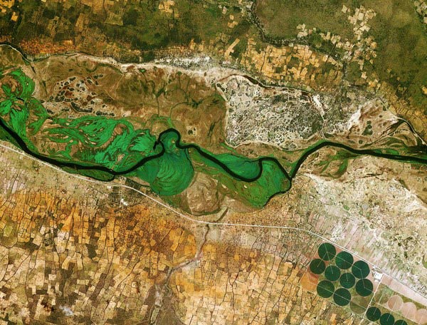
The image of the Amazon River (blue) is located in the center of Brazil's northern rainforest.The pink part in the main picture is vegetation, the darker the pink shows the density of the vegetation.

Envisat has sent a picture of the Yellow River flowing into the Yellow Sea in China.
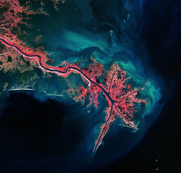
The image of the Mississippi River where it spills into the Gulf of Mexico has reached the frame of Envisat satellite.The vegetation of the Mississippi River Delta is pink and the blue, green part is the sedimentary rock.
The Okavango River running from Angola to Botswana marked the border between Namibia and Angola.
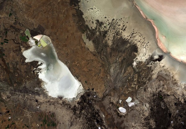
This is a plateau located in the central district of Anatolia, Turkey.Lake Tuz - Turkey's second largest lake reigns in the left corner of the picture.During the summer, the lake water recedes to reveal a thick layer of salt.
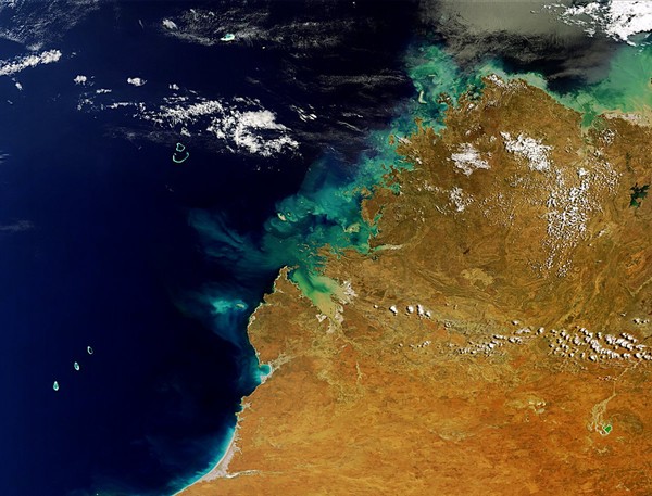
The image of Western Australia's Kimberley region is in the sights of Envisat.In the lower left corner is the Rowley Shoals coral reef and the upper right corner is Lake Argyle - Australia's largest artificial lake.
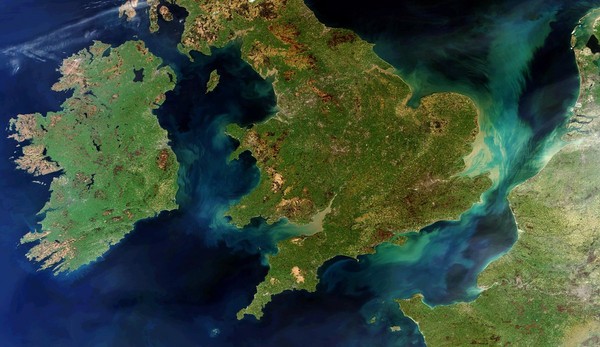
This is a rare picture that Envisat recorded when the country of Ireland, England and France encapsulated in a frame that was not obscured by any clouds.Blue and brown swirls are sedimentary rocks.
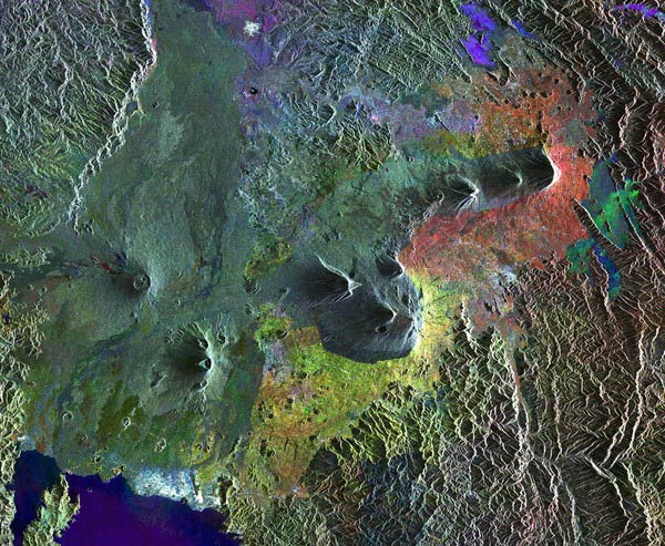
The image of a dangerous chain of volcanoes in the Virunga Mountains in Rwanda was sent to the center by Envisat.
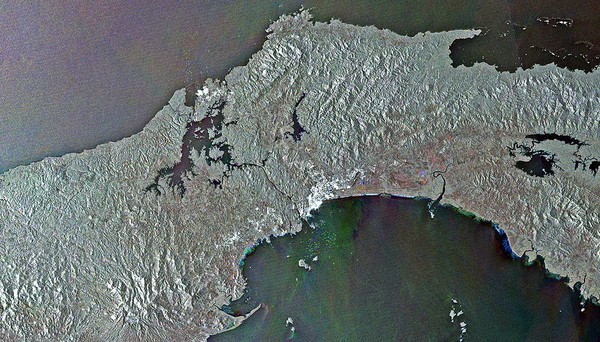
This is the Panama Canal.The colored dots in the center of the image, above and below are the boats going in and out of the canal.
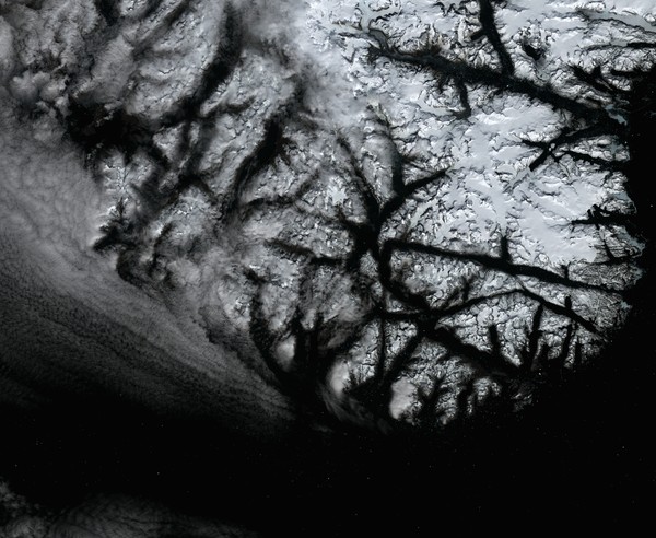
The white dots at the bottom of the picture are icebergs.This image is recorded in Greenland - the largest island in the world.
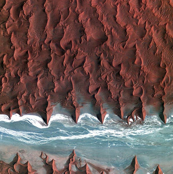
These are the sand dunes of the Namib desert.The blue and white areas are dried up by the river Tsauchab.
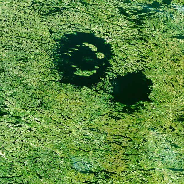
Clearwater Lake in Quebec was created by a meteorite impact more than 200 million years ago.
- India launches missiles with 5 foreign satellites
- Thousands of satellites on Earth orbit can crash into each other
- Vietnam satellite will enter space in 2018
- How do satellites melt in the Earth's atmosphere?
- Learn more about space satellite systems
- A series of tiny devices flew up into space
- Russia's killer satellite suddenly reactivated after 2 years
- Satellite Rosat rushes into the earth's atmosphere
- The fall of satellites made the Earth
- Old satellites race each other to fall to Earth
- American company launches satellites visible from Earth
- Wukong Ship finds dark matter sending data to Earth
 The 11 most unique public toilets in the world
 Explore the ghost town in Namibia
 Rare historical moments are 'colored', giving us a clearer view of the past
 The world famous ghost ship