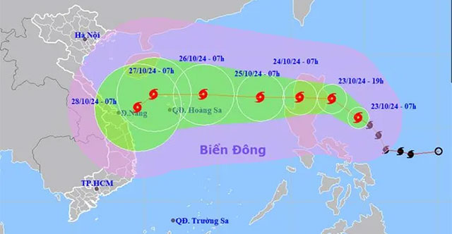
EnvironmentThe meteorological agency forecasts that storm Trami will enter the East Sea on October 24 and reach maximum intensity of level 12 when approaching the waters of the Hoa…
October 28, 2024
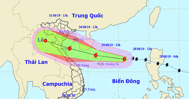
EnvironmentAt 13:00 on August 28, the location of the storm center was about 17.0 degrees North; 116.0 degrees east, about 450km to the east of the Paracel Islands.
August 28, 2019
ArcheologyThe world famous Atlas set of geographer Philippe Vandermaelen published in 1827 clearly shows that the Paracel and Spratly Islands are Vietnam, just received and announ…
December 17, 2018
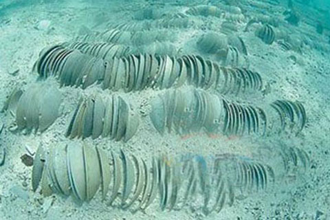
ArcheologyArchaeologists surveyed 12 old sites and discovered 12 new locations, collecting a large number of specimens including pottery, porcelain, coins, ancient ship parts unde…
December 17, 2018
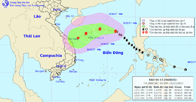
EnvironmentAt 4:00 am on 11/11, the location of the center of the storm is about 17.4 degrees north latitude; 116.5 degrees Kinh Dong is about 540 km from Hoang Sa archipelago to t…
December 16, 2018

EnvironmentIt is forecasted today (February 2) that the North East Sea region (including the Paracel Islands) continues to have strong Northeast winds of level 6, shock level 7-8;…
December 16, 2018
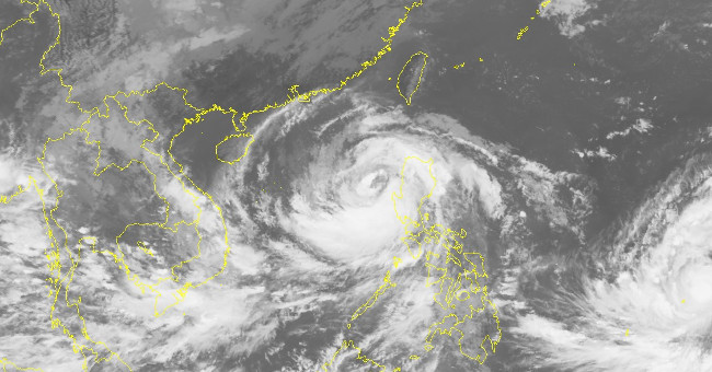
EnvironmentAt 8:00 on October 16, Typhoon Sarika crossed Luzon Island (Philippines) into the South China Sea with maximum winds of 165 km / h (level 14), 2 levels higher than last…
December 16, 2018

EnvironmentTyphoon Sarika is about 220km from the Paracel Islands, another newly formed storm is also heading towards the East Sea.
December 16, 2018
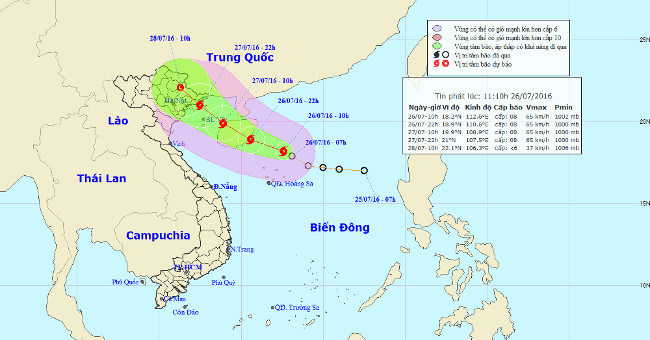
EnvironmentAt noon today (July 26), after going into the northeastern area of the Paracel Islands, the tropical depression intensified into a storm. Storm No. 1.
December 16, 2018
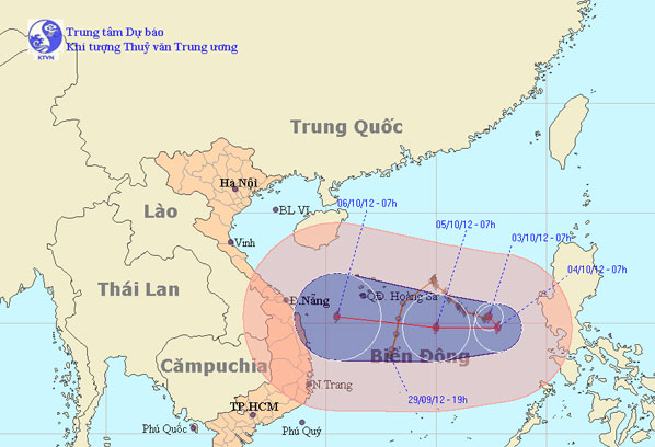
EnvironmentAt 07:00 on October 3, the location of the center of the storm is about 15.3 degrees Vi Bac; 117.4 degrees Kinh Dong, about 570 km from Hoang Sa archipelago to the East…
December 16, 2018
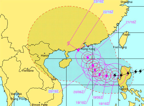
EnvironmentEntering the East Sea on the night of October 18, Megi storm strengthened to level 15, increasing one level. Hoang Sa area, where the storm swept through, there are many…
December 16, 2018

EnvironmentThe worst possibility is that the storm enters the Paracel Islands, where there are many fishing boats. The second possibility is a storm going south, along the western…
December 16, 2018
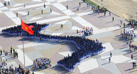
Science EventsIn the morning of June 5, the S-shaped map with the Spratly and Paracel Islands of Vietnam stood out on April 2 Square in Nha Trang city. With 1,500 young people partici…
December 15, 2018