Environment
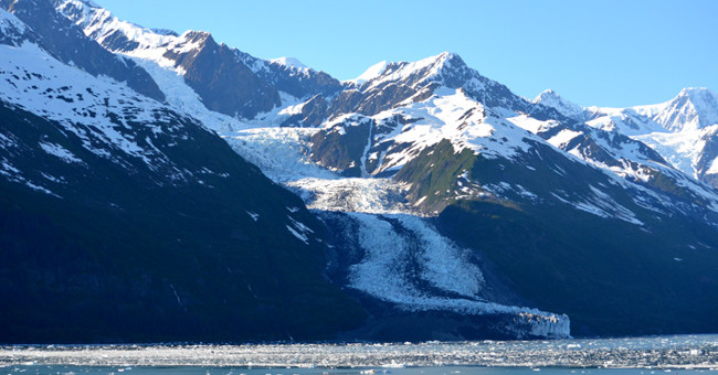
Smith Glacier Glacier melted much faster than expected
Smith Glacier - a large glacier located in the West South Pole, has been thinning 0.5 km of thickness in the past seven years, much faster than scientists have forecast.
Browse ScienceInfo articles and explainers related to Sea.
3,672 published items.
Smith Glacier - a large glacier located in the West South Pole, has been thinning 0.5 km of thickness in the past seven years, much faster than scientists have forecast.
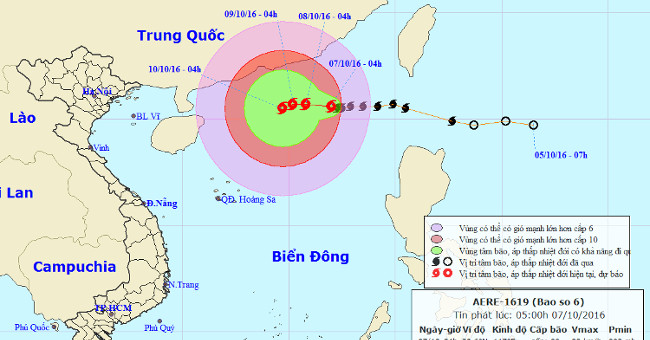
At 4 o'clock, the location of the storm center is about 20.6 degrees North latitude; 117.0 degrees Kinh Dong, in the Northeast of the East Sea, about 720km from Hoang Sa…
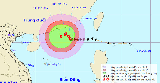
At 13 o'clock, the location of the center of the storm is about 20.7 degrees Vi Bac; 116.1 degrees east longitude, about 600km from Hoang Sa archipelago to the northeast…
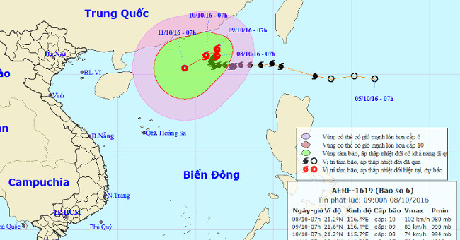
At 07:00 on October 8, the location of the storm center is about 21.2 degrees Vi Bac; 116.4 degrees Kinh Dong, about 680km from Hoang Sa archipelago to the Northeast.
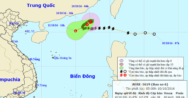
Chapter 04 hours on October 10, the location of the center of the storm at about 21.5 degrees North; 117.2 Kinh Dong, about 350km from Hong Kong (China) to the East of S…
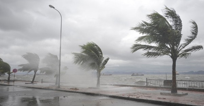
At 01:00 on October 12, the low pressure area in the North East Sea area is located at about 16.5-17.5 degrees North latitude; 113.3-114.3 Kinh Dong, on the eastern sea…
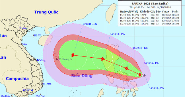
Currently, a storm with the international name Sarika is operating in the eastern Philippines.
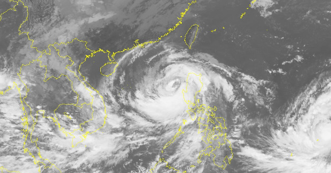
At 8:00 on October 16, Typhoon Sarika crossed Luzon Island (Philippines) into the South China Sea with maximum winds of 165 km / h (level 14), 2 levels higher than last…
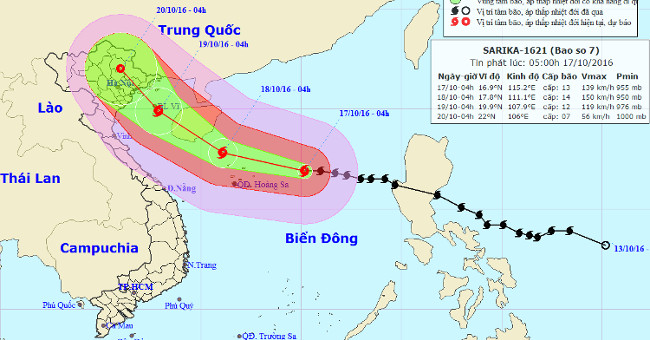
At 04:00 on October 17, the position of the center of the storm was about 16.9 degrees Vi Bac; 115.2 degrees Kinh Dong, about 320km from Hoang Sa archipelago to the East.

Typhoon Sarika is about 220km from the Paracel Islands, another newly formed storm is also heading towards the East Sea.
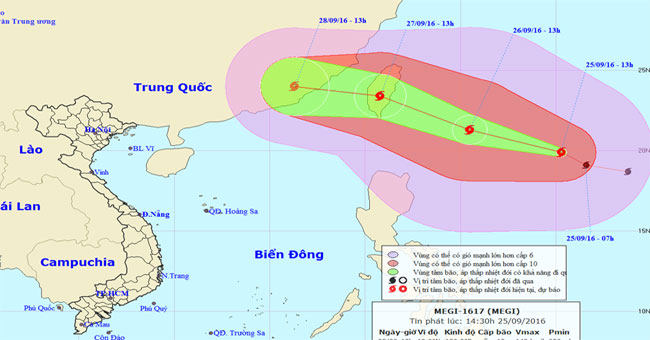
Currently (September 25), in the offshore waters of northeastern Lu-Dong Island (Philippines) a strong storm is active and has an international name as MEGI.
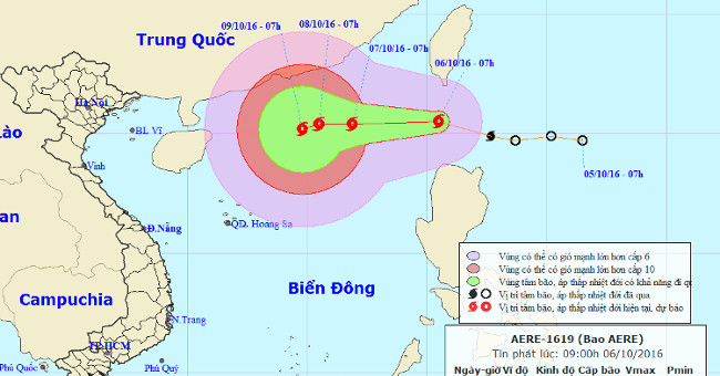
In the early morning of October 6, the tropical depression intensified into a storm, the name of which was called Aere. The strongest wind in the area near the storm cen…
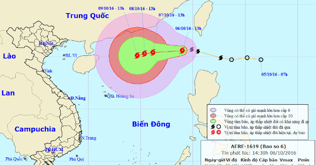
At 13 o'clock, the location of the center of the storm was about 20.6 degrees north latitude; 119.0 degrees east longitude, on the northeastern region of the East Sea. T…
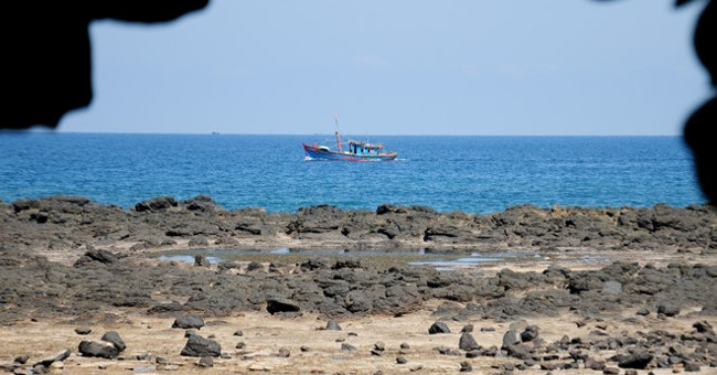
In the morning of September 8, Quang Ngai Department of Culture, Sports and Tourism held a meeting with experts to discuss emergency conservation measures of geological…
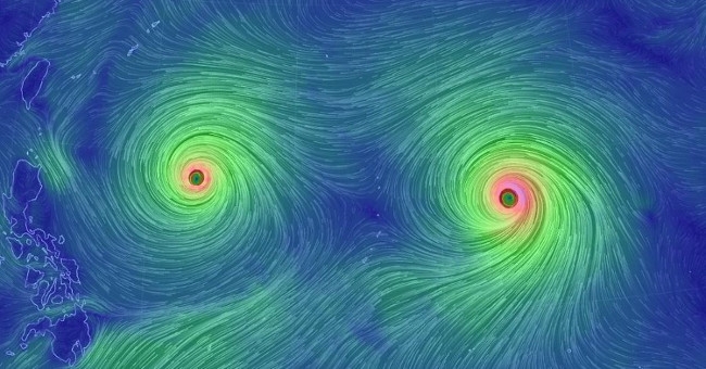
Over the past 40 years, storms attacking East and Southeast Asia have become more and more powerful - and perhaps that will continue, thanks to the