Environment
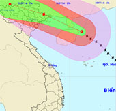
Thunderstorm storms straight into Quang Ninh
At 13 hours on July 18, the position of the center of the storm was about 19.9 degrees North latitude; 111.3 degrees Kinh Dong, about 420 km from Mong Cai (Quang Ninh) t…
Browse ScienceInfo articles and explainers related to Direction.
428 published items.
At 13 hours on July 18, the position of the center of the storm was about 19.9 degrees North latitude; 111.3 degrees Kinh Dong, about 420 km from Mong Cai (Quang Ninh) t…
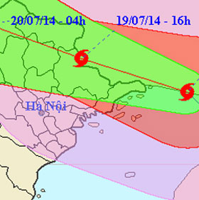
Around 4:00 am July 19, heavy rains started pouring down to Mong Cai and Bach Long Vi, Cua Ong outposts, strong winds gradually reached level 6-7.

According to a study published in the journal Nature on May 14, tropical tornadoes are getting stronger, moving far and away from the equator and getting closer to the t…

A team of researchers from the University of Arizona and Central Florida (USA) believes that it is possible to completely change the direction of the
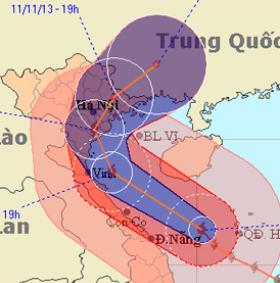
Haiyan typhoon is moving fast in the direction of gradually going north, along the central provinces, towards Thanh Hoa sea to Nam Dinh with decreasing intensity.
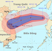
At 10 o'clock on November 1, the position of the center of the storm was about 19.0 degrees north latitude; 118.7 degrees Kinh Dong, about 740 km from Hoang Sa archipela…
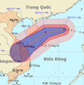
At 04:00 on November 2, the location of the center of the storm was about 19.4 degrees North latitude; 116.0 degrees Kinh Dong, about 510 km from Hoang Sa archipelago to…
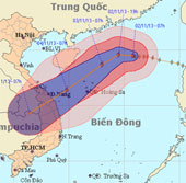
At 07:00 on November 2, the location of the center of the storm was about 19.5 degrees North latitude; 115.8 degrees Kinh Dong, 490 km from Hoang Sa archipelago to the N…
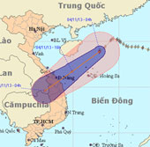
At 4 o'clock on November 4, the position of the center of the storm is about 18.9 degrees North latitude; 112.9 degrees east longitude, about 240 km from Hoang Sa archip…
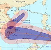
At 07:00 on November 4, the position of the tropical depression center was about 8.6 degrees Vi Bac; 125.9 degrees Kinh Dong, in the southern coastal region (Philippines…
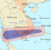
At 07:00 on November 6, the position of the tropical depression center was about 11.6 degrees north latitude; 111.8 degrees Kinh Dong, about 290 km from the coast of Kha…
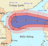
At 13 o'clock on October 31, the location of the center of the storm was about 18.0 degrees north latitude; 123.1 degrees east longitude, on the northeastern coast of Lu…
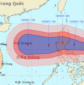
Currently, a storm is operating in the Eastern Philippines and has an international name as NARI.
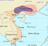
At 04:00 on September 23, the location of the center of the storm was about 23.3 degrees Vi Bac; 113.2 degrees east longitude, about 140km from Hong Kong (China) to the…
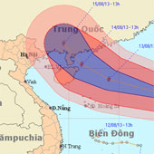
This afternoon (August 12), Typhoon UTOR passed Lu - Dong Island (Philippines) and went to the East of the North East Sea - storm No. 7.