While going to the forest, Mr. Dang Quoc Ai discovered a rock eroded over time, emerging a picture of Vietnam map with the two archipelagoes Hoang Sa and Truong Sa.

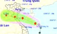
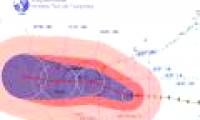
The Center for Hydro-meteorological Forecasting said that on the afternoon of July 15, the tropical low pressure on the Hoang Sa archipelago has become a storm, becoming the No. 2

At 04:00 on July 29, the location of the center of the storm is about 18.3 degrees Vi Bac; 112.9 degrees Kinh Dong, about 180 km from Hoang Sa archipelago to the North-East North.
 While going to the forest, Mr. Dang Quoc Ai discovered a rock eroded over time, emerging a picture of Vietnam map with the two archipelagoes Hoang Sa and Truong Sa.
 The Center for Hydro-meteorological Forecasting said that on the afternoon of July 15, the tropical low pressure on the Hoang Sa archipelago has become a storm, becoming the No. 2
 At 04:00 on July 29, the location of the center of the storm is about 18.3 degrees Vi Bac; 112.9 degrees Kinh Dong, about 180 km from Hoang Sa archipelago to the North-East North.
 Do signals from extraterrestrial civilizations detected by Sky Eye really exist?
 'City without air conditioning' in China: People don't know what heat is!
 The element of the sun god is giving scientists a headache
 Unique Village: Roofs Become Roads for Residents!
 Top 7 strange psychological effects of the brain that we all have without knowing
 Which is the most terrifying bedroom elixir in Chinese history?
 Earth's core may start rotating in reverse
 A day in Japan can be up to 30 hours long, does this country live in a different 'timeline'?