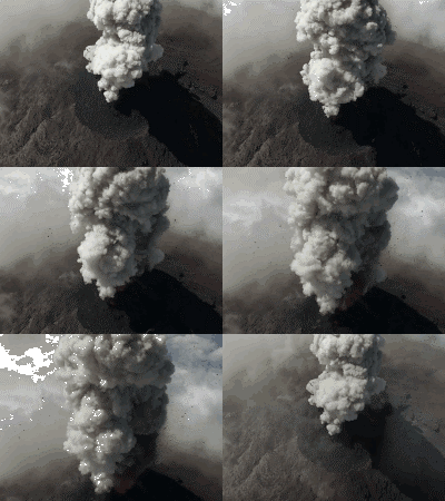
The beautiful volcanic landscape shot by the drone
Thanks to this modern and safe tool, scientists can fully explore volcanic activity in order to give warnings to local people before disaster strikes.
Not only is the intense heat coming from a volcanic eruption, toxic gas is also the reason why the study of volcanic activities is difficult.

The beautiful volcanic landscape is recorded by the drone.(Photo: YouTube).
However, scientists from the University of Cambridge have recently been able to return to beautiful moments from a volcanic eruption in Guatemala, thanks to drone - drone equipment.
In order to get close-up footage, the scientists controlled the drone with fixed wings to fly over the peaks of Volcan de Fuego and Volcan de Pacaya volcano in Guatemala City.
In the future, scientists can use this modern and safe tool to better understand volcanic activity, and predict eruptions, to warn local people about to evacuate. before the disaster.
Volcanic eruptions in Guatemala Scientists from Cambridge University have filmed a beautiful eruption volcano in Guatemala thanks to drone devices.
- Beautiful Vietnamese scenery is magnificent from above
- The beauty can only be felt from above
- Unique drone just know how to fly ... swim
- What happens when a drone plunges into our heads?
- The reason for drone transport has not been realized
- Amazon patented drone self destruct, avoiding danger for passers
- 10 impressive aerial shots in 2015
- Iran tests drone 'suicide bombings'
- Instead of moving horizontally, this drone flew along the wall like a spy
- The guy made a drone that flew very fast, and recorded 4K videos
- Discover the most beautiful volcanic cave in Southeast Asia
- Painting natural landscapes in agate stones
 Is the magnetic North Pole shift dangerous to humanity?
 Washington legalizes the recycling of human bodies into fertilizer
 Lightning stone - the mysterious guest
 Stunned by the mysterious sunset, strange appearance
 New research says: Not a meteorite, this is the terrible thing that destroyed the dinosaurs
  Confusing photos of volcanoes from space
  What caused the ancient Roman republic to collapse?
  Why is there so much lightning in the Taal volcanic eruption?
  Experimenting with 13,000-year-old ash and ash, scientists investigated why volcanic lightning formed
  The Earth was heavily contaminated with mercury before the collision with the Chicxulub meteorite