According to forecasts, storm No. 3 (storm Yagi) will accelerate to its greatest strength on September 6 .
According to weather forecast news from the US Cooperative Institute for Atmospheric Research (CIRA) , Yagi formed as a tropical storm on September 1, 2024 in the western Philippine Sea.
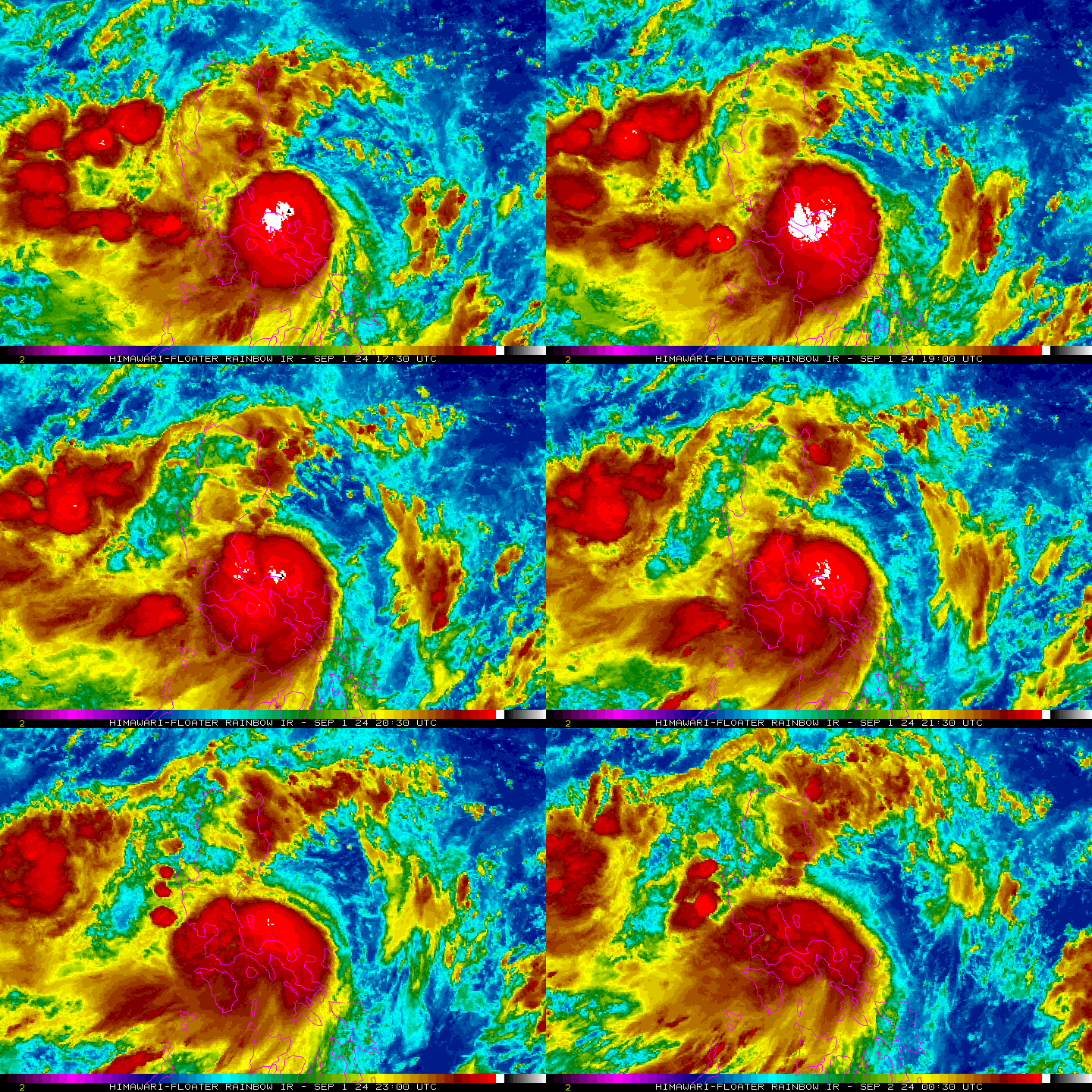
Animated satellite image of Typhoon Yagi. (Source: NOAA).
On September 2 , Yagi made landfall in the northern Philippines, bringing heavy rains. Typhoon Yagi killed at least 13 people in the Philippines, while schools and government offices were closed in the capital Manila and neighboring provinces on September 3 due to the storm.
According to the US Joint Typhoon Warning Center (JTWC) , by the morning of September 4, 2024, Typhoon Yagi had strengthened into a typhoon in the East Sea. Yagi had sustained winds of 130km/h - equivalent to a Category 1 typhoon on the Western Saffir–Simpson hurricane scale .

Forecast path of storm No. 3 (storm Yagi). (Source: National Center for Hydro-Meteorological Forecasting).
According to the Vietnam National Center for Hydro-Meteorological Forecasting , as of 7:00 a.m. on September 4, 2024, Typhoon Yagi (Typhoon No. 3) is located in the eastern sea of the North East Sea. The strongest wind near the storm center is level 11 (103-117 km/h), gusting to level 13, moving in the West Northwest direction, about 10 km/h.

Typhoon Yagi brought heavy rain. (Source: NOAA/The New York Times).
The forecast center predicted that by 7:00 a.m. on September 6, storm No. 3 would reach its maximum strength - level 14, gusting to level 17. At that time, storm No. 3 was in the northern part of the North East Sea. By 7:00 a.m. on September 7, the storm's intensity had slightly decreased - to level 13, gusting to level 16 - above the Gulf of Tonkin.
It is forecasted that in the next 24 hours, the eastern sea of the North East Sea will have waves 5-7 meters high, and near the storm center, waves 7-9 meters high.
What does Typhoon Yagi look like from above?
A few hours ago, the New York Times (USA) published satellite images of Typhoon Yagi. The newspaper said that satellite images can help determine the intensity, size and cohesion of a storm. The stronger the storm, the more likely it is to form an eye in the center. When the eye looks symmetrical, it usually means that the storm has not encountered anything that will weaken it.
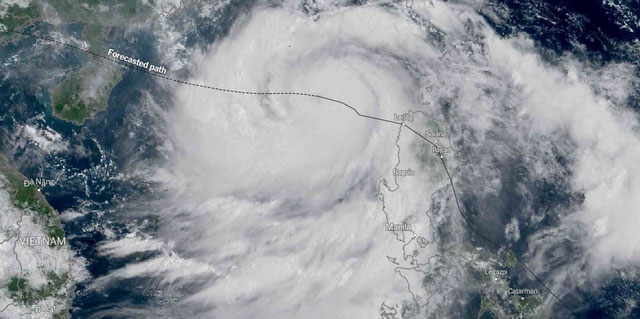
Satellite image of Typhoon Yagi at 9:00 a.m. on September 4, 2024. (Source: The New York Times).
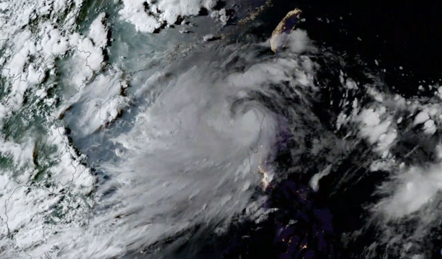
Satellite cloud image of Typhoon Yagi. (Source: CIRA).
Looking at the satellite cloud image of Typhoon Yagi, it can be seen that the clouds around the eye of the storm have spread out, almost covering the entire East Sea above.
Tracking the acceleration of Typhoon Yagi, the US Cooperative Institute for Atmospheric Research (CIRA) posted a video of satellite cloud images of Yagi showing how the storm accelerated in strength hourly from September 1 to late September 3 (Western time).
Watch video of Typhoon Yagi gaining strength as seen from satellite:
The strength of typhoon No. 3 (Yagi) seen from satellite clouds. (Source: CIRA).