Can Tho develops detailed climate change scenarios
Can Tho city is the first locality in the whole country to have a scenario of climate change and sea level rise in details.
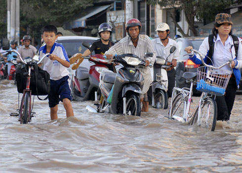
Can Tho flooded in the high tide last month. (Photo: Gia Bao)
The Institute of Meteorology, Hydrology and Environment said that this unit has just completed the climate change and sea level rise scenarios for Can Tho city under the National Capacity Building Project in response to climate change, with funding from the United Nations Development Program (UNDP).
According to the medium emission scenario, the average temperature by the end of this century in Can Tho will increase by 1.5-2.5 degrees Celsius compared to the average value in the period 1980-1999, rainfall will increase by about 5 % -7%.
In terms of sea level rise scenario, in 2050 the water level in this area can rise about 23cm to 27cm, by the end of this century it can rise to 59cm to 75cm, slightly lower than the west sea area from Ca Mau to Kien Giang.
According to experts, the abnormal hydrological regime of the period of climate change, the life of the people and the production industries in Can Tho city will be most affected compared to other localities. in the Mekong Delta region.
Dr. Tran Thuc, director of the Institute of Meteorology, Hydrology and Environment said that Vietnam is one of the countries most severely affected by climate change, in which the Mekong Delta is assessed. is one of the 3 plains in the world most vulnerable to sea level rise.
- SimCLIM helps build climate change scenarios
- Climate change is happening faster than expected
- The trees that are most affected by climate change
- The climate is becoming increasingly harsh
- This is how Dubai copes with climate change
- What is Climate Change?
- Marching for climate change around the world
- The terrifying change of the Earth due to climate change
- Climate change develops banana diseases
- 4 shocking findings on climate change
- Too many animals and plants disappear due to climate change
- How is climate change damaging our health?
 Is the magnetic North Pole shift dangerous to humanity?
 Washington legalizes the recycling of human bodies into fertilizer
 Lightning stone - the mysterious guest
 Stunned by the mysterious sunset, strange appearance