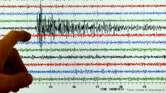
Earthquake 7.2 Richter in Indonesia
An earthquake of 7.2 on the Richter scale occurred in the Maluku Islands, eastern Indonesia this morning 11/12. However, the earthquake does not cause a tsunami risk. There have been no reports of casualties or significant damage.

Vibration from the earthquake in Indonesia is felt
Very strong reception in northern Australia - (Photo: ABC)
According to the US Geological Survey (USGS), the earthquake has a magnitude of 7.2 on the Richter scale and occurs at nearly 2 am on December 11 (local time) at a depth of 155.2 km below sea level. The epicenter of the earthquake is 365 km south-southeast from the town of Ambon on the Maluku Islands. Meanwhile, the Indonesian Agency for Meteorology and Geophysics recorded a magnitude 7.4 earthquake.
An official of the agency said: "We did not issue a tsunami warning . " In the districts close to the epicenter, such as Northern Halamahera and Morotai, slight tremors are felt. Indonesia is also located in an area prone to earthquakes and the Pacific Ring of Fire.
Sutopo Purwo Nugroho, a spokesman for the National Disaster Management Center, said there were no reports of people being injured or damaged in the earthquake.
However, the city of Darwin and Katherine in northern Australia felt the earthquake was strong, although it was 600km from the quake. Darwin weather workers were evacuated because of the shaking of the building. Weather reporter Angeline Prasad said it was the most powerful seismic in Darwin that she had known for over 20 years.
People in Darwin felt the shaking even though the earthquake happened when they were sleeping. Lecturer Kevin McCue of Central Queensland University said the earthquake should be seen as a warning for a stronger earthquake that may occur at any time.
- Earthquake 6.5 Richter in Indonesia, affecting Singapore
- The earthquake shook Indonesia again
- Indonesia: A series of aftershocks after an earthquake of 7.8 Richter scale
- The magnitude 6.2 earthquake shook Indonesia
- Earthquake 6.2 Richter in Indonesia
- Strong earthquakes in the Philippines and Indonesia
- More than 1,100 people died from earthquakes in Indonesia
- Strong earthquake in Indonesia
- Indonesia earthquake strong, at least 18 people died
- Casualties, damage due to earthquakes in Indonesia increased sharply
- Strong magnitude 6.3 earthquake off Indonesia
- Indonesia struck an earthquake again
 Is the magnetic North Pole shift dangerous to humanity?
 Washington legalizes the recycling of human bodies into fertilizer
 Lightning stone - the mysterious guest
 Stunned by the mysterious sunset, strange appearance
 Photos demonstrate the terrible devastation of the earthquake in Türkiye
  Strange phenomenon before earthquake in Japan: Strange light crosses the sky, flock of birds creates rare scene
  Strange phenomenon before earthquake kills 118 people in China
  The deadliest day in human history 500 years ago
  A 3.5 magnitude earthquake occurred in Luc Yen, Yen Bai
  Is the 6.6 magnitude earthquake in the Pacific Rim affecting Vietnam?