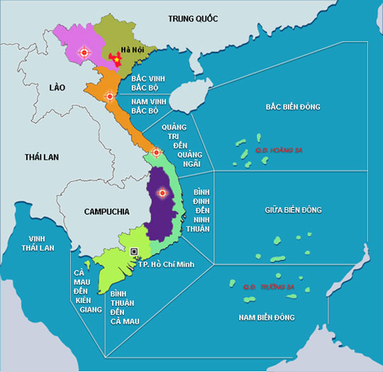
According to the Central Hydrometeorological Forecast Center, the Northern provinces continue to be influenced by the weak western edge of the continental cold high pressure blade, combined with the far western edge of the typhoon circulation 6 .

Cold air continues to affect other places in the North East. (Photo of NTDTV)
Forecast of temperature in the North East will be at the lowest of 20-23 degrees Celsius, particularly in the cooler mountains, there are places of 16-18 degrees C.
The highest temperature in this area is 29-32 degrees Celsius, there is mist in the morning and the fog is lightly scattered.
West of the North, the lowest temperature is 17-20 degrees Celsius, the highest is from 29-32 degrees Celsius.
Particularly, Hanoi has the lowest temperature from 21-24 degrees C, the highest from 29-32 degrees C.
The southern provinces are located on the southern edge of the above analyzed weather system with the activity of the moderate intensity southwest wind zone.
Meanwhile, Typhoon 6 is currently active in the northeastern sea area, about 670km northeast of the Paracel Islands and is moving north.
At 4 o'clock on October 22, the location of the storm center No. 6 is located in the northeast of the East Sea, about 320km from the coast of Guangdong Province (China) to the South-East of Southeast. Strongest winds in the area near strong storms level 14, level 15, level 16, level 17.
It is forecasted that in the next 24 hours, the storm will move mainly in the North, about 5-10km per hour. At 4 o'clock on October 23, the location of the storm center is about 150 km southeast of the coast of Guangdong Province (China).
The strongest wind in the area near the storm center is strong at level 13, level 14, level 15. Magnetic center of the storm, dangerous windy zone from level 10 or higher has a radius of about 200km, from level 6 or higher with a radius of about 400km .
In the next 24 to 48 hours, the storm moves in the North-West direction, about 5-10km per hour.
At 4 o'clock on October 24, the location of the storm center is located on the mainland southeast of Guangdong Province. The strongest wind in the area near the storm center is strong 9, level 10, level 11. From the center of the storm, the dangerous strong wind from level 6 or higher has a radius of about 300km.
In the next 48 to 72 hours, the storm moved in the direction between Northwest and North North West, about 10 km per hour and gradually weakened into tropical depression. At 4 o'clock on October 25, the position of tropical depression is located in the area of Guangdong Province (China). The strongest wind in the area near the center of strong low pressure tropical depression, level 8.
Due to the impact of the storm, the North East Sea (including the waters off Guangdong Province) has strong winds of level 12 and level 13, the area near the center of the storm passes through level 14, level 15, level 17 shock. High waves from 11-13m, the sea is intense.
 Is the magnetic North Pole shift dangerous to humanity?
 Washington legalizes the recycling of human bodies into fertilizer
 Lightning stone - the mysterious guest
 Stunned by the mysterious sunset, strange appearance