Making a 3D map in the Earth's heart, revealing the path of lava
By tracking the path of 273 strong seismic events over the past 20 years, scientists at UC Berkeley have for the first time created a 3D map of the inner structure of the Earth and that explains the magma due to Volcanic eruptions from where there are.
Scientists have created 3D maps in the heart of the Earth

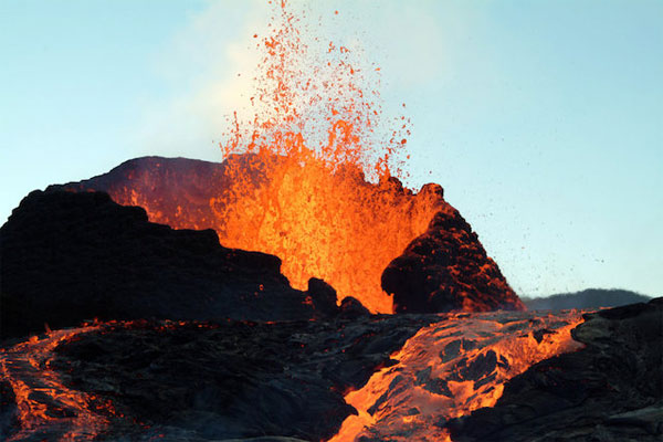
We all know that when volcanoes are active, magma will erupt 'from the ground' to the surface. But it is not yet known how the crater can be linked to the core of the lava pouch 2900km below the surface of the Earth. And more importantly, they learned that most lava flows do not go straight from the bottom up , but originate from '2 main sources' and spread out over the ground at volcanic hotspots.

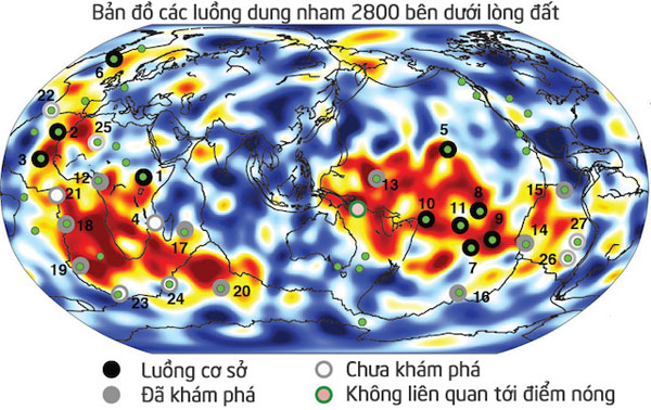
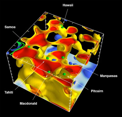
As can be seen from the map (in the video), the two red areas are the two sources of Earth's lava. It is located below the Earth's crust and above the iron core. This high-detail map shows not only a network of hotspots on the planet, but also the path of 1000km long dams stretching from 600 to 1000km, five times wider than the previously predicted. These lava flows have a temperature of 400 degrees Celsius higher than the surrounding rock layers.

The 1800-mantle beam section is located below the Pacific Ocean and the network is linked to terrestrial volcanic hotspots.
The researchers admit that this map is still not perfect because there are still many volcanic hotspots that are not listed. However, this is a huge step forward, increasing the knowledge of lava flows which is still a mystery to previous geologists. The team hopes to produce a more detailed version with the help of gravity-sensing satellites.
- Why does lava melt in the Earth's heart without causing the Earth's crust to melt?
- The 3D 'human heart' is about to become a reality
- What is lava?
- Process of collecting molten lava from volcanoes
- Video: What happens when lava meets ice?
- Detected many strange lava columns on Mars
- Monitor lava flow with 3D technology
- Decipher the mystery who runs on molten lava
- The lava lamp is 50 years old
- Explore volcanic lava lakes that are 1,000 degrees Celsius hot
- Huge lava lake on Kilauea volcano
- The 20-meter-high lava tower is red in the sea
 Is the magnetic North Pole shift dangerous to humanity?
 Washington legalizes the recycling of human bodies into fertilizer
 Lightning stone - the mysterious guest
 Stunned by the mysterious sunset, strange appearance
 Life could exist on Jupiter's moon
  Red hot lava flowing on snow causes confusion
  Mysterious people lived in lava tubes 7,000 years ago in Arabia
  Robot captures 320,000m2 lava field under the sea
  Scientists reproduce the lava explosion
  Discovered an unprecedented depth of volcanic lava