
Early this morning (August 26) on the tropical convergence band, the area between the South China Sea formed a tropical depression.

Due to the influence of the circulation of the depressed low pressure area from the storm No. 7, then formed a low-pressure trench through the North, so from the evening of night

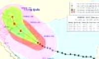
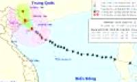
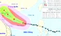
At 07:00 on October 18, the location of the center of the storm was about 18.7 degrees Vi Bac; 110.9 degrees Kinh Dong, on the southeastern coast of Hainan Island (China), about

Due to the influence of storm circulation number 7, to 04 hours on October 19 at Bach Long Vi island station, it is possible to measure strong winds of level 9, shock level 11; Co

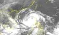
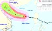
At 8:00 on October 16, Typhoon Sarika crossed Luzon Island (Philippines) into the South China Sea with maximum winds of 165 km / h (level 14), 2 levels higher than last night and

At 04:00 on October 17, the position of the center of the storm was about 16.9 degrees Vi Bac; 115.2 degrees Kinh Dong, about 320km from Hoang Sa archipelago to the East.

At 10 o'clock on October 17, the location of the center of the storm is about 17.3 degrees Vi Bac; 114.0 degrees Kinh Dong, about 220 km from Hoang Sa archipelago to the East.

This afternoon (August 12), Typhoon UTOR passed Lu - Dong Island (Philippines) and went to the East of the North East Sea - storm No. 7.

At 4 o'clock on August 13, the location of the center of the storm was about 18.2 degrees Vi Bac; 116.1 degrees east longitude. About 450km from Hoang Sa archipelago to the East

This morning, the storm center is about 140km from the coast of Guangdong province (China), the maximum wind power is 166km / h (level 14) and is expected to go into the province
 Early this morning (August 26) on the tropical convergence band, the area between the South China Sea formed a tropical depression.
 Due to the influence of the circulation of the depressed low pressure area from the storm No. 7, then formed a low-pressure trench through the North, so from the evening of night
 At 07:00 on October 18, the location of the center of the storm was about 18.7 degrees Vi Bac; 110.9 degrees Kinh Dong, on the southeastern coast of Hainan Island (China), about
 Due to the influence of storm circulation number 7, to 04 hours on October 19 at Bach Long Vi island station, it is possible to measure strong winds of level 9, shock level 11; Co
 At 8:00 on October 16, Typhoon Sarika crossed Luzon Island (Philippines) into the South China Sea with maximum winds of 165 km / h (level 14), 2 levels higher than last night and
 At 04:00 on October 17, the position of the center of the storm was about 16.9 degrees Vi Bac; 115.2 degrees Kinh Dong, about 320km from Hoang Sa archipelago to the East.
 At 10 o'clock on October 17, the location of the center of the storm is about 17.3 degrees Vi Bac; 114.0 degrees Kinh Dong, about 220 km from Hoang Sa archipelago to the East.
 This afternoon (August 12), Typhoon UTOR passed Lu - Dong Island (Philippines) and went to the East of the North East Sea - storm No. 7.
 At 4 o'clock on August 13, the location of the center of the storm was about 18.2 degrees Vi Bac; 116.1 degrees east longitude. About 450km from Hoang Sa archipelago to the East
 This morning, the storm center is about 140km from the coast of Guangdong province (China), the maximum wind power is 166km / h (level 14) and is expected to go into the province


 Why did the ancient Babylonian civilization perish? Was it because they considered 'that thing' a daily meal?
 Just discovered a 72km 'tear in the Earth', the world's second largest country is in fear of a tsunami attack
 Top 7 facts about the hottest place in the world, where you can fry eggs at outdoor temperature
 The Qing Dynasty collapsed, what surname did 20,000 royal descendants change to to integrate into the new era?
 After 389 days in the Arctic, costing more than $160 million, hundreds of scientists brought back bad news: What was it?
 How long does it take to fall in love with someone?
 How much silver has ever been discovered in the world?
 How does an atomic bomb work?