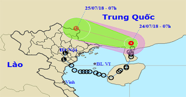
Environment7 o'clock today, the tropical depression is located in the north of Leizhou Peninsula (China), after taking an arc from the south of the Northern Delta, down to the Gulf…
December 16, 2018
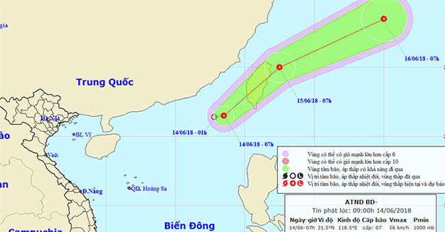
EnvironmentAt 07 o'clock, the position of the tropical depression is about 21.5 degrees north latitude; 118.5 degrees east longitude, about 240km from Taiwan to the southwest.
December 16, 2018
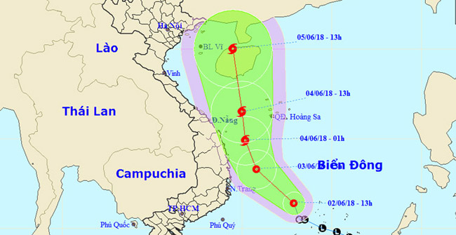
EnvironmentTropical depressions are now about 160 km west of Song Tu Tay Island, strong at level 6-7, level 9 and capable of becoming stormy.
December 16, 2018
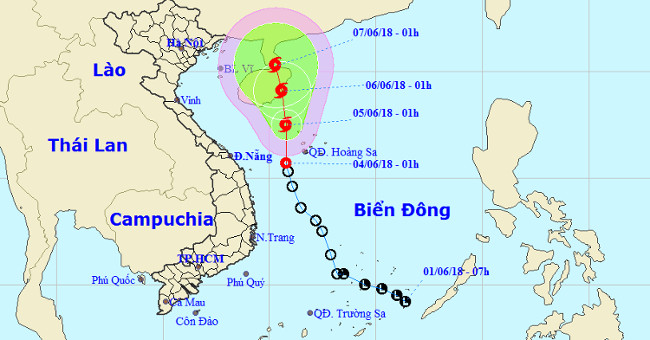
EnvironmentAt 01:00 on June 4, the position of the tropical depression center is about 15.7 degrees Vi Bac; 110.8 degrees Kinh Dong, in the area of the Paracel Islands.
December 16, 2018
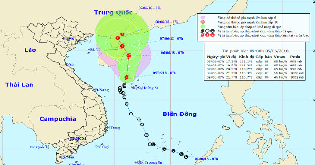
EnvironmentThis morning (June 5) after entering the northwestern area of the Hoang Sa archipelago, the tropical depression intensified into a storm (storm No. 02 in 2018).
December 16, 2018
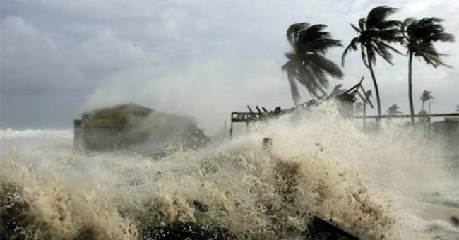
EnvironmentStorms and tropical depressions (NTDs) are quite familiar words to people when unusual natural phenomena occur.
December 16, 2018
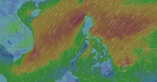
EnvironmentEspecially in the middle of February, there is a high possibility that there will be storms in the southern part of the South China Sea and may affect the waters of the…
December 16, 2018
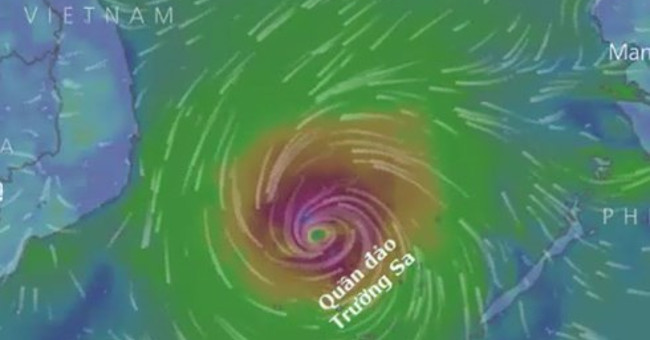
EnvironmentThe National Center for Meteorology and Hydrology said that there is a notable form at present that a tropical cyclone will enter the South China Sea around 27-28 Tet.
December 16, 2018
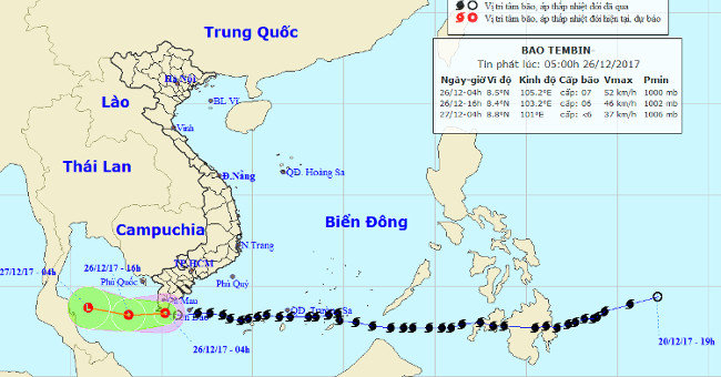
EnvironmentAt 04 hours on December 26, the position of the tropical depression center is about 8.5 degrees ViBac; 105.2 Kinh Dong, right on the coast of Bac Lieu and Ca Mau.
December 16, 2018
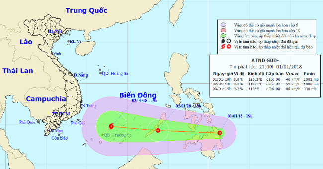
EnvironmentAccording to the Central Center for Hydrometeorological Forecasting, tropical depressions on the east coast of the southern Philippines are active and moving very fast.
December 16, 2018
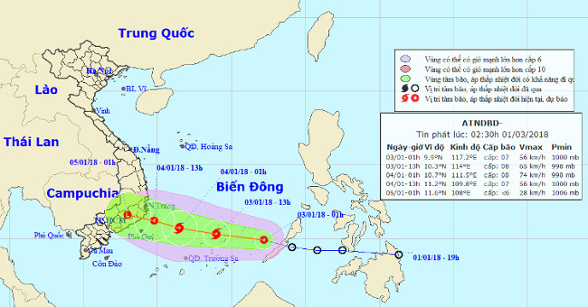
EnvironmentLast night (January 2), the tropical depression crossed the Central Island of Palawan (Philippines) and entered the South China Sea.
December 16, 2018

EnvironmentAt 10 am on January 3, the location of the storm center is about 10.7 degrees Vi Bac; 115.3 degrees east longitude, about 170 km from Song Tu Tay (belonging to the Sprat…
December 16, 2018
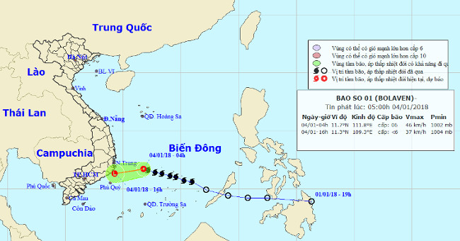
EnvironmentAccording to the Central Center for Meteorological and Hydrological Forecasting, in the early morning of January 4, after entering the western area of the No. 1 Spratl…
December 16, 2018
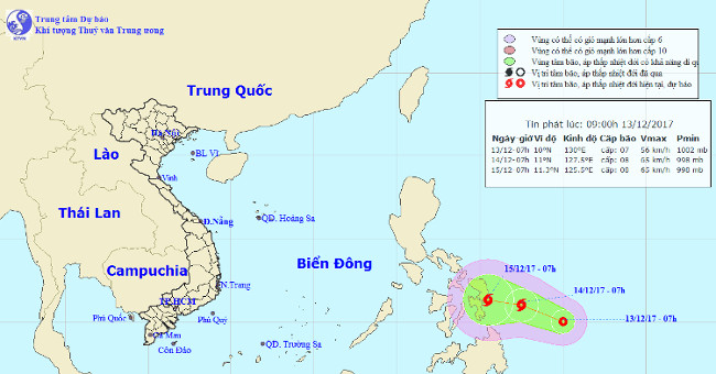
EnvironmentCurrently (December 13), in the south-east coast of the Philippines, a tropical depression is operating.
December 16, 2018
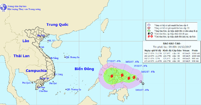
EnvironmentThis morning (December 14), the tropical low pressure system operating on the eastern region of the central region of the Philippines has become a strong storm and has a…
December 16, 2018